Questa guida subacquea regionale ha lo scopo di fornire ai già qualificati sommozzatore con informazioni che aiuteranno a pianificare le immersioni nelle acque della Penisola del Capo e False Bay, sia come residente locale che come visitatore. Le informazioni sono fornite senza pregiudizio e non sono garantite accurate o complete. Usalo a tuo rischio. Espandilo o correggilo quando puoi.
La regione descritta si trova a una gita di un giorno su strada da qualsiasi parte di maggiore Città del Capo, nel Western Cape provincia di Sud Africa e include oltre 280 siti di immersione nominati per i quali vengono registrate le posizioni, il che è molto per ogni singola destinazione.
Informazioni dettagliate sui singoli siti di immersione sono fornite nei sottoarticoli collegati dal from Siti di immersione sezione. Le informazioni nelle descrizioni del sito vanno da superficiali a molto dettagliate, a seconda di ciò che si conosce del sito. Potrebbe esserci una mappa. Le carte batimetriche di SURGMAP vengono aggiornate man mano che vengono raccolti nuovi dati di rilievo e vengono mappate nuotando lungo le curve di livello trainando una boa GPS. Sono ragionevolmente accurati - di solito entro un paio di metri - e affidabili per ciò che viene mostrato, ma raramente completi. È del tutto possibile che alcuni alti pinnacoli siano stati persi. Non c'è alcuna garanzia che non ne scoprirai uno colpendolo con la tua barca. Se lo fai, faccelo sapere.
In alcuni casi un sottoarticolo relativo a un sito di immersione includerà diversi siti che si trovano nelle immediate vicinanze, poiché molte delle informazioni saranno comuni a tutti. In altri casi, che coinvolgono solitamente siti di relitti, due siti adiacenti avranno ciascuno il proprio sottoarticolo, ma se due o più relitti si trovano nella stessa posizione, o con sostanziale sovrapposizione, saranno descritti nello stesso sottoarticolo.
Capire


Topografia generale
La città di Cape Town è stata fondata all'estremità settentrionale del Penisola del Capo, una stretta striscia di terra montuosa larga al massimo 11 km e lunga poco più di 50 km. Il confine settentrionale è la costa di Table Bay, una grande baia aperta con un'unica isola, Isola di Robben, nella sua bocca.
Una costa frastagliata segna il confine occidentale lungo l'Oceano Atlantico. Lungo la costa si trovano un certo numero di piccole baie con una sola grande, Hout Bay, circa a metà. Più a sud la penisola si restringe fino a terminare a Cape Point. Una catena montuosa con Table Mountain a 1.085 m all'estremità settentrionale costituisce la spina dorsale della penisola. Il punto più alto della penisola meridionale è Swartkop, a 678 m, vicino a Simon's Town. La penisola ha pendii abbastanza ripidi lungo la maggior parte della costa, con aree molto strette di terreno relativamente pianeggiante ad eccezione del lato occidentale della punta meridionale.
Il ripido lato orientale è delimitato da False Bay, e questo tratto di costa comprende la più piccola Smitswinkel Bay, Simon's Bay e Fish Hoek Bay, dove una striscia di pianura si estende tra le coste su entrambi i lati. A Muizenberg la costa diventa relativamente bassa e sabbiosa e curva verso est attraverso il confine meridionale del Appartamenti del capo a Gordon's Bay per formare il confine settentrionale di False Bay. A partire dal Baia di Gordon la costa oscilla all'incirca a sud e si fa strada a zig-zag lungo i piedi della catena montuosa dell'Olanda degli ottentotti fino a Cape Hangklip, che si trova quasi alla stessa latitudine di Cape Point. La vetta più alta da questo lato è Kogelberg a 1.269 m.
In pianta la baia è approssimativamente quadrata con bordi piuttosto traballanti, essendo all'incirca la stessa estensione da nord a sud come da est a ovest (30 km), con l'intero lato meridionale aperto sull'oceano. L'area di False Bay è stata misurata a circa 1.090 km² e il volume è di circa 45 km³ (profondità media circa 40 m). Il perimetro del terreno è stato misurato a 116 km, da una mappa in scala 1:50.000.
La morfologia del fondale di False Bay è generalmente liscia e abbastanza bassa, digradante dolcemente da nord a sud, tanto che la profondità al centro della foce è di circa 80 m. Il fondo è ricoperto da sedimenti che vanno da molto grossolani a molto fini, con la maggior parte dei sedimenti fini e del fango al centro della baia. L'eccezione principale è una lunga cresta di roccia sedimentaria che si estende in direzione sud dal largo dello Strand, approssimativamente al livello della foce del fiume Steenbras. La punta meridionale di questa cresta è conosciuta come Steenbras Deep.
C'è una vera isola nella baia, Seal Island, uno sperone di granito arido e pietroso lungo circa 200 m e con una superficie di circa 2 ettari. Si trova a circa 6 km a sud di Strandfontein ed è a meno di 10 m sul livello del mare nel suo punto più alto. Ci sono anche una serie di piccoli isolotti rocciosi che si estendono al di sopra del livello dell'acqua alta, e altre rocce e banchi che si avvicinano alla superficie. La maggior parte di questi sono granito del penisola plutone, ma ad est di Seal Island sono generalmente arenaria, probabilmente del Tygerberg formazione all'interno della baia, anche se è possibile che alcuni possano essere dei Montagna della Tavola serie. La più grande di queste aree della barriera corallina è Whittle Rock, una collina sottomarina di granito che sorge dal fondo sabbioso a circa 40 m fino a 5 m dalla superficie e circa 1 km di diametro.
Al di fuori della baia, ma che influenza le onde al suo interno, si trova Rocky Bank, un'estesa barriera corallina di Montagna della Tavola scogliera di arenaria tra 20 e 30 m di profondità in alto, e digradante fino a più di 100 m a sud.
A rigor di termini, False Bay fa parte dell'Oceano Atlantico, che si estende fino a Cape Agulhas, ma quando a Cape Town, Atlantic si riferisce generalmente alla costa occidentale della Penisola del Capo, e il lato orientale è indicato come False Bay, o il lato di Simon's Town. Questa convenzione verrà utilizzata in questa guida.
Topografia locale
L'influenza più forte sulla topografia locale è la geologia locale. I depositi non consolidati di limo, sabbia o ghiaia tendono ad essere abbastanza piatti. Ciottoli e piccoli massi possono inclinarsi più ripidamente, e il substrato roccioso e i grandi massi possono essere qualsiasi cosa, da sollevati leggermente al di sopra del fondo non consolidato circostante, a pareti rocciose e tori strapiombanti. Il tipo di roccia, e per gli strati sedimentari, il tuffo e l'impatto, hanno una grande influenza sulla gamma di possibili forme di barriera.
Le attuali strutture della barriera corallina si sono sviluppate come morfologie durante le ere glaciali, quando erano sopra il livello del mare, e le barriere coralline di granito sono state in gran parte modellate dal processo di alterazione sotterranea per periodi anche più lunghi. I graniti sono abbastanza vecchi e molto uniti da forze tettoniche, e i bordi delle fessure hanno avuto molto tempo per essere erosi chimicamente dalle acque sotterranee per arrotondare gli angoli e formare profondi crepacci e gole, che sono stati successivamente esposti dall'erosione del saprolite e ulteriormente modificato dall'erosione e dall'erosione delle superfici esposte alle strutture note come corestones e tori. Allo stesso modo, la roccia sedimentaria esposta si è erosa mentre era esposta al di sopra del suolo. Quando il livello del mare è salito durante lo scioglimento dei ghiacciai, queste forme di terra si sono semplicemente allagate e conservano gran parte della loro forma e del loro carattere precedenti. Da allora l'erosione costiera ha modificato le barriere coralline nelle aree esposte a un'azione delle onde di energia sufficientemente elevata e si verifica un movimento di sedimenti a causa di onde e correnti.
Clima, meteo e condizioni del mare

Clima del Western Cape
Il clima del Capo sud-occidentale è nettamente diverso dal resto del Sudafrica, che è una regione piovosa estiva, che riceve la maggior parte delle precipitazioni durante i mesi estivi da dicembre a febbraio. Il sud-ovest del Capo ha un clima di tipo mediterraneo, con la maggior parte delle precipitazioni durante i mesi invernali da giugno a settembre.
Durante l'estate il fattore dominante che determina il clima nella regione è una zona di alta pressione, nota come Atlantic High, situata sull'Oceano Atlantico meridionale a ovest della costa del Capo. I venti che circolano in senso antiorario da tale sistema raggiungono il Capo da sud-est, producendo periodi fino a diversi giorni di vento forte e cielo sereno. Questi venti da sud-est sono conosciuti localmente come Cape Doctor. Mantengono la regione relativamente fresca e aiutano a soffiare aria inquinata dalle aree industriali e da Cape Flats verso il mare. A causa della sua esposizione a sud, False Bay è esposta a questi venti, in particolare sul lato ovest, mentre Table Bay e la costa occidentale della penisola sono soggette a un vento offshore. Questo modello di vento è influenzato localmente dalla topografia nella misura in cui i venti di burrasca possono soffiare dentro Baia di Gordon , mentre a circa 10 km di distanza parti di Somerset Ovest potrebbe avere una giornata afosa e senza vento.
L'inverno nel sud-ovest del Capo è caratterizzato da perturbazioni dei venti circumpolari occidentali, che si traducono in una serie di depressioni frontali che si spostano verso est. Questi portano tempo nuvoloso, vento e pioggia da nord-ovest, seguiti da un calo della temperatura e uno spostamento verso sud-ovest al passaggio del fronte. I venti da sud-ovest sull'Atlantico meridionale producono le onde prevalenti da sud-ovest tipiche dei mesi invernali, che battono sulla costa atlantica esposta e sul lato est di False Bay. Le montagne della Penisola del Capo forniscono protezione all'interno del lato ovest di False Bay da questo vento e dalle onde sud-occidentali - un fatto che ha influenzato il governatore Simon van der Stel nella sua scelta di Simon's Bay come ancoraggio invernale per la Compagnia Olandese delle Indie Orientali navi per Città del Capo. Le tempeste invernali del nord-ovest hanno fatto naufragare molte navi ancorate a Table Bay nel corso dei secoli. Ancora oggi, nonostante i progressi tecnici e le migliori previsioni meteorologiche, ciò accade ancora, anche se meno frequentemente che in passato, e in questi giorni le operazioni di salvataggio hanno più spesso successo.
Tempo metereologico
La tendenza generale è che il tempo arrivi da ovest e si sposti verso est con i sistemi frontali, ma possono esserci anche fenomeni meteorologici più locali come i temporali (rari) e i venti 'berg', che sono venti caldi che scendono sul montagne dall'entroterra. Ci possono essere notevoli variazioni delle condizioni meteorologiche tra i diversi siti nell'area coperta da questa guida in qualsiasi giorno, sebbene la tendenza generale possa essere simile. Ad esempio, potrebbe piovere sulla Penisola del Capo al mattino, e nel pomeriggio queste condizioni potrebbero essersi spostate sul lato est di False Bay e la penisola potrebbe schiarirsi con un significativo spostamento direzionale del vento da nord-ovest a sud-ovest. La variazione locale della forza del vento può essere estrema, e talvolta difficile da credere, poiché potrebbe esserci una bonaccia in un punto e un vento ululante a pochi chilometri di distanza. Ci sono luoghi noti per l'esposizione sia ai venti da sud-est che da nord-ovest, e alcuni sono riparati dall'uno o dall'altro, mentre i venti da sud-ovest soffiano nella maggior parte dei luoghi, ma di solito non agli stessi estremi. Ciò a cui ciò corrisponde in pratica è che le condizioni meteorologiche in cui ti trovi in un determinato momento possono differire in modo significativo da quelle in un sito di immersione un po' più tardi nel corso della giornata.
Un vento di montagna è causato da un'alta pressione nell'entroterra d'alta quota, di solito in inverno, sulle aree fredde e secche dell'altopiano centrale sopra la grande scarpata, insieme a pressioni più basse sulla costa. Il vento scorre lungo la scarpata e si riscalda per compressione. L'aumento della temperatura può essere notevole e di breve durata. Questo vento caldo e secco è in mare aperto e non influisce molto sulle condizioni di immersione, ma di solito è seguito da venti freddi a terra con nuvole basse, nebbia e pioggerella, ed è spesso associato all'avvicinarsi di un fronte freddo da ovest in inverno, che può portare forti venti occidentali e consistenti piogge frontali.
Condizioni del mare
Onde e onde
Le onde che raggiungono le coste di False Bay e della Penisola del Capo possono essere considerate come una combinazione di onde del vento locale e swell da fonti lontane. Il moto ondoso è prodotto da sistemi meteorologici generalmente a sud del continente, a volte notevolmente distanti, i più importanti dei quali sono i sistemi frontali nell'Atlantico meridionale, che generano onde di vento che poi si disperdono lontano dalla loro sorgente e si separano nel tempo in zone di varia natura periodo. Le onde di lungo periodo sono più veloci e hanno più energia, e si muovono in anticipo rispetto alle componenti di periodo più breve, quindi tendono a raggiungere prima la costa. Questo è noto ai surfisti come un impulso, ed è generalmente seguito da un periodo di rigonfiamento graduale di minore potenza.
I venti locali produrranno anche onde che combineranno i loro effetti con le onde. I venti offshore come regola generale appiattiscono il mare poiché il fetch (distanza che il vento ha soffiato sull'acqua) è solitamente troppo piccolo per sviluppare onde di grande altezza o lunghezza. I venti a terra, d'altra parte, se abbastanza forti produrranno un breve e brutto chop che può rendere scomodi l'ingresso e l'uscita e spiacevoli le nuotate in superficie o le gite in barca.
Quando si pianifica un'immersione, è necessario considerare la combinazione di onde di mareggiata e di vento. Ciò richiede la conoscenza di queste condizioni, che sono previste con precisione variabile da un certo numero di organizzazioni, in alcuni casi per sette o più giorni prima. La precisione è generalmente inversamente proporzionale all'intervallo della previsione. Di solito è abbastanza affidabile guardare avanti di due o tre giorni, ma può essere un po' traballante per più di una settimana. Il tempo è così.
risvegli
I venti da sud-est che soffiano al largo e lungo la costa sul lato ovest della penisola del Capo e sul lato est di False Bay causano un movimento di acque superficiali al largo verso ovest della costa a causa del trasporto di Ekman. Questo allontanamento dell'acqua dalla costa è compensato dalla risalita di acque più profonde.
Queste risalite sono di notevole interesse per il subacqueo, poiché l'acqua di risalita sulla costa occidentale è fredda e relativamente limpida. Tuttavia, poiché l'acqua di risalita ha un alto contenuto di nutrienti, le risorgive sono spesso precursori di una fioritura di plancton nota come "marea rossa", che ridurrà drasticamente la visibilità. La temperatura dell'acqua tende a scendere sotto i 12°C durante una risalita della costa occidentale e può raggiungere occasionalmente i 7°C freddi.
Sul lato est di False Bay le risorgive spesso causano scarsa visibilità in quanto possono disturbare il sedimento molto fine ea bassa densità che è comune su quel lato della baia, in particolare nella parte meno profonda vicino a Gordon's Bay. Anche l'acqua è relativamente fredda, ma di solito non così fredda come sul lato occidentale della penisola e le temperature possono scendere da circa 19°C a 12°C in un giorno o due.
maree
Le maree locali sono a dominanza lunare, semi-diurne e relativamente deboli, e non ci sono forti correnti di marea sulla costa atlantica o a False Bay. I flussi di marea risultanti sono di scarsa importanza per il subacqueo, l'effetto principale sono i leggeri cambiamenti nella profondità nel sito di immersione e le variazioni dell'ostacolo presentato dalle fronde di alghe vicino alla superficie, che possono influenzare lo sforzo richiesto per attraversare le alghe a la superficie. A questo proposito è generalmente più facile con l'alta marea.
Il varo delle barche in alcuni scali può essere difficile con la bassa marea, il che può occasionalmente influenzare i programmi di immersione in barca, e la bassa primavera è all'incirca all'ora del primo lancio (circa dalle 09:00 alle 09:30).
L'escursione di marea massima a Città del Capo è di circa 1,86 m (maree primaverili) e a Simon's Town di 1,91 m, con intervalli minimi in entrambi i luoghi di circa 0,26 m (maree di quadratura).
Temperatura dell'acqua
La temperatura media estiva della superficie dell'Atlantico al largo della Penisola del Capo è compresa tra 10° e 13°C. La temperatura del fondo potrebbe essere di qualche grado più fredda. La temperatura minima è di circa 8°C, anche se sono state fatte affermazioni a partire da 6°C e una massima di circa 17°C.
La temperatura media invernale della superficie dell'Atlantico al largo della Penisola del Capo è compresa tra 13° e 15°C. La temperatura del fondo costiera è più o meno la stessa.
La temperatura superficiale media invernale di False Bay è di circa 15°C e la temperatura del fondo è molto simile o leggermente inferiore. La temperatura superficiale media estiva di False Bay è di circa 19°C. La temperatura del fondale è generalmente inferiore di 1° a 3°C rispetto a quella invernale, ma non è noto che tra 10° e 12°C.
correnti
Le correnti di solito non sono considerate un problema nella maggior parte dei siti di immersione in questa regione. Una corrente superficiale superficiale può essere prodotta da forti venti, in un breve periodo, che possono essere un inconveniente se tramontano al largo. La profondità della corrente dipende da quanto tempo soffia il vento, e quando si alza un vento improvviso mentre ci si sta immergendo, la corrente è bassa e un subacqueo può tornare a riva a una profondità di 3-6 m al di sotto della maggior parte della corrente. Le correnti di marea sono trascurabili e si verificano solo in alcuni siti di immersione isolati, come Spiaggia del mulino a vento, durante le maree primaverili quando c'è qualche moto ondoso. Tieni presente che una corrente superficiale spinta dal vento fluirà a sinistra della direzione del vento a causa degli effetti di Coriolis, e l'angolo aumenterà e la forza diminuirà con la profondità.
Due luoghi che possono subire correnti significative sono alla foce di False Bay, a Banca rocciosa e Soffietto Rock, dove i vortici della corrente di Agulhas producono frequentemente una corrente da leggera a media, che può essere abbastanza forte da disturbare i subacquei nelle secche intorno a Bellows Rock. Occasionalmente sono state sperimentate correnti fino a circa un nodo nei siti di immersione al largo di False Baia a sud di Simon's Town e sulla costa atlantica vicino a Duiker Point e Robben Island. Queste correnti sono generalmente considerevolmente più deboli sul fondo, e di solito non presentano molte difficoltà per i subacquei, sebbene rendano più importante l'uso di un DSMB per l'emersione, poiché si può andare alla deriva anche in una normale risalita con una sosta di sicurezza . Queste correnti di superficie possono essere più un inconveniente all'inizio dell'immersione, in quanto ti porteranno oltre la linea di tiro se non sei pronto a scendere, cosa che dovrebbe essere fatta non appena la linea è in vista. Inoltre, a seconda del gioco della linea di tiro, la boa sarà sottovento e sottocorrente della boa di diversi metri. Uno skipper competente farà un po' di tolleranza e farà scendere i subacquei a monte della boa.
Dati meteo
Sono disponibili dati meteo in tempo reale per False Bay da a boa del tempo gestito dal Center for Observational Oceanography. Vengono visualizzati i dati storici attuali e di 7 giorni per la temperatura dell'aria e della superficie del mare, la forza e la direzione del vento e la pressione atmosferica. La posizione della boa può variare, ma ad ottobre 2012 era a 34°11'19"S, 18°27'03"E. (circa 700 m ad est del porto di Simon's Town)
Prevedere le condizioni meteorologiche e del mare
La previsione delle condizioni di immersione in questa regione è piuttosto complessa. Ci sono siti web come Tempo di boa, Surf-Previsione e Windguru che forniscono previsioni ragionevolmente affidabili per vento e moto ondoso. Questo combinato con le informazioni sulle recenti condizioni di temperatura e visibilità dell'acqua consentirà una previsione abbastanza affidabile delle condizioni con alcuni giorni di anticipo. Il locale Wavescape sito web e surf report è anche un prezioso riferimento con un caratteristico ambiente sudafricano, anche se come gli altri, è principalmente destinato ai surfisti e i subacquei devono interpolare un po'.
La visibilità può schiarirsi abbastanza rapidamente (durante la notte) sulla costa atlantica a causa delle correnti e dei sedimenti relativamente grossolani. Sul lato ovest di False Bay è un po' più lento, e possono volerci diversi giorni, anche settimane, sul lato est della baia, dove i sedimenti sono fini e leggeri.
I dati satellitari sulla temperatura della superficie del mare e sulla clorofilla sono disponibili anche su Internet e possono aiutare a prevedere le condizioni della superficie, ma non è noto quanto prevedano le condizioni del fondale.
Fino a quando non avrai sviluppato un'idea di questa procedura, è utile ottenere una seconda opinione da persone o organizzazioni con esperienza.
Alcuni degli operatori di noleggio subacquei locali hanno una reputazione migliore per le previsioni del tempo rispetto ad altri, e ce ne sono alcuni che affermano quasi sempre che le condizioni sono o erano buone. Il Lampo blu la newsletter settimanale è buona come qualsiasi altra e migliore di molte. Questo si riferirà alle aree preferite al largo della Penisola del Capo, incluso il lato ovest di False Bay. Per informazioni sul lato est di False Bay puoi provare a telefonare a Indigo Divers.
L'ecologia marina

Le bioregioni
Cape Point sulla punta della Penisola del Capo è considerato il confine tra due delle cinque bioregioni marine costiere del Sud Africa. A ovest di Cape Point si trova la bioregione costiera del sud-ovest del Capo, da temperata fresca a fredda, e ad est c'è la bioregione costiera più calda e temperata di Agulhas. La rottura di Cape Point è considerata un cambiamento relativamente distinto nelle bioregioni e questo può essere chiaramente visto dalla differenza nella vita marina tra la costa atlantica della penisola e False Bay.
Gli habitat
Nel mare di questa regione esistono quattro habitat principali, caratterizzati dalla natura del substrato. Il substrato, o materiale di base, è importante in quanto fornisce una base a cui un organismo può ancorarsi, il che è di vitale importanza per quegli organismi che hanno bisogno di rimanere in un particolare tipo di luogo. Le coste rocciose e le scogliere forniscono un solido substrato fisso per l'attaccamento di piante e animali. Alcuni di questi possono avere foreste di alghe, che riducono l'effetto delle onde e forniscono cibo e riparo per una vasta gamma di organismi. Le spiagge e i fondali sabbiosi sono un substrato relativamente instabile e non possono ancorare le alghe o molti altri organismi bentonici. Infine c'è l'acqua aperta, sopra il substrato e libera dalla foresta di alghe, dove gli organismi devono andare alla deriva o nuotare. Frequentemente si trovano anche habitat misti, che sono una combinazione di quelli sopra menzionati. Gli habitat sono descritti più dettagliatamente nelle sezioni seguenti.
coste rocciose e scogliere

La grande maggioranza dei siti di immersione popolari nelle acque locali sono su scogliere rocciose o fondali misti rocciosi e sabbiosi, con un numero significativo di relitti, che equivalgono a scogliere rocciose per la classificazione dell'habitat, in quanto in generale gli organismi marini non hanno particolari il materiale del supporto se la struttura e la resistenza sono adatte e non è tossico. Per molti organismi marini il substrato è un altro tipo di organismo marino ed è comune la coesistenza di più strati. Ne sono un esempio i baccelli da esca rossi, che di solito sono incrostati di spugne, ascidie, briozoi, anemoni e gasteropodi, e abalone, che di solito sono ricoperti da alghe simili a quelle che si trovano sulle rocce circostanti, di solito con una varietà di altri organismi viventi sulle alghe.
Il tipo di roccia del reef è di una certa importanza, in quanto influenza la gamma di possibilità per la topografia locale, che a sua volta influenza la gamma di habitat forniti, e quindi la diversità degli abitanti.
Le scogliere di granito hanno generalmente una superficie relativamente liscia nella scala da centimetro a decimetro, ma sono spesso di alto profilo nella scala del metro, quindi forniscono macro-variazioni nell'habitat dalla superficie superiore relativamente orizzontale, vicino ai lati verticali, a strapiombi, fori e gallerie, su una scala simile ai massi e agli affioramenti stessi. Ci sono relativamente poche piccole fessure rispetto alla superficie complessiva.
L'arenaria e altre rocce sedimentarie si erodono e si alterano in modo molto diverso e, a seconda della direzione dell'immersione e dell'impatto, e della pendenza dell'immersione, possono produrre scogliere di profilo relativamente piatto o molto alto e piene di piccole crepe. Queste caratteristiche possono trovarsi ad angoli variabili rispetto alla costa e al fronte delle onde. Ci sono molte meno piccole caverne e passaggi nelle scogliere di arenaria, ma spesso molte fessure profonde ma basse quasi orizzontali. In alcune zone la barriera corallina è costituita prevalentemente da massi rotondi da medi a piccoli. In questo caso il tipo di roccia ha poca importanza.
La costa in questa regione era considerevolmente più bassa durante le ultime ere glaciali e la topografia di dettaglio dei siti di immersione si è formata in gran parte durante il periodo di esposizione sul livello del mare. Di conseguenza, i siti di immersione sono per lo più molto simili nel carattere al paesaggio più vicino sul livello del mare.
Ci sono notevoli eccezioni in cui la roccia sopra e sotto l'acqua è di un tipo diverso. Questi sono per lo più a False Bay a sud di Smitswinkel Bay, dove c'è una costa di arenaria con scogliere di granito.
Foreste di alghe

Le foreste di alghe sono una variante delle barriere coralline rocciose, poiché le alghe richiedono un substrato abbastanza forte e stabile in grado di resistere ai carichi di onde ripetute che si trascinano sulle piante di alghe. Il bambù del mare Ecklonia maxima cresce in acque abbastanza basse da consentirgli di raggiungere la superficie con i suoi gambi pieni di gas, in modo che le fronde formino uno strato denso appena sotto la superficie. La più corta alghe Split-fan Laminaria pallida cresce principalmente su scogliere più profonde, dove non c'è così tanta concorrenza dal bambù marino. Entrambe queste specie di alghe forniscono cibo e riparo per una varietà di altri organismi, in particolare il bambù marino, che è una base per una vasta gamma di epifite, che a loro volta forniscono cibo e riparo a più organismi.
L'alga della vescica Macrocysta angustifolia può anche essere trovato in alcuni siti, per lo più vicino a Robben Island. Questo è uno dei pochi posti al mondo in cui si possono trovare tre generi di alghe nello stesso posto.
Spiagge e fondali sabbiosi (compresi i fondali conchiglie, ciottoli e ghiaia)
I fondali sabbiosi a prima vista sembrano essere aree piuttosto aride, poiché mancano della stabilità per supportare molte delle spettacolari specie basate sulla barriera corallina e la varietà di grandi organismi è relativamente bassa. La sabbia viene continuamente spostata dall'azione delle onde, in misura maggiore o minore a seconda delle condizioni meteorologiche e dell'esposizione della zona. Ciò significa che gli organismi sessili devono essere adattati in modo specifico ad aree di substrato relativamente sciolto per prosperare al loro interno e la varietà di specie che si trovano su un fondo sabbioso o ghiaioso dipenderà da tutti questi fattori.
Per questi motivi i fondali sabbiosi e ghiaiosi non sono solitamente apprezzati da neofiti e visitatori, solitamente attratti dai siti più spettacolari, ma al subacqueo interessato alla piena varietà dell'ambiente marino possono fornire una variante rinfrescante e affascinante, poiché ci sono molti organismi che si trovano solo su questi tipi di fondo. Per lo più possono essere trovati adiacenti alle aree della barriera corallina, ma ci sono alcuni siti prevalentemente sabbiosi.
I fondali sabbiosi hanno un'importante compensazione per la loro instabilità, gli animali possono scavare nella sabbia e muoversi su e giù all'interno dei suoi strati, il che può fornire opportunità di alimentazione e protezione dalla predazione. Altre specie possono scavarsi buche in cui ripararsi, o possono nutrirsi filtrando l'acqua prelevata attraverso il tunnel, oppure estendendo parti del corpo adatte a questa funzione nell'acqua sopra la sabbia.
maree rosse
Sulla costa occidentale della penisola e in misura minore sul lato est di False Bay, i venti di sud-est possono causare il sollevamento di acque profonde, fredde e ricche di sostanze nutritive. Questo accade generalmente in estate quando questi venti sono più forti e questo, in combinazione con l'intensa luce solare estiva, fornisce condizioni favorevoli alla rapida crescita del fitoplancton. Se la risalita è poi seguita da un periodo di vento leggero o venti onshore, alcune specie di fitoplancton possono fiorire così densamente da colorare l'acqua, in modo più evidente di un colore rossastro o brunastro, noto come marea rossa.
A seconda delle specie coinvolte, queste maree rosse possono causare mortalità di massa agli animali marini per vari motivi. In alcuni casi gli organismi possono consumare tutti i nutrienti disponibili e poi morire, lasciando resti in decomposizione che impoveriscono l'acqua di ossigeno, asfissiando la vita animale, mentre altri possono semplicemente diventare così densi da ostruire le branchie degli animali marini, con un effetto simile. Un terzo gruppo è intrinsecamente tossico, e questi possono essere particolarmente problematici poiché alcune specie che si nutrono di filtri sono immuni alle tossine ma le accumulano nei loro tessuti e saranno quindi tossiche per gli esseri umani che potrebbero mangiarle.
Le maree rosse hanno anche l'effetto più diretto sulle condizioni di immersione di ridurre la visibilità. La riduzione della visibilità può variare da un lieve effetto negli strati superficiali, a visibilità gravemente ridotta fino a profondità considerevoli.
Le maree rosse possono essere piccole e localizzate e di solito durano alcuni giorni, ma in casi estremi è noto che si estendono da Doringbaai a Cape Agulhas, diverse centinaia di chilometri da entrambi i lati di Cape Town, e impiegano settimane per disperdersi (marzo 2005).
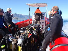
Attrezzatura
Equipaggiamento standard
La maggior parte dei siti di immersione in questa regione sono relativamente poco profondi e possono essere effettuati in aria con le normali attrezzature subacquee ricreative, che includerebbero:
- Una muta completa di almeno 5 mm di spessore, cappuccio, stivali e guanti.
- Una bombola con cablaggio, regolatore e manometro sommergibile.
- Un dispositivo equilibratore di galleggiamento (BCD).
- Maschera e boccaglio.
- Pinne.
- Un sistema di pesi amovibili correttamente calibrato per il resto dell'attrezzatura.
- Un computer subacqueo o un profondimetro e un timer con tabelle di decompressione e piano di immersione.
A questo puoi aggiungere:
- Qualsiasi altra attrezzatura che tu o la tua agenzia di certificazione potreste considerare obbligatoria, come un erogatore secondario, un dispositivo di gonfiaggio del GAV a bassa pressione, un coltello, ecc.
- Qualsiasi attrezzatura che porti o usi per una questione di preferenza personale, come macchina fotografica, dispositivo di segnalazione, lavagnetta da polso, muta stagna, mulinello e boa segnaletica di superficie, fornitura di gas alternativa, bussola, ecc.
Raccomandazioni
- Se le pinne hanno scarpette piene (tallone chiuso) e gli stivali della muta hanno suole morbide, potrebbe essere necessario indossare scarpe per raggiungere il punto di ingresso durante le immersioni da terra. Pinne con tacco aperto e stivali con suola rigida sono consigliati per la maggior parte delle immersioni dalla riva in questa regione perché il terreno tende ad essere accidentato e le scarpe potrebbero non essere ancora dove le hai lasciate quando torni dall'immersione.
- Una boa segnaletica di superficie standard non è consigliata dove c'è una forte crescita di alghe, poiché si impiglia frequentemente e fornisce un fastidio infinito. Un marker di superficie dispiegabile o "ritardato" è migliore in tali siti ed è sempre una buona cosa da portare con sé durante un'immersione dalla barca.
- Tralasciare uno qualsiasi degli elementi di cui sopra è a proprio rischio. Ci sono subacquei che non indosseranno cappucci, guanti o stivali, né sentono che uno snorkel o un jacket non sono necessari o che possono immergersi con una muta da 3 mm. Provalo prima in un'immersione facile, dove puoi uscire rapidamente. Potrebbe funzionare per te: ci sono subacquei che se la cavano in ciascuno di questi casi, ma sei stato avvertito.
Equipaggiamento aggiuntivo

For each dive site there may be additional or alternative equipment required or recommended, which may improve the dive experience or improve safety at that site. The most commonly recommended items are:
- Compass
- Dry suit
- Light
- Nitrox
- Reel with DSMB
Use of a compass is recommended wherever it may be desirable to swim back to shore below the surface to avoid wind or boat traffic, or to keep below the kelp fronds. It is required for the compass navigation routes.
A dry suit is recommended for most dives on the Atlantic seaboard, or in general if the dive is deeper than about 20 m and the water is colder than 13°C. An appropriate undergarment is required for the dry suit, at this is what provides the insulation. With a suitable combination it is possible to enjoy an hour's dive in comfort at a water temperature of 8°C, when most of the divers in 7-mm wetsuits are cold after 30 minutes. If your face and head are particularly sensitive to cold, a full-face mask will keep your face warm.
Recommendations for a light are for daytime dives, as lights are considered standard equipment on night dives. Backup lights should be carried on night dives from a boat. Underwater flashers may not be well received by the other divers as they are extremely annoying. If you feel you must use one, warn the others and stay away from those divers who do not wish to have a light continually flashing in their peripheral vision and distracting them. A strobe which may be switched on in an emergency is another matter entirely, and is accepted as a valuable safety aid.
The equipment recommendations are for divers who are competent to use those items, and if you are not, you should consider whether your competence is sufficient to dive the site without this equipment.
No recommendations are made regarding equipment for wreck penetration dives and deep dives. If you do not know exactly what equipment is required and have it with you, or are not competent in its use, you should not do the penetration. Depth, wrecks and caves are nature’s tools for culling reckless divers.
Recommendations for gas mixtures are generic. You must choose the appropriate mixture based on your qualifications, competence and the dive plan. Nitrox mixtures are generally recommended to increase dive time without obligatory decompression stops, and Trimix to reduce narcotic effects. Nitrox is available from many of the dive shops, and charter operators will usually provide cylinders filled with the blend of your choice if given sufficient notice. Trimix is more difficult to arrange, as not many filling stations keep Helium in stock, so it may require a bit of shopping around.
Decompression dives should generally only be planned by divers who are familiar with the site, and are competent and properly equipped for the planned dive. Recommendations in this regard are outside the scope of this article, and it will be necessary to discuss any planned decompression dives well in advance with the dive operator, as only a few of them are competent and willing to support planned decompression dives, and those will usually require strong evidence of your competence to do the dive, and advance notice of your dive plan.
Exotic equipment

Diving equipment other than open circuit back mounted scuba with half mask and mouth-grip demand valve is considered to be exotic for this section.This would include surface supplied breathing apparatus and full face masks, used as standard equipment by commercial divers, and rebreathers, seldom used by commercial divers, but frequently used by military divers and gaining popularity with Technical recreational divers.
Also considered as exotic equipment is side-mount scuba and diver propulsion vehicles (scooters), as they are not used by many recreational divers.
Generally speaking, any use of surface supplied diving equipment will require special preparation and logistics, which are not available from the listed service providers, but are perfectly legal for use and technical support is available from the suppliers to the commercial diving industry in Cape Town.
Rebreathers are relatively uncommon, but are used by a few local aficionados, and sorb is available over the counter at a few suppliers. There is even one charter boat which regularly runs dives for mainly rebreather divers. Expect to be checked out for skills and certification before being allowed to join these dives, so it would be advisable to make prior arrangements. Technical support is available for a limited range and parts will usually only be available from overseas agencies. Most of the local dive sites do not really justify the expense and relative risk of rebreathers, and they are mostly used by divers who also use them in other places where they are more of an advantage, and by those who just enjoy the technology. They are not available for rental, except in some cases as part of a training package.
Full-face masks will not be a problem, provided you can show your ability to provide buddy support if diving with a partner (some charters will insist that you dive with a buddy). Technical support and parts are available from local agencies for most of the more popular models used for commercial and technical diving, but you may have to wait some time if parts are not in stock. The use of a full-face mask can be a particular advantage when the water is cold, and if you have one and prefer to use it, by all means bring it to Cape Town.
Side mount scuba is relatively uncommon in Cape Town, but there should be no problems if you chose to use it. Do not expect boat crews to know how to help you kit up, but they will probably respond well to explanations. There is a growing number of local side-mount aficionados, including several instructors for side-mount.
Diver propulsion vehicles (scooters) are rare but not unknown. Check with the charter boat whether will be space on board for your unit, and don't expect to find one for rental.
Decompression and bailout sets are not considered exotic, but are not easily available for rental. Bring your own, or ask around. Some of the service providers carry a small range of cylinders suitable for sling mount, but may not have the gas mixture you want in stock. Almost all the local divers that carry decompression or bailout cylinders routinely have their own equipment
Siti di immersione


The dive sites described in these articles include some which are well known favourites and have been dived frequently and by many divers for decades, and also newly described sites, which may only have been dived a few times, and by a few divers. There are also sites which have been known for years, but seldom dived due to their relative inaccessibility, and a few which are basically not particularly interesting, but have been included in the interests of completeness, as the information is available, and occasionally people want to know what they are like. With a few exceptions, the information provided is based on personal observation at the sites by Wikivoyagers. All photos of marine life and features of interest were taken at the listed site.
Geographical information is provided in as much detail as is available. Sites are geolinked, which allows them to be identified on various internet map systems. Positional accuracy is usually good. The maps provided should be usable, to scale, and accurate, but are not guaranteed either to be correct in all details or complete. Clicking on the thumbnail will open a link to a higher resolution image.
Atlantic coast of the Cape Peninsula

Introduction and some tips on diving the Atlantic coast.
This coastline from Table Bay to Cape Point is exposed to the south westerly swells generated by the cold fronts of the Southern Ocean. The continental shelf is narrow in this part of the coast and swells are not greatly influenced by the narrow band of shallow water, so they retain most of their deep-water energy. These swells pound this coast most of the winter, and to a lesser extent in summer, so diving in this region is mostly a summer activity, and the frontal weather patterns far to the south are more important than local weather for swell prediction.
North westerly winds are a feature of the approach of a cold front, and in winter they can be very strong for a few days before swinging to southwesterly as the front passes. These north westerly winter storms were responsible for many shipwrecks in Table Bay and other parts of the west coast, and the associated wind waves can be severe. However the fetch is short and these onshore wind waves do not last long after the storm. They do mess up the visibility though, and this effect lasts for some time after the waves have dissipated.
The south easterly winds are longshore to offshore in this area and tend to knock the swell down a bit. They also cause an offshore displacement of the surface water, which results in deeper water rising to take its place. This upwelling brings colder, initially cleaner water to the inshore areas, and can produce conditions of 20 m visibility and temperatures down to 8°C, though more usually 10° to 12°C. The diving is wonderful if you are sufficiently insulated. Out of the water, however, it is commonly fine and hot, with blazing sunshine high ultraviolet levels and air temperatures in the high 20 and 30° Celsius. This means you will be overheating until you get in the water, hence the comment that summer diving in Cape Town is one easy step from hyperthermia to hypothermia.
There is no escaping the need for a well-fitting, thick (preferably 7 mm), wet suit or a dry suit with an adequate undergarment for these conditions if you intend to stay for more than a few minutes. Carrying a bottle of water with your equipment to wet the outside of your suit before or after putting it on will help keep the temperature down due to evaporative cooling, specially on a windy day. Overheating after leaving the water is seldom a problem. The alternative option of kitting up at the water’s edge requires a shore party to look after your clothes, etc., while you dive, so it has become less common. Do not leave equipment unattended if you wish to see it again.
An upwelling is frequently followed by a plankton bloom, often called a red tide. This will reduce visibility considerably, particularly near the surface. Often the water will be much clearer below the surface layer, though the light levels may be a bit dim and the colour relatively green, or even brownish. The phytoplankton will bloom while the sun shines, so it is much more developed in summer.
The south-easter is an offshore wind at some sites, and besides its influence on temperature and visibility, it also affects the swim back to shore after the dive. The south-easter can appear seemingly out of nowhere on a previously cloudless and windless day, and build up to near gale force in the time you are underwater on a dive, though it is usually predictable, so take note of weather forecasts, and in any case, allow sufficient reserve air to swim back a few metres below the surface. A compass is extremely useful if you do this as it allows you to swim shallower, which is good for air consumption, decompression and warmth. A depth of 3 to 5 m is recommended for a long swim home. The strong south-easter in these cases produces a short, steep wind chop with white-caps which does not penetrate to any significant depth, but the constant slapping of waves and the spray in the air can make snorkelling unpleasant and difficult. There may also be a shallow offshore wind drift (surface current), but this takes some time to develop and gets rapidly weaker with depth and is not usually a problem below about a metre depth inshore. Further offshore the wind induced current can take you several hundred metres during a decompression stop, at a rate of about 0.5 to 1 kph.
When boat diving a deployable surface marker buoy (DSMB) is useful to both facilitate controlled ascent and accurate decompression or safety stop depth, and as a signal to the boat that you are on your way up. In strong wind conditions it will also improve your visibility on the surface, specially if your equipment is all black, so it is worth carrying even if only as a signalling device. Bright yellow has been shown to be best for all round visibility at sea, but orange and red are fairly good too.
Robben Island

These sites are all boat dives. There is no other practical way to get to them, as they are all several kilometres from the mainland across major shipping lanes.The waters around Robben Island were proclaimed a Marine Protected Area in 2019, so a permit is required to dive there. The boat operator will have to have a permit for the restricted area. Details of how this will be done are not yet known.
Local geography:Robben Island is a low, rocky shored island in the mouth of Table Bay. The island and surrounding reefs are rock of the Tygerberg series of the late Precambrian Malmesbury group. These are folded sedimentary rocks, frequently with very steep dip, which often weather to form rather jagged outcrops.
The sites include:
- 1 MV Treasure: S33°40.45' E018°19.95' (approximate)
- Wreck dive. Boat access only. Depth: 30 to 50 m
- On 23 June 2000 the damaged Panamanian registered bulk ore carrier sank off the coast of South Africa approximately 7 nautical miles north of Robben Island.
- The vessel lies upright on a fairly level bottom at about 50 m depth. The superstructure was removed shortly after the sinking by sawing it off at about 30 m depth with a cable towed by tugs as it was a hazard to shipping.
- 2 Robben Island steamer wreck: S33°49.886', E018°21.524' (approximate centre of wreckage)
- Wreck dive. Boat access only. Depth: 30 to 36 m
- Unidentified wreck of a steel steamship about 48 m long in reasonable structural condition.
- 3 MV Afrikaner: S33°50.012' E018°20.686'
- Boat access only. Deep wreck dive. Depth 43 to 50 m
- The 61 m fishing vessel struck Whale Rock in 1993 and sank while being towed away from the rock.
- 4 Whale Rock: S33°50.112' E018°22.858'
- Reef dive. Boat access only. Depth: Mostly less than 10 m
- A large shoal area of rocky reef, usually with a break over the pinnacle, which is the last resting place of a few ships.
- 5 SS Hypatia: S33°50.10’ E018°22.90’ (Turner 1988)
- Wreck and reef dive. Boat access only. Depth: Shallow, maximum probably about 15 m
- British Houston Line steamer of 5 728 tons, built in 1902. Wrecked on Whale Rock in Table Bay on 29 October 1929 in fog while on a voyage from Beira to New York with a cargo of blister copper and chrome ore.
- 6 MV Daeyang Family: S33°50.388' E18°23.133
- Wreck and reef dive. Boat access only. Maximum depth about 15 m
- A large Korean ore carrier which was wrecked on Whale Rock on 1 March 1986 when anchors dragged in heavy weather. The wreckage lies at a depth of about 15:nbsp;m
Table Bay

- 7 MV Winton: S33°52.1514' E18°29.1828 (Engine block)
- Wreck dive. Boat access, though shore access is feasible. Close to surf line. Maximum depth about 6 m.
- Wreck of a small steel freighter on a flat sand bottom.
- 8 MV Gemsbok: S33°53.0' E018°20.5'
- Boat access only. Deep wreck dive. Depth about 57 m on the sand.
- The 50 m 313 tonne buoy tender MV Gemsbok capsized and sank about 4 km from Green Point Lighthouse on 2 Seprember 1975 while transferring an anchor chain of a cargo vessel. The chain snagged and the weight of the chain caused the vessel to capsize and sink within minutes. The wreck lies on its starboard side.
- 9 Highfields: S33°53.13’ E018°25.83’ (Bow)
- Wreck dive. Boat access only. Close to major shipping lane at harbour mouth. Maximum depth 24 m.
- Wreck of a steel barque which sank after a collision in 1902.
- 10 SS Cape Matapan: S33°53.233' E018°24.533' About a kilometer north of Granger Bay harbour
- Wreck and reef dive. Boat access only. Maximum depth 25 m. The wreck is close to the shipping lane and there are no landmarks nearby.
- Wreck of a steel fishing boat which was sunk in a collision in 1960 in heavy fog.
- 11 RMS Athens: S33°53.85’ E018°24.57’
- Wreck and reef dive. Shore or boat access. Maximum depth about 7 m
- Union Company iron steam screw barque of 739 tons, built in 1856. Wrecked between Mouille Point and Green Point on 17 May 1865 during a north-west gale while trying to steam out of Table Bay. The site can be identified by the remains of the engine-block, which is visible above the water.
- 12 SS SA Seafarer: S33°53.80’ E018°23.80’
- Wreck and reef dive. Boat access recommended. Depth: Fairly shallow. Mostly between 5 and 9 m.
- The 8000-ton Safmarine freighter SS South African Seafarer was wrecked in a north westerly gale on 1 July 1966, and lies in front of the Green Point lighthouse.
- 13 Two Oceans Aquarium: S33°54.476’ E018°25.074’
- Shore access only. Confined water. Maximum depth 6 m
- Visitors may dive in the Predator tank, which is a large oval tank, or the Kelp Forest tank, which is roughly square. There are large windows, almost full height on one side, through which you can observe the other visitors watching you if you get bored with the fish.
Sea Point

Local Geography:There is a narrow coastal plain at the base of Signal Hill and Lion’s Head. The contact zone between the intrusive granites of the penisola pluton and the sedimentary greywackes and shales of the Tygerberg formation of the Malmesbury series is in this area.The northern sites are on the Tygerberg rocks, which are steeply dipped and form parallel ridges and gullies, while Bantry Bay is on the granite, and has the characteristic corestone topography of rounded boulders and outcrops with sand bottom in deeper areas.
The sites include:
- 14 Three Anchor Bay: S33°54.36’ E018°23.85’
- Reef dive. Shore access. Depth: Shallow
- A small sand bottomed bay with reef to both sides. Easy access.
- 15 Sea Point Ridge Pinnacles: S33°54.905' E018°21.421'
- Reef dive. Boat access. Depth: 17 to 27 m
- An isolated pair of corestone pinnacles on a low granite ridge.
- 16 Bantry Bay: S33°55.56’ E018°22.65’
- Reef dive. Shore or boat access Depth: Less than 10 m
- This little bay is at the southern end of Sea Point, towards Clifton.
Clifton

Clifton Rocks is generally considered a shore dive, but the Paws are quite a distance offshore and are only dived from boats. Parking in Clifton is often a problem, particularly in the kind of weather in which you may wish to go diving. Weekdays will be better and early morning will help. The offshore dives avoid this problem by using boats from Oceana Power Boat Club slipway, which has its own parking problems, though not quite as serious.
Local geography:The suburb of Clifton is built on the rather steep slopes of the base of Lion’s Head above Clifton Bay. There are four beaches in the bay which are famous for white sand, shelter from the south easter and cold water. North Paw is offshore of the headland to the north, and South Paw is offshore from Clifton Rocks, on the south headland. Access to the area by road is from Sea Point to the north and Camps Bay to the south.
The reefs of Clifton are granite corestones of the penisola plutone. In this area the granite base of the mountain extends to approximately the height of Signal Hill, and is capped by sandstones of the Graafwater and Table Mountain formations. Occasional rounded granite outcrops can be seen on the mountainside, which is mostly deeply weathered granitic saprolite, with some sandstone scree.
The sites include:
- North Lion’s Paw: S33°55.854’ E018°21.849’ (Exposed Rock)
- Reef dive. Boat access only. Depth: 15 to 23 m.
- A spectacular site in good conditions. A popular part of the site is the cave rock, which is slightly offshore from the exposed rocks.
- 17 North Lion’s Paw Northern Pinnacles
- 18 North Lion’s Paw Monty's Pinnacles
- 19 North Lion’s Paw Eastern Pinnacle
- 20 North Lion’s Paw Barry's Pinnacles
- 21 North Lion’s Paw Cave Rock
- 22 North Lion’s Paw Main Reef
- 23 South Lion’s Paw: S33°56.308’ E018°21.890’
- Reef dive. Boat access only. Maximum depth about 20 m.
- An extensive reef of granite corestones marked by the large outcrop which extends above the water.
- 24 Clifton Rocks: S33°56.346’ E018°22.222’
- Reef dive. Shore or boat access. Maximum depth about 14 m.
- A large area of granite corestones, bounded to the north by sand bottom. The reef extends to seaward from the shoreline at the point.
- 25 Cleeve's Tunnel: S33°56.540' E018°21.894'
- Reef dive. Boat access. Maximum depth about 20 m.
- A large corestone pinnacle with a long low tunnel
Camps Bay
Local geography:Camps Bay is in the corner made by Lion’s Head and Table Mountain. Access is over Kloof Nek from the city bowl, and round the coast from Sea Point via Clifton to the north, and from Hout Bay via Oudekraal to the south
The reefs of this area are like those of Clifton.
The sites include:
- 26 Bakoven Rock: S33°57.555’ E018°22.204’
- Reef dive. Shore or boat access. Maximum depth 17 m.
- This site is generally considered a shore dive. Parking is limited so it is most conveniently dived during the working week when there is less competition for space, otherwise get there early.
Oudekraal

This area includes some of the best and most popular shore dive sites on the Atlantic seaboard. Most can also be dived from a boat, and this is of particular importance to divers with restricted mobility on shore, as there is generally a rugged bit of coast to negotiate and in some cases a long climb. There is also a moderate to long swim at some of the sites, and at some states of the tide, heavy kelp inshore.
Local geography:The coastline at the base of the Twelve Apostles range just south of Table Mountain is steep, and south of Camps Bay, virtually undeveloped. Fortunately for divers, the coastal road is not far above sea level in the north of this area, and though there are not many off-road parking areas, the road is wide enough to park along the side.
This is an area of pale grey penisola Granite corestone outcrops and boulders with some Table Mountain Sandstone boulders which have rolled down the mountainside to the water’s edge. The mountainside below the sandstone cliffs is deeply weathered granite saprolite with occasional corestone outcrops. The cuttings at the roadside display the granular yellow-brown saprolite with a thin soil covering. The underwater topography is almost entirely corestones exposed by erosion, surrounded by samd, and is a continuation of the granite boulders and outcrops at the water’s edge.

North Oudekraal
The sites include:
- 27 Dreadlocks Reef: S33°58'22.05" S18°21'42.59"
- Reef dive. Boat access. Depth: 1.5 to 20 m.
- A relatively new site. First survey 30th January 2010. This granite ridge peaks about 1.5m from the surface at low tide, but the tip is small and seldom breaks. Bottom on low granite at about 20m. Colourful and diverse invertebrate cover, and notable for the relatively large colonies of Dreadlock hydroids.
- 28 Geldkis Blinder: S33°58.67’ E018°21.62’
- Reef dive. Boat or shore access. Maximum depth about 20 m.
- A relatively infrequently dived site. The highest rock on the reef is a blinder beyond Geldkis rock which occasionally breaks the surface at low tide. Huge boulders and outcrops, and a few swimthroughs.
- 29 Rocce Di Fragole: S33°58.725’ E018°21.658’ (approximate)
- Reef dive. Shore or boat access. Maximum depth about 15 m.
- The two smaller rocks to the north of Geldkis rock. Several small caverns and swimthroughs.
- 30 Geldkis: S33°58.73’ E018°21.61’
- Reef dive. Shore or boat access. Maximum depth about 15 m.
- A large group of rocks with lots of overhangs, swimthroughs and chimneys. The Dutch East Indiaman Het huys te Craijestein was wrecked on the rocks in the bay at Oudekraal on 27 May 1698 in thick mist. Three chests of treasure disappeared and the name "Geldkis" (money-chest) appears on maps of the area and is now applied to the offshore rocks.
- 31 Boardroom: S33°58.761’ E018°21.151’
- Reef dive. Boat access, though possible from shore. Maximum depth about 21 m near the pinnacle, but deeper water nearby. about 10 m on top.
- A very large boulder with a large swimthrough cave and a large overhang in an area of high profile boulder reef.
- 32 Het Huis te Kraaiestein: S33°58.85’ E018°21.65’
- Wreck and reef dive. Shore access. Maximum depth 10 m.
- Remnants of the Dutch East Indiaman Het Huis te Kraaiestein of 1,154 tons, which was wrecked in the bay at Oudekraal on 27 May 1698 in thick mist while trying to find the way into Table Bay. Some cannon, anchors and a few baulks of timber are all that are usually visible above the sand.
- 33 Pinnacolo di funghi: S33°58.781’ E018°21.521’
- Reef dive. Shore or boat access. Maximum depth 17 m.
- A submerged granite tor (stacked group of large corestones) between Geldkis and Justin’s Caves. The pinnacle is surrounded by lower outcrops separated by sandy gullies.
- 34 Baia di sabbia: S33°58.90’ E018°21.65’
- Reef dive. Confined waters. Shore access. Maximum depth 4 m
- A shallow sheltered cove at Oudekraal, suitable for open water training exercises, refresher courses and testing equipment when you don’t need depth. Entry area for several other sites.
- 35 Le grotte di Justin: S33°58.85’ E018°21.50’
- Reef dive. Shore or boat access. Maximum depth about 13 m.
- A group of big granite corestone outcrops and boulders with several swimthroughs, overhangs, caves and deep narrow gaps between the rocks. Spectacular in good visibility, colourful reef life.

Central Oudekraal
The sites include:
- 36 Antipolis: S33°59.06’ E018°21.37’ (Bow section)
- Wreck and reef dive. Shore or boat access. Maximum depth about 10 m.
- The tankers "Romelia" and "Antipolis" were under tow on 28 July 1977 during a north westerly gale when the tow cable to the "Antipolis" snagged on the sea bed. In the ensuing confusion the cables broke and the two ships were driven aground by the wind. The "Antipolis" ran aground at Oudekraal and was later cut down to water level.
- 37 Klein Pannekoek: S33°58.91’ E018°21.09’
- Reef dive. Boat or shore access. Maximum depth about 15 m.
- A group of large fairly low and flat rocks visible offshore to the west of the "Antipolis" and north of Coral Gardens.

South Oudekraal
The sites include:
- 38 Groot Pannekoek: S33°59.13’ E018°20.75’
- Reef dive. Boat or shore access. Maximum depth about 15 m
- A large flattish outcrop of granite, which extends a short way above the sea level at all tides. Some overhangs, crevices and small caves.
- Giardini di corallo (Oudekraal): S33°59.270' E018°20.782' (The pinnacles)
- Reef dive. Shore or boat access. Maximum depth 17 m
- A spectacular dive in good conditions. Huge granite boulders in groups with open patches between them. There are overhangs, small caverns, a few swimthroughs, and many deep gaps and crevices. Extensively covered in colourful reef life. Possibly the best shore dive on the Atlantic side of the Cape Peninsula on a good day.
- 39 Giardini di corallo
- 40 Pinnacle offshore di Coral Gardens
Llandudno

These sites can be accessed from the shore or by boat. Parking is limited, but the area is reasonably secure. Some walking is required, but no serious climbing as the parking is near the sea level.
Local geography:The small residential suburb of Llandudno is built on the moderately steep slopes of the Cape Peninsula below the peak of Klein-Leeukop, where the coast road (M6 – Victoria Drive) from Camps Bay crosses over the neck to Hout Bay. There is only one way into Llandudno by road, which is from the M6 near the top of the pass.This is an area of granite corestone reefs with sand bottom.
The sites include:
- 41 13° Apostolo: S33°59.486' E18°19.922'
- Reef dive. Boat access. Depth: 10 to 24 m.
- A large granite pinnacle on an area of low granite reef with occasional sand patches.
- 42 Llandudno Reef: S34°00.037' E18°19.897'
- Reef dive. Boat access. Depth: 10 to about 30 m, on sand
- An unsurveyed granite reef, with several pinnacles, outcrops and gullies.
- 43 Logies Bay: S34°00.25’ E018°20.53’
- Reef dive. Shore access. Maximum depth probably about 10 m.
- A small rocky cove to the north of Llandudno beach.
- 44 MV Romelia: S34°00.700’ E018°19.860’ approximately
- Wreck and reef dive. Shore or boat access. Maximum depth about 24 m.
- The tankers Romelia and Antipolis were under tow on 28 July 1977 during a north westerly gale when the tow cable to the Antipolis snagged on the sea bed. In the ensuing confusion the cables broke and the two ships were driven aground by the wind. Il Romelia ran aground at Sunset Rocks, Llandudno, where its back was broken by the heavy surf and the ship split in two. Later the bow section sank, leaving the stern mostly above sea level on the rocks. Over the years the stern section has also broken up and is no longer visible above the water.
Oude Schip headland
Local geography:Oude Schip headland lies at the foot of the Karbonkelberg between Sandy Bay to the north and Leeugat to the south, It is a low rocky headland of Peninsula granite, with several reef dives and one known wreck. It is a fairly exposed section of coast but protected from the south easterly winds by the mountain. The sites are only accessible by boat as there is no road access to this part of the shore, and most are too far offshore to safely swim.
This is an area of granite bedrock of the penisola pluton, The reefs are exposed corestone outcrops and boulders, with sand patches in the deeper areas
The sites include:
- 45 Passi: S34°01.330’ E018°18.600’
- Reef dive. Boat access only. Maximum depth about 20 m.
- An area of high granite reef with deep gullies. Not actually in Leeugat, but just north of Oude Schip headland.
- 46 MV Harvest Capella: S34°01.600’ E018°18.750’
- Wreck dive. Boat access only. Maximum depth about 15 m.
- An area of mostly flattish granite reef with a few ridges and some wreckage of a steel motor fishing vessel, some of which has washed up onto the point and is visible from a distance. Not actually in Leeugat, but on the north shore of Oude Schip headland.

The Blue Flash Reefs
- 47 Rachel's Reef: S34°01.431' E018°18.151'
- Reef dive. Boat access only. Depth between about 3 and 21 m.
- Rachel's Reef is a compact granite pinnacle with surrounding high profile reef.
- 48 Humpback Ridge: S34°01.548' E018°18.142'
- Reef dive. Boat access only. Depth between about 4 and 21 m.
- A fairly massive granite pinnacle in the middle of a more extensive north-south ridge rising to about 12 m. Humpback whales have been seen near these reefs on several occasions.
- 49 Wilhelm's Wall: S34°01.502’ E018°17.931’
- Reef dive. Boat access only. Depth between about 12 and 31 m.
- A granite ridge somewhat more than 50 m long with sheer faces to the north and south, a flattish bottomed gully to the south, and another, more broken ridge south of the gully. Colourful sessile invertebrates on the sides and seaweeds on top.
The Middelmas reefs:
- Hakka Reef (Middelmas): S34°01.747’ E018°18.328’
- Reef dive. Boat access only. Maximum depth about 21 m.
- 50 Die Middelmas is a rock that projects several metres above the water at all tides, to the west of the Oude Schip peninsula.
- 51 Hakka Reef Southeast pinnacles is off this rock.
- 52 Hakka Reef Sven's Caves pinnacles is nearby at a set of pinnacles near a sand patch.
- 53 Twin Towers: S34°01.920’ E018°18.330’
- Reef dive. Boat access only. Depth about 20 m at the tops of the pinnacles to 34 m on the sand.
- A small but tall double-peaked granite pinnacle on a narrow base reef and surrounded by sand.
Leeugat (Maori Bay)

.jpg/220px-Gelderland_(1).jpg)
Although several of the sites are quite close inshore, this area is in practice only accessible by boat, as the distance to the nearest parking is too far to carry dive gear (about 3 km as the crow flies, more on foot).
Local geography:Leeugat, also known to divers as Maori Bay, lies at the foot of the Karbonkelberg, between the northern headland of Oude Schip, and Duikerpunt to the south. It is a small bay, but fairly deep close inshore, which in combination with the partial barrier afforded by the reefs at the headlands, has provided the wrecks in Leeugat bay with better protection from wave action than those on more exposed parts of the coastline. This means that not only have they lasted well for their ages, but conditions are suitable for diving more often than for many other wrecks on the Atlantic seaboard of the Cape Peninsula.
This is an area of granite bedrock of the penisola pluton, The reefs are exposed corestone outcrops and boulders, with sand patches in the deeper areas
The sites include:
- 54 MV Keryavor and the Jo May: S34°02.037’ E018°18.636’
- Wreck and reef dive. Boat access only. Depth: Not available, probably between 25 and 30 m.
- These two wrecks lie next to each other approximately between the Maori and the Gelderland. Il Jo May sank first and not much of her wooden structure remains. Il Ker Yar Vor was a steel lobster fishing vessel and several chunks of hull structure and twisted sections of plating remain.
- 55 SS Maori: S34°02.062’ E018°18.793’ (Machinery)
- Wreck and reef dive. Boat access only. Depth: 6 to 21 m
- La SS Maori was a typical British steam cargo vessel of the early 1890s. The ship was wrecked in the bay between Oude Schip and Duikerpunt on 5 August 1909 in thick fog and drizzle while on a voyage from London to New Zealand.
- 56 SAS Gelderland: S34°02.070’ E018°18.180’
- Wreck and reef dive. Boat access only. Depth: 30 to 35 m
- The Ford class Seaward Defense Boat SAS Gelderland was scuttled on 21s ecember 1988, north west of Duiker Point, as demolition trials.
- The vessel was about 40 m long but the main part of the wreckage is now only about 20 m long as the bow and stern sections were blown right off.
- Plan B pinnacle is just to the south of the southernmost wreckage.
- 57 SS Oakburn / MV Bos 400: S34°02.216’ E018°18.573’
- Wreck and reef dive. Boat access only. Depth: Maximum 22 m
- The "Oakburn", a British cargo steamer of 3865 tons, was wrecked on the north side of Duikerpunt in fog on 21 May 1906, on a voyage from New York to Sydney. The Oakburn has pretty much fallen apart, and on 27 June 1994, the French pipe-laying crane barge Bos 400, broke its towline and stranded virtually on top of the older wreck. The Bos has started to break up, and two large sections have collapsed into the sea, though the main crane section is still firmly stuck on top of the rocks.
Outer Hout Bay


This area includes the dive sites between Duiker Point and Duiker Island and the extensive reefs to the south as far as Vulcan Rock and Tafelberg Reef. All of these are only accessible by boat. There are a number of sites being explored in this area: the reefs between Kanobi’s wall and Stonehenge, and a wreck of a lifeboat which was used to salvage materials from the Boss 400 and which lies between Stonehenge and Duiker Island are among these. There are several unexplored pinnacles in the region identified on the SAN charts as bakleiplaas, where the sea is often very lumpy due to the influence of the underwater topography on the swell.
Local geography:The suburb of Hout Bay lies in the valley between the Constantiaberg to the east and the peninsula formed by Karbonkelberg and its lesser peaks to the west. One of these peaks, the Sentinel, gives its name to a dive site at its foot. At the mouth of the valley is the business area of Hout Bay, with its small commercial fishing harbour and marina, and a public slipway used by dive charters and private dive boats for access to most of the southern peninsula dive sites on the Atlantic coast. The slipway is in good condition, wide and accessible, and has a large parking area, which on occasions can be crowded due to heavy use by commercial fishing skiboats.
The bedrock of this area is granite of the penisola pluton, and most of the sites are on corestone reefs of this rock.
The sites include:
Duiker Point sites:
- 58 Die Perd: S34°02.282’ E18°18.324’
- Reef dive. Boat access only. Depth: Not available, maximum probably about 20 m
- This rock off Duiker Point extends above the water and is surrounded by rugged reefs of high outcrops and deep gullies.
- 59 Kanobi’s Wall: S34°02.365’ E018°18.138’
- Reef dive. Boat access only. Maximum depth about 25 m.
- This blinder off Duiker Point is a good site with rugged topography, good biodiversity and large depth variation. Huge boulders are stacked, with tunnels, overhangs and caves of various sizes, and lots of vertical walls, some probably 10 m or more in height.
- 60 SURG Pinnacles: S34°02.375' E018°18.015'
- Reef dive. Boat access only. Depth 9 to over 30 m.
- A group of steep granite corestone pinnacles, probably mostly huge boulders, with walls, overhangs and a swimthrough. Deep narrow cracks divide the pinnacles. Spectacular topography, covered with lots of sea urchins and vast numbers of hairy brittlestars, a moderate variety of sponges, noble corals, gorgonians, and patches of cauliflower soft coral. Red bait and Laminaria on the tops of the pinnacles. Surge can be strong when a long swell is running.
- Star Wall: S34°02.466' E18°18.087' (pinnacle)
- Reef dive. Boat access only. Depth: 6 to 32 m.
- This site has the tallest and longest wall known in the Cape Town area and is a dive site well worth visiting. A massive and continuous granite wall of about 25m almost vertical height, extending for a length of 100 m on the south face and 50 m on the south-east face. Very diverse and colourful invertebrate cover on the wall face. The sites are:
- 61 Star Wall
- 62 Star Wall - M&M Cave
- 63 Star Wall - Lollipop Pinnacle
- 64 Sunfish Pinnacle: S34°02.475' E18°18.290' (pinnacle)
- Reef dive. Boat access only. Depth: 7 to 26 m.
- A fairly large pinnacle on a rocky bottom on the way to Duiker Point from Hout Bay harbour, which has been picked up quite frequently on the echo sounders of dive boats passing over it. It has now been dived, and to some extent mapped. The site is quite pretty and should make a pleasant alternative site. Topography is rugged, with high vertical walls on two sides of the pinnacle.
Stonehenge sites:
- 65 Canyon: S34°02.595’ E018°18.073’
- Reef dive. Boat access only. Maximum depth about 35 m.
- The area is named for a gully between rows of pinnacles. Big boulders and rock outcrops cover an extensive area.
- Stonehenge: S34°02.838’ E018°18.316’
- Reef dive. Boat access only. Maximum depth about 22 m.
- The area is named for a group of tall rocks which break the surface. Big boulders and rock outcrops cover an extensive area. High profile in the deeper areas, with swimthroughs, holes and overhangs. Heavy kelp in some areas. Included in this area, Stonehenge Blinder, a pinnacle that approaches the surface and breaks in a large swell or at low tide.
- 66 Stonehenge Dusky Pinnacles - Coral Pinnacle
- 67 Stonehenge North
- 68 A-340 Pinnacle
- 69 Stonehenge Central
- 70 Stonehenge South
- 71 Stonehenge Blinder
- 72 Stonehenge Wreck
Seal Island sites:
- 73 Seal Island (Duiker island): S34°03.458’ E018°19.562’
- Reef dive. Boat access only. Profondità: Poco profondo, per lo più inferiore a 6 m.
- Il piccolo isolotto roccioso segnato su mappe e carte come Duikereiland è diventato noto come Seal Island a causa della colonia residente di foche che è diventata un'attrazione turistica. Non va confuso con Isola delle foche a False Bay.
Siti rupestri di Vulcano:

- 74 Le crepe di Di: S34°03.855' E018°18.400' - Grande pinnacolo di 14m - masso in cima al reef. Circa 300 m a nord ovest (328° magnetico) di Vulcan Rock
- Immersione nella barriera corallina. Accesso solo in barca. Profondità: da 10 a 30 m.
- Un'immersione spettacolare se la visibilità è buona. Molte pareti e strapiombi, bagnanti e profonde e larghe fessure. Ricca copertura di invertebrati. Buon sito per la fotografia scenica grandangolare drammatica.
- 75 Vulcano Rock: S34°03.967' E018°18.582'
- Immersione nella barriera corallina. Accesso solo in barca. La profondità massima è di oltre 25 m vicino alla roccia.
- La roccia vulcanica è il punto più alto di una grande barriera corallina di granito e rompe la superficie in alcuni stati della marea. È basso e piatto sopra. Un'immersione spettacolare se la visibilità è buona.
Siti della barriera corallina di Tafelberg:
- 76 Tafelberg Reef: S34°04.22' E018°18.93'
- Immersione nella barriera corallina. Accesso solo in barca. Profondità: da 8 a 30 m.
- Vasta area di aspri affioramenti granitici con altorilievo e fondale sabbioso a circa 29 m ad ovest. Crepacci e gole profonde. Non molto strapiombo, ma molte pareti verticali. Topografia molto aspra e spettacolare in buona visibilità.
- 77 Klein Tafelberg Reef (Insalatiera, relitto yacht): S34°04.442’ E018°19.191’
- Immersione nella barriera corallina. Accesso solo in barca. Profondità: da 14 a 36 m.
- Enorme affioramento granitico con grossi massi. Fondo di sabbia nelle zone più profonde. Topografia aspra e spettacolare. Il relitto di uno yacht in vetroresina giace in una rientranza sul lato del pinnacolo. È possibile fare un'immersione da 40 a 45 m partendo dalla sabbia a est della barriera corallina e nuotare nella barriera corallina in direzione nord-ovest, ma è probabile che sarà necessaria la decompressione se si arriva fino a il pinnacolo poco profondo.
- Tafelberg Deep:
- Immersione nella barriera corallina. Accesso solo in barca. Profondità massima circa 40 m sulla sabbia.
- Affioramenti granitici di profilo medio-basso, digradanti verso il Tafelberg Deep Pinnacle a sud del pinnacolo di Klein Tafelberg Reef. È possibile fare un'immersione di 50 m e nuotare fino alla barriera corallina, ma sarà necessaria una certa decompressione.
- 78 Tafelberg Deep
- 79 Tafelberg Deep Pinnacle
Hout Bay


Questa zona comprende i siti tra Sentinel e Chapmans Peak. La maggior parte di queste sono immersioni in barca. L'unica eccezione, Sentinel, è accessibile via terra senza grandi difficoltà, ma ha un problema di sicurezza.
Il Sentinel è una zona tipica della costa granitica, con un gran numero di massi lungo la riva e scogliere di corestone con i soliti profili arrotondati. I relitti dell'Aster e della Katsu Maru si trovano su un fondo sabbioso piatto, e il sito di Die Josie è granito relativamente inalterato alla base delle scogliere del Lower Chapman's Peak
I siti includono:
- 80 Sentinella:
- Immersione nella barriera corallina. Accesso a terra o in barca. Profondità: Per lo più meno di 10 m.
- Questo è il luogo della costa atlantica dove la profondità di 30 m è più vicina alla costa.
- Il Sentinel è considerato da alcuni come l'area al di sotto delle scogliere verticali, ed è un'area di barriera corallina piatta con un sacco di alghe e meduse scatola, e alcuni grandi massi.
- I Pinnacles sono un gruppo di rocce vicino alla riva appena fuori dal porto di Hout Bay, vicino alle fognature.
- 81 MV Aster: S34°03,891’ E018°20.955’
- Immersione sul relitto. Accesso solo in barca. Profondità massima 28 mt.
- Il motoscafo "Aster" di 340 tonnellate e 27 m di lunghezza era un peschereccio di aragoste registrato in Sudafrica che è stato preparato come barriera artificiale adatta ai subacquei pulendo e tagliando aperture nella struttura ed è stato affondato nella baia di Hout vicino al relitto del "MV Katzu Maru" il 9 agosto 1997. È stato utilizzato come luogo di addestramento per la penetrazione di relitti. La nave è in posizione verticale sul fondo e comincia a rompersi.
- 82 MV Katsu Maru: S34°03.910' E018°20.942' (al centro del relitto)
- Immersione sul relitto. Accesso solo in barca. Profondità massima circa 30 m.
- Il peschereccio giapponese "Katsu Maru #25" ha colpito un oggetto non identificato in mare ed è stato forato sul lato sinistro. Mentre era rimorchiata verso Hout Bay, la nave si allagò e affondò nella baia il 7 agosto 1978. Il relitto giace sul lato di dritta sul fondo sabbioso.
- 83 Muori Josie: S34° 04.497' E018° 21.256'
- Immersione nella barriera corallina. Accesso solo in barca. Profondità: da 7 a 17 m.
- Una barriera corallina poco profonda sotto Chapman's Peak, che si trova vicino al porto di Hout Bay ed è adatta per immersioni notturne. Una delle poche aree in cui il granito non è arrotondato dagli agenti atmosferici, come si può vedere dalle scogliere sopra il sito.
Penisola Meridionale Atlantica

Questa zona comprende tutta la costa della penisola a sud di Noordhoek. Non viene spesso immerso per scopi ricreativi in quanto è molto lontano da buoni siti di lancio e non sono noti molti buoni siti di immersione. Ci sono diversi relitti in questa zona, in particolare a Albatross Rocks/Olifantsbospunt. Solo alcuni dei relitti sono stati identificati con certezza.
I siti includono
- 84 SS Clan Monroe: S34°08.817' E18°18.949'
- Relitto e immersione Reef. Accesso solo in barca. Profondità: da 4 a 8 m.
- Distrutto un po' a nord del faro di Slangkop a Kommetjie. Molto raramente immerso. Scogliera di arenaria piatta poco profonda, con relitti incrostati di alghe coralline.
- SS Thomas T. Tucker:
- Relitto e immersione Reef. Accesso solo in barca. Profondità: Poco profondo
- Questa nave è naufragata in alto sugli scogli e parti del relitto sono visibili a terra. La maggior parte del relitto si trova in acque abbastanza basse.
- 85 Stella d'Africa:
- Relitto e immersione Reef. Accesso solo in barca. Profondità: circa 27 m massimo.
- 86 SS Bia: Sezione di prua: S34°16.140' E018°22.812' Sezione principale: S34°16.217' E018°22.638'
- Relitto e immersione Reef. Accesso solo in barca. Profondità: da 3 a 8 m.
- 87 SS Umhlali: S34°16.435' E18°22.487'
- Relitto e immersione Reef. Accesso solo in barca. Profondità: da 5 a 8 m.
- 88 Albatros Rock: S34°16.495' E18°22.197'
- Immersione nella barriera corallina. Accesso solo in barca. Profondità: Probabilmente meno di 15 m vicino alla roccia.
- Scogliere sud-occidentali:
- Immersione nella barriera corallina. Accesso solo in barca. Profondità: incerta.
- Un'enorme area di barriera corallina poco profonda e letti di alghe a ovest della punta della penisola. È il ritrovo di pescatori subacquei e pescatori di gamberi ed è inesplorato in immersione.
False Bay costa della Penisola del Capo


Introduzione e alcuni consigli sulle immersioni lungo la costa di False Bay nella Penisola del Capo (lato Simon's Town)
A differenza del resto della regione, il lato ovest di False Bay è riparato dai venti occidentali invernali, ma in cambio affronta il sud-est. Per questo motivo la regione è solitamente immersa in inverno, quando il sud-est raramente soffia a lungo o con grande forza.
Le tempeste frontali invernali sull'Oceano Australe producono rigonfiamenti che vengono rallentati dalla piattaforma continentale e rifratti e diffusi intorno alla Penisola del Capo, in modo che si propagano per lo più paralleli alla costa, e hanno perso gran parte della loro energia nel momento in cui curvano verso la riva. La forma irregolare della costa anche qui protegge alcune zone più di altre. In generale, quelle parti della costa che corrono in una direzione più da nord ovest a sud est sono meglio protette dalle onde da sud ovest rispetto alle parti da nord a sud, quindi la scelta del sito di immersione dipende dai recenti modelli meteorologici.
Durante i mesi estivi quando il sud-est soffia più frequentemente, più a lungo e generalmente più duro, questa zona non è spesso tuffabile, e la visibilità è generalmente più scarsa che in inverno anche quando le condizioni sono altrimenti adatte.
La temperatura dell'acqua durante i mesi invernali in questa zona è generalmente più calda rispetto alla costa atlantica in estate, il che compensa in qualche modo le ore diurne più brevi e il clima spesso freddo e piovoso.
La temperatura dell'acqua può variare con la profondità. Di solito c'è un termoclino in estate e la visibilità può cambiare significativamente al di sotto del termoclino. La superficie può essere di 18 o 19°C con 10 o 11°C nella parte inferiore, ma è più probabile che la differenza sia di 5°C o meno. Le condizioni in profondità non sono facilmente prevedibili e possono essere migliori o peggiori che in prossimità della superficie. Ci può essere una fioritura di plancton negli strati superficiali e un improvviso miglioramento della visibilità da 3 m o meno a oltre 10 m nell'acqua fredda di fondo. Anche la profondità del termoclino non è molto prevedibile, ma si sa che alla fine dell'estate è compresa tra 12 e 20 m.
In inverno l'acqua può avere la stessa temperatura da cima a fondo, e poiché c'è meno luce solare per alimentare le fioriture di fitoplancton, la visibilità e l'illuminazione naturale possono essere migliori anche se c'è meno luce.
Tra i fronti freddi e piovosi ci sono spesso giornate con poco o nessun vento e sole da mite a caldo, quando l'acqua è piatta e limpida e le immersioni sono meravigliose, e il gran numero di siti rende difficile decidere dove andare in quanto c'è così tanta scelta. È una vita dura qui alla fine dell'Africa, ma qualcuno deve pur farlo.
La temperatura dell'acqua durante l'inverno è solitamente compresa tra 13°C e 17°C, anche se è noto che scende fino a 11°C, quindi anche qui è necessario un buon vestito. In estate la temperatura può superare i 20°C, ma è più probabile che si aggiri intorno ai 17°C - 19°C.
La maggior parte delle immersioni dalla riva sono relativamente poco profonde, nell'ordine da 8 m a 15 m di profondità massima, anche se è possibile fare un'immersione da 30 m dalla riva se non ti dispiace una nuotata di 700 m per arrivarci. Le acque poco profonde rendono meno vantaggiosa una muta stagna, ma uscire dalla muta sotto il vento e la pioggia di notte spinge di nuovo su la muta stagna come opzione desiderabile. È bello avere la scelta, e molti subacquei locali si scambiano mute stagne e bagnate a seconda dell'immersione pianificata.
Muizenberg a Kalk Bay

Questi siti sono i siti più settentrionali del lato ovest di False Bay. Sono poco profonde ed esposte ai venti e alle onde del sud-est, quindi sono generalmente considerate immersioni invernali.
Geografia locale:C'è una stretta striscia di terra tra la montagna e il mare che è occupata dai sobborghi di St James e Kalk Bay, e all'estremità meridionale di questa c'è una piccola collina chiamata Trappieskop. A questo punto la costa curva in False Bay prima di tornare indietro per formare Fish Hoek Bay. Il piccolo porto peschereccio commerciale di Kalk Bay è costruito in questa baia.
Questa è un'area dove il litorale è arenaria della serie Table Mountain, e il tuffo è quasi orizzontale a circa 7° a sud. Il litorale risultante è generalmente roccioso, con alcune zone sabbiose, ed è sorprendentemente basso considerando la ripidità del fianco della montagna. Il fondale sabbioso inizia a circa 5 m di profondità a Dale Brook e più vicino a 9 m al porto.
I siti includono:
- 1 Relitti del peschereccio Muizenberg
- Immersione su relitti, accesso in barca. Profondità massima circa 18 m.
- Due pescherecci d'acciaio che furono affondati per le esercitazioni di bombardamento negli anni '70 o giù di lì. Sono abbastanza deperiti, ma le strutture dello scafo sono moderatamente intatte e pesantemente ricoperte da invertebrati.
- 2 Dale Brook: S34°07.436' E018°27.154'
- Immersione nella barriera corallina. Accesso dalla riva. Profondità massima circa 6 m.
- Questo sito è ben noto nella letteratura scientifica per una grande diversità di vita marina, ed è stato a lungo una zona di santuario, ma raramente viene fatto immersioni da subacquei sportivi. È ideale come sito per lo snorkeling a causa della profondità ridotta e della grande varietà di vita della barriera corallina, ed è un'immersione subacquea molto piacevole in condizioni di calma. È il sito più vicino per l'accesso stradale dalla maggior parte della città sul lato est della penisola.
- 3 Kalk Bay Harbour Wall: S34:07.787' E018:26.967'
- Immersione nella barriera corallina. Accesso a terra. Profondità massima circa 10 m.
- Muro di cemento del porto con sabbia e scogliera bassa alla base. Rilievo inferiore non molto elevato. Scogliera bassa di arenaria, chiazze di ciottoli e sabbia a circa 8-9 m.
Fish Hoek e Glencairn
Questi siti relativamente poco profondi sono esposti al vento da sud-est e alle onde e sono generalmente considerati immersioni invernali. Tutto può essere fatto come immersioni dalla riva, anche se Fish Hoek Reef e Quarry Barge sono generalmente fatte come immersioni dalla barca poiché c'è una lunga nuotata dalla riva. Grandi squali bianchi sono stati visti girare in questa zona.
Geografia locale:La valle bassa e relativamente piatta di Fish Hoek è delimitata a sud dai ripidi pendii del Brakkloofrant e dell'Else Peak, che degradano ripidamente verso il mare anche a est.
Fish Hoek Reef è a una certa distanza dalla spiaggia e gli altri siti di immersione di questa zona si trovano lungo questo breve tratto di costa rocciosa. La strada principale per Simon's Town, la M4 e la linea ferroviaria condividono la stretta fascia costiera. C'è spazio per alcune case a Sunny Cove, e appena passato Quarry il fiume Else ha tagliato una valle più piccola con la spiaggia di Glencairn. La cava a cui si fa riferimento è una cava di arenaria in disuso sul fianco della montagna sopra la strada appena a nord del sito di immersione omonimo.
Questa è un'area in cui l'errore ha causato il Montagna della Tavola Le arenarie si estendono al di sotto del livello del mare, lo sciopero è generalmente est-ovest e il tuffo è poco profondo, da circa 7° (sud) a Sunny Cove a circa 10° (sud) a Cava. La giunzione tuttavia è approssimativamente nord ovest/sud est.
I siti includono:
- 4 Fish Hoek Reef:
- Immersione nella barriera corallina. Accesso in barca o a terra. Profondità massima circa 15 m.
- 5 Baia del Sole: S34°08.68' E018°26.30'
- Immersione nella barriera corallina. Accesso dalla riva. Profondità massima circa 11 m.
- Prende il nome dalla stazione ferroviaria del sito. Rocce, creste e canaloni di arenaria di moderato rilievo che degradano verso la sabbia a circa 10 m.
- 6 Cava: S34°09.390' E018°26.157' (Cendenza entrata/uscita)
- Immersione nella barriera corallina. Accesso dalla riva. Profondità massima circa 10 m.
- Prende il nome dalla vecchia cava di arenaria nella collina sopra la strada leggermente a nord. Creste inclinate a rampa di arenaria della Table Mountain, approssimativamente perpendicolari alla costa, con occasionali sacche sabbiose. Profilo non molto alto.
- 7 Chiatta da cava: S34°09.395' E018°26.474' (approssimativo)
- Relitto e immersione Reef. Accesso in barca o a terra. Profondità da 12 a 14 m.
- Piccolo relitto di una chiatta d'acciaio. Lo scafo è abbastanza intatto e giace in posizione verticale su una zona sabbiosa tra gli scogli. Due prese sono aperte per l'accesso dall'alto e il sovraccarico attorno ai lati è banale.
- 8 Giardino dei fan di Glencairn: S34°09.418' E018°26.412' (approssimativo)
- Immersione nella barriera corallina. Accesso in barca. Profondità da 12 a 14 m.
- Area abbastanza estesa di scogliera arenaria di basso e medio profilo con macchie sabbiose, e un gran numero di gorgonie, principalmente la gorgonia delle Palmate, ma anche un numero moderato di gorgonie sinuose e alcuni gorgonie.
- 9 P87 relitto: S34°09.570' E018°26.420'
- Immersione su relitti, accesso in barca. Profondità: circa 15 mt.
- Relitto di una piccola motovedetta navale in legno. La sua posizione è indicata su SAN1017 come ¼ nm a sud-sud-ovest della Quarry Barge a 15 m.
La città di Simone


La piccola baia sul lato orientale della Penisola del Capo conosciuta come Simon's Bay è la parte più riparata della costa di False Bay dalle onde da sud-ovest, ed è anche meglio protetta dalle onde da sud-est rispetto a qualsiasi altro luogo in questa parte della costa .
Poiché l'ancoraggio principale del Capo a Table Bay è male esposto alle tempeste invernali da nord-ovest e Hout Bay è aperta alle onde da sud-ovest, Simon's Bay era l'unico ancoraggio alternativo ragionevolmente sicuro a una distanza ragionevole da Cape Town, e per questi motivi fu scelto dal primo governatore olandese al Capo, Simon van der Stel, come ancoraggio invernale per la Compagnia Olandese delle Indie Orientali al Capo.
La città che si sviluppò in questo ancoraggio divenne nota come Simon's Town, e l'ancoraggio si sviluppò nel quartier generale e nel cantiere navale per l'emisfero meridionale della Royal Navy e in seguito per la Marina sudafricana, che rimane fino ad oggi.
L'accesso via terra alla città è relativamente scarso, comprendendo la tortuosa e stretta strada principale lungo la costa di False Bay, con la parallela Boyes Drive e la linea ferroviaria, l'ancora più tortuosa Chapman's Peak drive sulla costa atlantica e la Old Cape Road ( Ou Kaapseweg), un passo abbastanza ripido e tortuoso sulle montagne al centro della penisola. Tutti sono percorsi panoramici, ma nessuno è davvero adatto al traffico ad alto volume e può essere fastidiosamente congestionato durante l'ora di punta. Tutti convergono sulla strada costiera di False Bay poco prima di raggiungere Simon's Town.
I siti di immersione sono abbastanza riparati dal vento da sud-est e dalle onde, soprattutto più a sud a Long Beach, e sono praticabili per la maggior parte dell'inverno e qualche volta in estate.
Geografia locale:La città è alla base delle montagne costiere, che sono piuttosto ripide e hanno un terreno ragionevolmente poco pianeggiante ai piedi dei pendii, tuttavia la baia è bassa e per lo più sabbiosa, con una lunga spiaggia sabbiosa sul lato occidentale. A est del cantiere navale la costa diventa di nuovo rocciosa, con nuclei di granito esposti a Seaforth.
Questa zona ha una costa di arenaria, probabilmente Graafwater serie, ma non è esposta molta barriera corallina nei siti di immersione che sono per lo più su fondali sabbiosi.
I siti includono:
- 10 SS Clan Stuart: S34°10.303' E018°25.842'
- Immersione sul relitto. Accesso dalla riva. Profondità massima 9 mt.
- Il "Clan Stuart", un piroscafo a torretta britannico da 3500 tonnellate, si è arenato dopo aver trascinato l'ancora in una burrasca da sud-est il 21 novembre 1914. Il blocco motore della nave rompe ancora la superficie.
- 11 Brunswick: S34°10.880' E018°25.607'
- Immersione sul relitto. Accesso a terra o in barca. Profondità: da 4 a 6 m.
- Inglese East Indiaman di 1.200 tonnellate, catturato dall'ammiraglio francese Linois nell'Oceano Indiano e portato a Simon's Town. Si incagliò a Simon's Town il 19 settembre 1805 dopo aver perso tre ancore durante una burrasca da sud-est. Non è rimasto molto del relitto.
- 12 HNMS Bato: S34°10.998' E018°25.560'
- Immersione sul relitto. Accesso dalla riva. Profondità: da 3 a 4 m
- Nave da guerra olandese di 800 tonnellate e 74 cannoni. La nave era stata utilizzata per diversi anni come batteria galleggiante nella baia di Simon. Incendiato e affondato al largo di Long Beach, Simon's Town, l'8 gennaio 1806, lo stesso giorno in cui iniziò la battaglia di Blaauwberg. Non rimane molto del relitto.
- 13 Lunga spiaggia: S34°11.239' E18°25.559'
- Immersione sul relitto. Percorso di navigazione subacquea. Accesso dalla riva. Profondità massima circa 9 m.
- Chiamato per il lungo tratto di spiaggia sabbiosa. A prima vista blando, ma un'attenta indagine rivelerà la vita interessante e varia. Questo è il posto dove andare quando le condizioni sono cattive altrove. Sito di formazione molto popolare e ottimo per risolvere nuove configurazioni di apparecchiature.
- Ci sono alcuni piccoli relitti che possono essere visitati su un percorso di navigazione della bussola.
- 14 Molo di Simon's Town
- Immersione artificiale nella barriera corallina. Accesso dalla riva. Profondità circa 2 mt.
- Piccolo pontile su pali di cemento. Accesso molto facile e molto riparato.
- 15 Ormeggi del False Bay Yacht Club
- Immersione artificiale nella barriera corallina. Accesso a terra. Profondità massima circa 8 m.
- Marina di yacht club con una piccola barriera corallina e qualche relitto. Si estende fino al muro del porto di Simon's Town, dove alcuni dei relitti galleggiano ancora.
Scogliere dell'area Roman Rock

Le immersioni in mare aperto nelle vicinanze di Roman Rock sono relativamente esposte alle onde da sud-est, ma sono più profonde, quindi l'effetto è meno grave una volta che sei in profondità. Il forte vento da sud-est e il chop possono rendere scomoda la gita in barca, quindi questi siti non sono spesso immersi in estate, quando la visibilità è spesso scarsa.
Geografia locale:Il fondale è per lo più sabbioso digradante molto in questa zona, con massicci affioramenti granitici, che sono i siti di immersione. La sabbia tende ad essere abbastanza fine lontano dalle barriere coralline, con sabbia conchiglia più grossa vicino alla base delle rocce.
I siti offshore di Roman Rock, Rambler Rock e Castor Rock sono enormi nuclei di granito del penisola plutone.
I siti includono:
- 16 Scogliera bersaglio S34°10.619' E018°27.226'
- Immersione nella barriera corallina. Accesso solo in barca. Profondità da 6 a 22 m
- Piccola barriera corallina in granito e macerie con base in cemento armato in disuso.
- 17 Livingstone Reef Living: S34°10.605' E018°27.571'
- Immersione nella barriera corallina. Accesso solo in barca. Profondità da 14 a 23 m
- Barriera corallina in granito di dimensioni moderate con un buon rilievo e diversi invertebrati.
- Scogliere di Castor Rock: S34°10.74' E018°27.61'
- Immersione nella barriera corallina. Accesso solo in barca. Profondità: da 4 a 20 m
- Ampia barriera corallina di granito. Fondamentalmente un affioramento molto ampio con occasionali rilievi, piccoli canaloni, massi, piccoli crepacci e strapiombi. La parte superiore della barriera corallina è di moderato rilievo, con gole sabbiose relativamente poco profonde, piccoli strapiombi e massi, e presenta alcune aree ripide ai bordi.
- 18 Castor Rock - Pinnacolo settentrionale è attraverso una stretta fessura con fondo sabbioso a nord della barriera corallina principale.
- 19 Castor Rock - Pinnacolo Centrale è sulla barriera corallina principale.
- 20 Meraviglie Pinnacolo si trova sul lato ovest del lobo sud di Castor Rock.
- 21 Il Riposo Romano si trova all'estremità orientale del lobo sud di Castor Reef
- Scogliere rocciose romane: S34°10.87' E018°27.60'
- Immersioni nella barriera corallina. Accesso solo in barca. Profondità massima 21 mt.
- Questa zona comprende un gruppo di affioramenti granitici separati da un fondo sabbioso, sul più grande dei quali sorge il faro.
- 22 Roman Rock Nord: Una distesa di scogliera abbastanza grande ma relativamente bassa, approssimativamente a nord-ovest del faro, di nessun interesse particolare conosciuto. Punto più basso a circa 11 m, e circa 18 m sulla sabbia a nord-ovest.
- 23 Rock Romano: Un sito di immersione facile da trovare poiché è contrassegnato dall'omonimo faro al largo di Simon's Town Harbour. Una grande barriera corallina di granito con una profondità che va dai 20 m all'estremità orientale alla superficie intorno alle rocce del faro.
- 24 Scogliere di granseole: Due piccole scogliere parallele a ovest di Roman Rock, che salgono dalla sabbia a circa 21 m fino a 16 m nel punto più basso. Sono separati da uno stretto spazio di sabbia e possono essere visti l'uno dall'altro con una visibilità ragionevole.
- 25 Roccia romana del sud: Una piccola sezione di reef parallela al reef principale a circa 100 m a sud-ovest del faro che sale dalla sabbia a circa 21 m e probabilmente a circa 18 m in cima.
- 26 Pinnacoli di Tivoli. S34°10.892' E018°27.765': Circa 250 m con rilevamento magnetico 301° al faro di roccia romana.
- Immersione nella barriera corallina. Accesso solo in barca. Profondità da 10 a 22 m.
- Un reef compatto e di alto profilo a breve distanza a est di Roman Rock.
- Pinnacoli Friskies
- Immersione nella barriera corallina. Accesso solo in barca. Profondità da 12 a 22 m
- Due piccole scogliere con un alto pinnacolo a breve distanza a est delle scogliere di Castor Rock.
- 27 Friskies Pinnacle: S34°10.778' E018°27.822', il più grande e meno profondo, a sud, e
- 28 Pinnacle di North Friskies il più piccolo e profondo, a nord.
- Scogliere di Rambler Rock
- Immersione nella barriera corallina. Accesso solo in barca. Profondità da 10 a 22 m.
- Un'alta scogliera di granito a est del faro di Roman Rock al largo di Simon's Town Harbour. Ci sono quattro grandi gruppi di rocce in questo sito.
- 29 Pinnacolo nord-ovest di Rambler Rock: S34°10.924' E018°27.899'
- 30 Rambler Rock Barriere coralline nord-orientali: S34°10.916' E018°27.996'
- 31 Pinnacoli del sud di Rambler Rock: S34°11.011' E018°27.918'
- 32 Pinnacolo Hotlips: S34°11.145' E018°28.091' (Pinnacolo Hotlips)
- 33 Cupola Rock: S34°11.119' E018°27.776' (pinnacolo di roccia della cupola)
- Immersione nella barriera corallina. Accesso solo in barca. Profondità da 16 a 25 m.
- Una compatta barriera corallina di granito a sud del faro di Roman Rock e ad ovest della parte meridionale delle scogliere di Rambler Rock.
- Scogliere di rocce casuali
- Immersione nella barriera corallina. Accesso solo in barca. Un piccolo gruppo di scogliere a sud di Rambler Rocks.
- 34 Rocce casuali di Rudy: S34°11.329' E018°28.037' (Pinnacolo all'estremità sud) Profondità da 21 a 26 m. Un compatto reef di granito.
- 35 Barriera corallina senza nome (piccoli pinnacoli): S34°11.365' E018°28.055' (Pinnacolo) Un reef parzialmente esplorato di estensione sconosciuta, probabilmente piuttosto piccolo.
Da Seaforth a Froggy Pond


Questi siti si trovano a est ea sud del cantiere navale di Simon's Town. Sono moderatamente poco profonde ed esposte al vento di sud-est e alle onde, quindi sono generalmente considerate immersioni invernali.
Geografia locale:Questi siti sono tutte aree di barriera corallina di granito, anche se potrebbero esserci occasionali massi di arenaria.
I siti Seaforth includono:
- 36 Chiatte di munizioni: S34°11.408' E018°26.985'
- Immersione sul relitto. Accesso in barca o a terra. Profondità: da 8 a 10 m.
- Due piccole chiatte d'acciaio a ovest della secca di Phoenix. Sono molto cresciuti e abbastanza rotti.
- 37 Banco della Fenice: S34°11.388' E018°26.898'
- Immersione in barriera corallina e relitto. Accesso in barca o a terra. Profondità massima 10 mt.
- La "Phoenix" era una nave britannica di 500 tonnellate, costruita nel 1810. Fu naufragata poco al largo di Phoenix Shoal nella baia di Simon il 19 luglio 1829. Parte della zavorra di ferro può essere vista sulla barriera corallina e la prua giace sepolto nella sabbia.
- L'Arca di Noè e i relitti dell'Arca Rock: S34°11.533' E018°27.232'
- Relitto e immersione nella barriera corallina. Accesso in barca o a terra. Profondità massima 14 mt.
- Chiamato per il grande rock con lo stesso nome nelle classifiche SAN. C'è un relitto di una chiatta appena a sud della roccia, il relitto di una piccola nave a vapore a ovest e una nave più grande in ferro o acciaio, probabilmente la "Parana", naufragata nel 1862, a nord ovest. Relitti sotto forma di caldaie isolate di un battello a vapore sconosciuto o battelli a vapore si trovano a sud e ad est del relitto della chiatta. Ci sono anche schiere di pilastri di cemento rimasti da una gamma di smagnetizzazione navale in disuso a sud, e un altro piccolo relitto d'acciaio a est della roccia.
- 38 L'Arca di Noè Rock
- 39 Relitto dell'Arca Rock Barge
- 40 Relitto dell'Arca Rock Boiler #1
- 41 Relitto dell'Arca Rock Boiler #2
- Ark Rock Boiler relitto #3a
- 42 Relitto dell'Arca Rock Boiler#3b
- 43 Relitto Parana, sezione principale
- 44 Relitto Parana, piccola sezione
- 45 Arca di Noè - Doppia fila di pilastri in cemento
- 46 Arca di Noè - Singola fila di pilastri in cemento
- 47 Arca di Noè - Relitto orientale
- 48 Arca di Noè - Scambiatore di calore
- 49 Arca di Noè - Chiatte gemelle
- 50 punto pinguino (Massi): S34°11.889' E018°27.254'
- Immersione nella barriera corallina. Accesso dalla riva. Profondità massima 8 mt.
- Chiamato per il santuario dei pinguini. Questo è il punto e la barriera corallina all'estremità sud-orientale di Boulders Beach a Seaforth.
- Scogliere di Maidstone Rock: S34°11.581' E018°27.466'
- Immersione nella barriera corallina. Accesso in barca Profondità: da 8 a 27 m.
- Chiamato per il reef mostrato sulle carte della Marina SA. I siti sono Maidstone Rock, Anchor Reef e Ammo Reef
- 51 Maidstone Rock
- 52 Barriera di ancoraggio
- 53 Barriera di munizioni
- 54 Barriera del fotografo (JJM Reef): S34°11.839' E18°27.434'
- Immersione nella barriera corallina. Accesso in barca o a terra. Profondità da 3 a 14 m.
- Questa barriera corallina è contrassegnata come barriera corallina del fotografo sulle carte SAN. È anche noto ai subacquei che si sono immersi negli anni '80 come JJM Reef. Il reef inferiore a sud è JJM junior. Ci sono molti altri reef isolati nella zona, per lo più piccoli, abbastanza bassi e senza nome.
- 55 Barriera corallina: S34° 11.700' E018°27.960'
- Immersione nella barriera corallina. Accesso solo in barca. Profondità: da 20 a 30 m.
- Questa è una piccola barriera corallina a est della barriera corallina del fotografo. In una delle prime immersioni registrate in questo sito un subacqueo ha perso la torcia e il nome è rimasto.
- 56 Barriera corallina esterna del fotografo: S34°11.778' E018°27.898'
- Immersione nella barriera corallina. Solo accesso in barca Gamma di profondità da 20 a 30 m.
- Un grande affioramento di granito isolato a est di Photographer's Reef a circa 140 m a sud-ovest di Torch Reef. Top piatto e pareti a strapiombo.

- Scogliere offshore del mulino a vento
- Immersioni nella barriera corallina. Solo accesso in barca Gamma di profondità da 12 a 30 m.
- Un gran numero di gruppi sparsi di affioramenti granitici. Raramente immerso, poco conosciuto. Per lo più non ancora censito. Quelli che sono stati in parte censiti sono:
- 57 Il pericoloso Doug Reef
- 58 Barriera corallina in pizzo
- 59 Mulino a vento in mare aperto
- 60 Mulino a vento esterno
I siti di Windmill Beach e Froggy Pond includono:
- 61 Spiaggia del mulino a vento: S34°12.06' E018°27.40'
- Immersione nella barriera corallina. Accesso dalla riva. Profondità massima circa 8 m.
- Immersione da riva con zone di ingresso e uscita dalla spiaggia molto riparate. Fondo sabbioso con grandi affioramenti granitici e massi, alcuni con altissimo rilievo, che si estendono dalla sabbia piatta fino in prossimità o sopra la superficie. Spiagge che lentamente degradano. Popolare sito di formazione.
- 62 Stagno rana: S34°12.22' E018°27.40'
- Immersione nella barriera corallina. Accesso a terra Profondità: inferiore a 10 m.
- Questa piccola baia è in realtà chiamata Froggy Pond sulle mappe e sulle carte ufficiali della zona. Nonostante il nome, questa è un'immersione in mare e non ci saranno rane. Spiaggia di sabbia con massi nelle secche. Abbastanza ripida scaffalatura al litorale. Scogliere rocciose su entrambi i lati.
- 63 Spiaggia dei Pescatori: S34°12.357' E018°27.497'
- Immersione nella barriera corallina. Accesso dalla riva. Profondità: inferiore a 10 m.
- La prossima baia a sud di Froggy Pond. Ha una spiaggia molto più lunga.
Punto Oatlandslands

Oatlands Point è il primo punto a sud dell'area di Froggy Pond. C'è un piccolo gruppo di case sul lato verso il mare della strada principale, e altre case sul fianco della montagna. È facilmente riconoscibile dal grande masso di granito con la sommità piatta appena al largo.
Geografia locale:Oatlands Point si trova ai piedi del picco Swartkop, a 678 m, il punto più alto della penisola meridionale. Il fianco della montagna è abbastanza ripido, e le case sono in una fascia abbastanza stretta lungo la costa. Questa è la parte di False Bay dove l'isobata di 30 m è nel punto più vicino alla riva e dove l'accesso è buono per un'immersione dalla riva.
Questi siti sono tutte aree di barriera corallina di granito, anche se potrebbero esserci occasionali massi di arenaria. I massi più piccoli lungo la riva sono spesso arenaria che si sono spostati lungo il fianco della montagna nel corso degli anni e sono stati arrotondati dalle onde.
I siti includono:
- 64 Una cornice (Punto Oatlands): S34°12.484' E018°27.662'
- Immersione nella barriera corallina. Accesso dalla riva. Profondità massima circa 10 m
- Chiamato per un faro a treppiede che ora è stato sostituito da un semplice palo. Il faro è uno degli indicatori di confine per un santuario marino. Il sito è inoltre caratterizzato da un enorme affioramento granitico che si estende per diversi metri sopra l'acqua. A nord c'è un fondale sabbioso con una barriera corallina bassa e grandi massi, alcuni che affiorano in superficie, e un paio di nuotate. Creste di media altezza si estendono oltre il grosso scoglio con un pinnacolo all'estremità verso il mare. A sud ci sono più affioramenti, e una vasta area di piccoli massi sparsi e affioramenti con fondo sabbioso in mezzo, che diventano più rocciosi verso la riva.
- 65 D-Frame (Oatlands Reef, Wave Rock): S34°12.378' E018°27.996'
- Immersione nella barriera corallina. Accesso dalla riva. Profondità: da 15 a 30 m.
- Questo è il punto sul lato ovest di False Bay dove il profilo di 30 m è più vicino alla riva. I subacquei che desiderano fare un'immersione da 30 m dalla riva possono farlo qui.
- La barriera corallina comprende diversi grandi affioramenti di granito con fondale sabbioso in mezzo. C'è un punto che sale a circa 4 m dalla superficie con un dislivello quasi verticale a 14 m su entrambi i lati. La maggior parte delle parti non è così alta. La barriera corallina meridionale ha uno sperone roccioso a strapiombo noto come "Wave Rock".
Punto Rocklands

A sud di Oatlands Point, la costa diventa più ripida e non ci sono molte case. La strada si snoda lungo la costa, guadagnando leggermente quota verso Miller's Point. Rocklands Point è riconoscibile dalla strada da Spaniard Rock. una roccia granitica di medie dimensioni a circa 100 m al largo, e la più grande roccia visibile della zona.
La riva è piuttosto ripida a Rocklands Point e non ci sono case nelle immediate vicinanze. C'è una vasta area di scogliera rocciosa poco profonda sulla costa di Rocklands blinder e Spaniard Rock. A sud di Spaniard Rock, e si estende fino a un paracadute a sud noto come Stern Reef, è un'area di scogliere granitiche sparse, per lo più basse, ma con alcuni affioramenti abbastanza alti. Questa zona è complessa e non è stata ancora mappata.
Come i siti a nord e a sud, questa è un'area di nuclei di granito su un fondo sabbioso, anche se i massi di arenaria si trovano spesso sul bordo dell'acqua.
I siti includono:
- 66 Insanity Reef: S34°12.817' E018°28.044'
- Immersione nella barriera corallina. Accesso in barca. Profondità: da 2 a 14 m.
- Grandi nuclei di granito affiorano e massi su fondo sabbioso abbastanza pianeggiante. Il reef è abbastanza piccolo e frastagliato, ma compatto, e tutte le rocce sono vicine tra loro. C'è un enorme masso all'estremità nord che è appoggiato su affioramenti per formare un piccolo bagno con fondo sabbioso con circa 4 ingressi.
- 67 Rocklands Blinder (Colonia di foche): S34°12,9' E018°28,0'
- Immersione nella barriera corallina. Accesso a terra o in barca. Profondità: da 3 a 13 m.
- The main reef is large outcrops of granite rising from about 13 m on the sand to the north east, to about 3 to 4 m depth on top. The inshore side slopes down more gradually to lots of small boulders and low outcrops. The smaller second reef is high and on a sand bottom.
- 68 Spaniard Rock: S34°13.03’ E018°28.03’
- Reef dive. Shore or boat access. Maximum depth 13 m.
- Spaniard rock is a high pinnacle on a sand bottom which extends a couple of metres above the water. Contiguous low reef lies to the north. To the west is another pinnacle comprising a group of big corestone outcrops and boulders, one of which breaks surface occasionally.
- 69 Alpha Reef (Outer Spaniard): S34°12.987’ E018°28.184’
- Reef dive. Boat access. Depth 2 to 15 m.
- The site was previously known as Outer Spaniard, but Alpha reef now seems to be more common usage. The reef is an outcrop of granite corestones in two main sections divided by an east-west gulley.
- 70 Omega Reef: S34.21426 E018.47412
- Reef dive, Boat access. Depth 15 to 25 m.
- A granite corestone reef about 220 m long from NW to SE, and about 80 m wide. Not often dived.
- 71 Stern Reef: S34°13.164’ E018°28.032’
- Reef dive. Shore or boat access. Maximum depth about 14 m.
- An extensive area of high to low relief granite corestone outcrops on a sand bottom, marked by a rock which breaks the surface at some states of the tide.

Il punto di Miller

Local geography:This part of the peninsula coastline is a steep mountainside below the Swartkopberge. The mountainside is quite steep close to the shore, but on reaching the sea, the slope flattens out dramatically. The small rocky peninsula of Miller’s Point juts out rather abruptly into the bay and provides a sheltered site for the slipway from which most of the boat launches in this area are made. There is sufficient reasonably level ground for extensive parking areas off the main road, including boat trailer parking.
This area is characterised by large areas of granite corestone reef interspersed with sandy patches, and relatively flat sand bottom further out. There are also sandstone boulders along the shoreline. Many of the reefs are fairly large areas of massive outcrops with ridges, gullies and boulders on top, some of which are very large.
The sites include:
- 1 SAS Pietermaritzburg: S34°13.303’ E018°28.465’
- Wreck dive. Boat access only. Maximum depth 22 m.
- This 1330 tonne minesweeper was launched in 1943 as HMS Pelorus, and was sold in 1947 to the South African Navy and renamed HMSAS Pietermaritzburg. It was scuttled by explosive charges on 12 November 1994 to form an artificial reef. The wreck lies upright on the sand and is slowly collapsing.
- Caravan Reef including PMB Pinnacles, North Caravan, Central Caravan, South Caavan, Inner Caravan.
- Reef dive. Boat access only. Depth: 3 to 22 m
- This site is offshore of the caravan park at Miller’s Point, which may be the origin of its name. Extensive granite reefs on sand bottom. The reef may extend continuously to Miller's Point.
- 2 Caravan Reef - PMB Pinnacles
- 3 Caravan Reef - North Caravan
- Caravan Reef - Caravan Central
- 4 Caravan Reef - South Caravan
- 5 Caravan Reef - Inner Caravan
- Il punto di Miller: S34°13.822’ E018°28.411’ (Slipway)
- Reef dive. Shore access. Depth: Shallow inshore.
- Fairly shallow rocky reef of granite outcrops and boulders, some smallish swimthroughs and quite a few overhangs and holes under boulders.
- 6 Miller's Point slipway
- 7 Miller's Point tidal pool
- 8 Miller's Point - Rumbly Bay
- 9 Murphy's: S34°13.958' E018°28.988'
- Reef dive. Boat access. Depth: 14 to about 20 m.
- Small pinnacle with medium profile adjacent reef of boulders and outcrops over a fairly large area.
- 10 Boat Rock (Bakoven Rock): S34°14.05’ E18°29.05’
- Reef dive. Boat access only. Maximum depth 22 m.
- Coarse shelly sand bottom at about 14 m with big granite boulders and reef. The rock that gives the site its name extends a few metres above sea level. High relief and a lot of small holes under rocks, mostly too small to swim through.
Rocce del castello

This has been a marine sanctuary area for many years and as a result is one of the best sites for fish. There are several excellent dive sites accessible from a very limited amount of roadside parking, or by a short boat ride from Miller's Point.
Local geography:This part of the peninsula coastline is a steep mountainside below the Swartkopberge. There is very little ground along this strip which is not steep, but on reaching the sea, the slope flattens out and the small rocky peninsula of Castle Rocks juts out into the bay. There is sufficient reasonably sloped ground for a few houses above and below the main road.
This area is characterised by granite corestone reefs with sandy patches between them, and almost flat sand bottom further out. There will occasionally be the odd sandstone boulder which has made its way a short distance offshore with the assistance of wave action and gravity, and a lot of the smaller shoreline boulders are sandstone. Many of the reefs are fairly large areas of massive ridges, gullies with occasional loose boulders on top, and some of these boulders are huge.
The sites include:
- 11 Fan Reef: S34°14.165 E18°29.260
- Reef dive. Boat access only. Depth: 25 to 30 m.
- A low granite outcrop at about 30 m maximum depth, with a large number of sea fans.
- 12 Shark Alley: S34°14.21’ E018°28.60’ Estimated
- Reef dive. Shore or boat access. Maximum depth about 12 m.
- Named for the Cowsharks often seen at the site. Big granite boulders and outcrops with sand patches. Shark Alley is between the kelp forests on near-shore reef and the reef surrounding Pyramid rock.
- Pyramid reef
- Reef dive. Shore or boat access. Maximum depth about 12 m.
- Named for the pointed rock that marks the site. It projects above the water at all tides and is easily identified. Large granite boulders and outcrops with sand around them in deep areas and at the bottom of some gullies. Several small tunnels, caves and overhangs. Lots of fish.
- 13 Pyramid Rock: S34°14.225’ E018°28.698’
- 14 Castle Pinnacles: S34°14.356’ E018°28.826’ — A group of fairly tall pinnacles along the edge of the sand. One of them has a large swimthrough under it.
- Sansui Reef An area of picturesque small ridges and boulders on a rippled white sand bottom near the Castle Pinnacles.
- Castle Rocks and Parson’s Nose:
- Reef dive. Shore access. Maximum depth about 18 m.
- Castle Rocks applies to the point as a whole and the offshore rocks to the south east. The point is a small rocky peninsula that can be an island at high tide.
- The small headland just to the south of Castle Rocks is known as Parson’s Nose. Castle Pinnacles is actually part of the Pyramid Rock reef, though if dived from the shore, the Castle Rocks north entry is likely to be used,
- 15 Castle Rocks North SideS34°14.322’ E018°28.65’
- 16 Castle Rocks Point Reefs (Outside Castle) S34°14.4’ E018°28.8’
- 17 Inner Castle (South Castle) S34°14.46’ E018°28.674’
- 18 Phone reef: S34°14.225’ E018°29.202’
- Reef dive. Boat access. Depth 15 to about 24 m.
- A small patch of granite reef east of Outer Castle and north of Giant's Castle. There is a compact group of tall outcrops to the east of the reef, with the top of the pinnacle at about 15 m depth, The reef is surrounded by sand bottom. There is some unsurveyed reef to the south.
- 19 Giant's Castle: S34°14.362’ E018°29.225’
- Reef dive. Boat access. Depth 17 to about 30 m.
- A small patch of granite reef east of Outer Castle. The main feature is a compact group of tall outcrops with the top of the pinnacle at about 17 m depth, Below 24 m and the reef extends mainly to the east, and it is surrounded by sand bottom. There is a small low outlier to the north and Zigzag Reef reef is a short distance to the east.
- 20 Zigzag Reef: S34°14.362’ E018°29.275’
- Reef dive. Boat access. Depth 20 to about 33 m.
- A small patch of granite reef east of Giant's Castle. The main feature is a tall and massive but compact outcrop with the top of the pinnacle at about 20 m depth, Below 24 m the low reef extends mainly to the north-east, and it is surrounded by sand bottom.
- Pie Rock reefs:
- Reef dive. Boat access only. Depth: 5 to 25 m.
- Large granite corestone outcrops and boulders. There is a pinnacle to the east of the site, where it is generally deepest. Spectacular site in good visibility, and there are usually lots of fish.
- 21 Outer Castle (Blindevals): S34°14.320’ E018°29.002’ — Depth: about 3 to 33 m. A blinder off Castle Rocks, which breaks if there is much swell. It is marked on the SAN charts as “blindevals”. The main feature of the site is a huge granite boulder on a rock base standing on four points with a swimthrough gap underneath and a small air trap overhang. Part of the Pie Reef area.
- 22 North Pie Rock Reef: S34°14.375' E018°29.090' — Two adjacent groups of pointy pinnacles rising to about 9 m
- 23 South Pie Rock Pinnacles: S34°14.445' E018°28.985' — A group of pinnacles on a lobe of reef extending southwards between two sand tongues.
- 24 West Pie Rock Reef: S34°14.396' E018°28.943' — A lobe of reef extending in a southwesterly direction.
Dal punto di Finlay al punto di pernice
The stretch of coastline south of Castle Rocks to Smitswinkel Bay is not really accessible from the road, partly due to the higher altitude of the road in this area and partly due to the rather steep mountainside, so these dive sites, though mostly close to the shore, are almost always dived from a boat.
The stretch of coastline south of Castle Rocks to Smitswinkel Bay is not really accessible from the road, partly due to the higher altitude of the road in this area and partly due to the rather steep mountainside, so these dive sites, though mostly close to the shore, are almost always dived from a boat.
Local geography:There are two small points along this relatively straight coastline at Finlay’s Point and Partridge Point, where some very large granite corestones form reefs which extend some distance into the bay. A few of these project quite high above the water and are easy landmarks for the dive sites.
The shoreline is consistently rocky in this section, and is made up of granite corestones with sandstone boulders which have found their way down the mountainside over the years. Above the waterline, the lower mountainside is granitic saprolith with dense vegetation cover.

The Finlay's Point area sites include:
- 25 Finlay’s Point (Jenga Reef): S34°14.959' E018°28.611'
- Reef dive. Boat access. Shore access is possible but rather athletic. Maximum depth about 15 m.
- The last big boulders north of Partridge Point. Bottom is mostly low to moderate rocky reef of outcrops and boulders of assorted sizes, some pretty big, in chaotic arrangement. Directly off the big corestones of the point is an area of big boulders and rugged reef, with small patches of sand.
- Graeme's Spot and The Jambles
- Reef dive. Boat access only. Depth 9 to 24 m.
- Large granite outcrop and huge boulders on an extensive area of granite corestone reef bordered by sandy areas to the west, north and east, and Carnaby Street Pinnacle tom the south. Good biodiversity and reef cover and spectacular topography.
- 26 The Jambles: S34°14.885' E018°28.890' —
- 27 Graeme's Spot: S34°14.9029' E018°28.9170' —
- 28 Finlay's Pinnacle: S34°14.970' E018°28.780'
- Reef dive. Boat access only. Depth 9 to 18 m.
- Large granite outcrop and boulders on an extensive area of granite corestone reef bordered by a sandy strip to the south. Contiguous reef extends to The Jambles to the north and Carnaby Street Pinnacle to the east.
- 29 Carnaby Street Pinnacle: S34°14.980' E018°28.920'
- Reef dive. Boat access only. Depth 9 to 24 m.
- Large granite outcrop and large boulders on an extensive area of granite corestone reef bordered by sandy areas to the south and east, Graeme's Spot to the north, and Finlay's Pinnacle to the west.
- 30 Finlay's Deep (Mont Blanc): S34°15.005' E018°29.194'
- Reef dive. Boat access only. Depth: 20 to 30 m.
- This is a small granite outcrop reef on a sand bottom directly offshore from Finlay's Point on the 30 m depth contour. Rich in Gorgonian sea fans.
- 31 Atlantis Reef: S34°15' E018°29'
- Reef dive. Boat access only Depth 4 to 27 m.
- A pair of huge granite pinnacles (The Pillars of Hercules), on an extensive area of high and low profile reef. Excellent diversity of reef cover, shoals of fish and some exceptionally dense groups of gorgonian sea fans.
The Partridge Point area sites include


- 32 Sherwood Forest: S34°15.190' E18°29.010' (Pinnacle) between Atlantis and Partridge Point.
- Reef dive. Boat access only. Maximum depth about 30 m.
- Reported on Underwater Cape Town as newly discovered site on 3 May 2012. Lots of sea fans.
- 33 Fish Tank: S34°15.229’ E018°28.930’ (Pinnacle)
- Reef dive. Boat access only. Maximum depth about 21 m.
- Compact granite reef, Lots of sea fans.
- Partridge Point
- Reef dive. Boat access only. Maximum depth 26 m.
- The site known as Partridge Point includes the Big Rock group of rocks to the south, while Seal Rock (or Deep Partridge) is the reef offshore of the low rock to the east of the point. Peter's Pinnacle is the reef inshore and slightly south of the Big Rock. Very large granite boulders and outcrops, some extending above the surface by several metres.
- 34 Seal Rock: S34°15.3370' E018°28.8920' — A fairly large flattish rock used as a haulout rock by seals with fairly shallow reef around it.
- 35 Deep Partridge: S34°15.3500' E018°29.0000' — A lobe of high profile reef sloping down to a sandy bottom at about 27 m.
- 36 Dave's Caves: S34°15.3780' E018°28.7040' — An exposed rock with a little cave under it in a kelp forest
- 37 Partridge Point - Big Rock: S34°15.4650' E018°28.7880' — A large exposed rock marking a moderate depth area of high profile reef with a large swimthrough and a small air-trap overhang. Maximum depth about 21 m on the sand to the south and east.
- 38 Peter's Pinnacles: S34°15.5150' E018°28.6870' — A group of shallow pinnacles with a swimthrough cave. Sand depth about 15 m
Baia di Smitswinkel

The wrecks of Smitswinkel bay are among the best known and most popular boat dives of the Cape Town area. The water is deep enough to reduce surge significantly and shallow enough for recreational divers. The wrecks are easy to find, large and sufficiently intact to be recognisable, and have also developed a thriving ecology which includes a few relatively rare organisms.
Local geography:Smitswinkel Bay is a moderately large bay on the east side of the Cape Peninsula. The coast road gains altitude as it winds along the mountainside south of Simon’s Town and turns inland at Smitswinkel Bay.
To the north of the bay, the exposed rock at sea level is penisola granite, but on the south side the Graafwater sandstone extends below sea level. The bottom of the bay is flat sand.
The sites include:
- 39 SAS Transvaal: S34°15.956’ E018°28.778’ (Bow)
- Wreck dive. Boat access only. Depth 27 to 34 m.
- Loch class frigate "HMSAS Transvaal" F602 was launched at Belfast on 2 August 1944. The ship was sold for scrap and scuttled by explosive charges in Smitswinkel Bay to form an artificial reef on 3 August 1978. The wreck lies upright on a sand bottom and has partly collapsed.
- 40 MFV Orotava: S34°16.023’ E018°28.796’ (bow)
- Wreck dive. Boat access only. Depth 23 to 34 m.
- The "MFV Orotava" was built in 1958. The trawler was donated to the False Bay Conservation Society along with the Princess Elizabeth by Irvin and Johnson. In August 1983 the vessels were towed out to Smitswinkel Bay and scuttled. Il Orotava is the larger of the two trawlers and lies on the sand heeled to port about 20°.
- 41 Good Hope Reef: S34°16.049’ E018°28.899’
- Reef dive. Boat access only. Depth 30 to 35 m.
- A small granite reef with lots of gorgonian sea fans.
- 42 MFV Princess Elizabeth:S34°16.060’ E018°28.816’(bow) S34°16.068’ E018°28.839’ (stern)
- Wreck dive. Boat access only. Depth 22 to 36 m. Il Princess Elizabeth was built in 1961. The trawler was badly damaged by a fire and was donated to the False Bay Conservation Society along with the Orotava by Irvin and Johnson. In August 1983 the vessels were towed out to Smitswinkel Bay and scuttled. Il Princess Elizabeth is the smaller of the two trawlers and lies on the sand with a slight list to starboard.
- 43 SAS Good Hope: S34°16.80’ E018°28.851’ (midships)
- Wreck dive. Boat access only. Depth 27 to 36 m.
- The Loch class frigate "HMSAS Good Hope" was launched in 1944. The vessel saw service as a convoy escort during the closing stages of World War II and was for many years the flagship of the SA Navy. The ship was sold for scrap and scuttled by explosive charges in Smitswinkel Bay to form an artificial reef on 18 June 1978.
- 44 MV Rockeater: S34°16.135’ E018°28.855’ (Bow)
- Wreck dive. Boat access only. Maximum depth 34 m
- The 65 m "MV Rockeater" was built in New Orleans in 1945 as a coastal freighter for the United States Navy. The ship was bought by Ocean Science and Engineering (South Africa) in 1964 to be used for marine prospecting. The Rockeater was towed to Smitswinkel Bay on 15 December 1972 and scuttled.
- Smits Swim
- Wreck dive. Boat access only. Depth 22 m to maximum of 36 m
- It is possible to visit all five wrecks on a single no-decompression dive. This is occasionally organised for people who want to have been there and done that.
Zona Batsataata

A small group of dive sites just to the south of Smitswinkel Bay. They are inaccessible by land due to the steep cliffs along the shore and lack of nearby roads.
Local geography:These sites are at the foot of Judas Peak, the mountain peak on the south headland of Smitswinkel Bay. Their position at the base of the steep cliffs gives them protection from south westerly winds and swell, but they will catch some of the north westerly wind which comes through the gap above Smitswinkel Bay. They are exposed to south easterly winds and waves.
The shoreline and shallow reef at Smits Cliff is Montagna della Tavola Sandstone, probably Graafwater series, while the offshore reefs at Smits Reef and Batsata Rock are penisola Granite. The unconformity is near sea level in this area.
The sites include:
- Smits Reef
- Reef dive. Boat access only. Depth 6 to 27 m.
- This is a very large area of granite reef extending north from near the Batsata Rock into the mouth of Smitswinkel Bay. It is a huge outcrop rising from coarse shelly sand bottom at about 27 m at the east side to 5 m on top. The reef has gradually sloping low areas and vertical walls, narrow deep gullies and ledges along jointing lines. Kreef Reef is a fairly large, relatively low profile outlying reef to the north.
- 45 Kreef Reef: S34°16.360’ E018°28.780’ — A fairly large, relatively low profile outlying reef to the north.
- 46 Horseshoe Reef: S34°16.410’ E018°28.940’ — The pinnacle on the northeastern ridge.
- 47 Smits Reef: S34°16.4860’ E018°28.9290’ — The top of the main reef at about 5 m depth.
- 48 Smits Reef - Batsata Maze: S34°16.5170’ E018°29.0170’ — A group of huge boulders clustered together on the bedrock forming several small caves, gullies and swimthroughs.
- 49 Smits Reef - West Pinnacle: S34°16.495’ E018°28.863’ — A group of pinnacles rising to about 6 m at the south end of a large but relatively low outcrop to the west of the main reefs.
- 50 Smits Cliff (Hell’s Gate): S34°16.48’ E018°28.41’
- Reef dive. Boat access only. Maximum depth about 16 m.
- The cliffs at the south side of Smitswinkel Bay are marked on the charts as Hell’s Gate. The site is not dived very often as there are more popular sites which are more accessible. As a result it is mostly unexplored and has not been mapped. The reef appears to be mostly sandstone.
- Batsata Rock Reefs
- Reef dives. Boat access only. A large area of mostly granite reef.
- 51 Batsata Blinder: S34°16.553' E018°28.840' — The half-tide rock north of the exposed rock.
- 52 Batsata Rock: S34°16.602’ E018°28.830’ — Sandstone reef with granite substrate at greater depth. Fairly shallow around the exposed rocks, maximum depth not known.
- 53 Banging Rocks Reef: S34°16.775’ E018°28.830’ — Granite corestone reef, depth 6 m on top of the pinnacle, 19 m on sand patch a few metres to the east. Maximum depth about 24 m.
Buffels Bay
This site is inside the Cape Point National Park area. Access is controlled by the Parks Board and various fees are charged. A slipway at Buffels Bay is also controlled by Parks Board, and the facilities are usually in good condition, It would probably be more popular if access was allowed after 6 pm.
Local geography:Buffels Bay is the closest place to Cape Point where there is road access to a place sufficiently sheltered for a slipway to be viable.
The shoreline is sandstone in this area.
The sites include:
- 54 Bordjiesrif: S34°18.99’ E018°27.83’
- Reef dive. Shore access. Depth: Fairly shallow.
- Shallow sandstone reef in the Cape Point National Park area.
- 55 Buffels Bay: S34°19.217' E018°27.73'
- Reef dive. Shore access. Depth: Fairly shallow, less than 10 m.
- Shallow sandstone reef in the Cape Point National Park area.
False Bay Offshore


Introduction and some tips on diving the Central False Bay sites.
All the sites in this area are fairly far offshore, and can only be done as boat dives. They are also relatively deep and because of the long boat trip and exposed positions, generally only dived when conditions are expected to be good.
This area is exposed to the same south westerly swells as the Atlantic coast, but they must travel over a much wider continental shelf, much of which is less than 100 m deep, so there is a significant dissipation of wave energy before it reaches the shoreline.
During summer the strong south easterly winds have sufficient fetch to produce sea states which are unpleasant and though the wave action may not produce a great deal of surge at the bottom, the surface conditions may be unsuitable for diving, and in winter the north-wester can have a similar effect.
As the area is affected by the winds and wave systems of both winter and summer, there is less seasonal correlation to suitable conditions, and it is simply dived when conditions are good, which is not very often, but may be more often than previously thought, and at some reefs the visibility may be better than inshore.
It is quite common for the surface visibility offshore to be poor, with better visibility at depth, but the reverse effect can also occur. These effects are often associated with a thermocline, which is associated with midsummer to autumn.
Water temperature can differ with depth in summer from 20°C on the surface to 9°C at the bottom at 28 m, sometimes with a distinct thermocline, though usually there is less of a change, and in winter the temperature may be nearly constant at all depths. A dry suit is recommended for any of these dives, but they are also often done in wetsuits.
There is often a surface current associated with wind at the offshore sites, which generally sets to the right of the wind direction.
barriere coralline


These sites are not dived as frequently as the inshore reefs, as they are further from the launch sites and therefore take considerably longer to get to. They are also more exposed to the weather from all directions, so the trip is often bumpy. However, as they are relatively deep, and far offshore, the visibility can be very good, and may well be better than inshore areas at any given time, particularly with an onshore wind and swell. Unfortunately this is not reliably predictable.
Local geography:The topography of the reefs differs according to the geology of the area. As a result the character varies enormously.
Seal Island, Whittle Rock, Anvil Rock and Bellows Rock are granite outcrops, probably all part of the Penisola del Capo plutone. Steenbras Reef is sedimentary rock, thought to be Tygerberg formation of the Malmesbury series, but looks more like sandstone than shale, and Rocky Bank is sandstone, probably of the Montagna della Tavola group.
The sites include:
- 1 Choirboys Reef: S34°08.005' E18°45.270'
- Reef dive. Boat access only. Depth 20 to about 26 m
- Hard sedimentary rock reef, in moderate to low profile ridges and gullies.
- 2 Isola delle foche: S34°08.25’ E018°34.95’
- Cage dive. Boat access only. Depth shallow — the cages are only about 2 m deep.
- These dives are for one purpose only: to see sharks. Other fish may be attracted to the bait, but that is not what you do this dive to see. Cage dives must be done through a licensed Shark Cage Diving charter.
- 3 East Shoal: S34°08'54" E18°38'47"
- Reef dive. Boat access only. Depth probably about 2 to 25 m.
- The reef is said to be Montagna della Tavola sandstone. A seldom dived site due to distance from launch sites, with an astonishing density of echinoderms.
- 4 Drop Zone: S34°08.561' E18°45.829'
- Reef dive. Boat access only. Depth probably from about 12 to 25 m.
- The moderate profile but extensive reef is sedimentary rock, either Malmesbury series or Montagna della Tavola sandstone. It was only dived by charter boats beginning in 2014. Colourful invertebrates, including large numbers of gorgonian sea fans.
- 5 Moddergat: S34°09.150' E18°49.650'
- Reef dive. Boat access only. Depth probably from about 13 to 16 m.
- The moderate to low profile but extensive reef is sedimentary rock, either Malmesbury series or Montagna della Tavola sandstone. It was only dived by charter boats beginning in 2014. Colourful invertebrates, including quite large numbers of nudibranchs. Also known as a fishing spot, but not many fish seen of a size worth catching.
- 6 Sterretjies Reef: S34°09.364' E18°45.039'
- Reef dive. Boat access only. Depth 16 to about 30 m
- Hard sedimentary rock reef, in moderate to low profile ridges and gullies.
- 7 York Shoal: S34°09.367', E018°35.583'
- Reef dive. Boat access only. Depth is between 4 and about 28 m.
- The reef is a hard sedimentary rock. It is near Seal Island where Great White sharks are a tourist attraction.
- Steenbras Deep Reef
- Reef dive. Boat access only. Depth 17 to 30 m.
- This site is at the southern end of a long ridge towards the east side of False Bay. The southern pinnacle is irregular in shape, with a large number of cracks, grooves and indentations, mostly not very deep. Sand is coarse and shelly with lots of bryozoan detritus at the edge of the reef. There is also a northern pinnacle, though both are relatively flat.
- 8 Steenbras Deep - North Pinnacles: S34°12.15’ E018°45.57’
- 9 Steenbras Deep - South Pinnacles: S34°12.642’ E018°45.498’
- 10 Off-Whittle Ridge: S34°14.364' E18°34.847'
- Reef dive. Boat access only. Depth 19 m to more than 30 m.
- An area of granite corestone reef nearly 2 km to the west-northwest of Whittle Rock. The pinnacle is in the form of a ridge running roughly north-south with a cluster of large boulders to the northeast, and is quite small. The topography is rugged in the ridge area, with a wall down to about 25 m on the west side.
- Whittle Rock
- Reef dive. Boat access only. Depth 4 m to more than 36 m.
- This is a large area of granite corestone reefs surrounded by sand. The topography varies considerably as it is such a large area. The top of the shallowest pinnacle is at about 4 m depth, and the surrounding sand is around 30 to 40 m.
- 11 Kelly's Anchor: S34°14.668' E18°33.646'
- 12 Riaan and Sven's anchor: S34°14.735' E18°33.590'
- 13 North-west corner pinnacles: S34°14.750' E18°33.482'
- 14 JJ's anchor: S34°14.756' E18°33.720'
- 15 September anchor: S34°14.762' E18°33.575'
- 16 Whittle Rock North-west Pinnacle: S34°14.765’ E018°33.622’
- 17 Euphrates anchors: S34°14.776' E18°33.801' and S34°14.783' E18°33.795'
- 18 Little anchor: S34°14.785' E18°33.666'
- 19 Whittle Rock West Pinnacle: S34°14.844’ E018°33.682’
- 20 Whittle Rock: S34°14.846’ E018°33.714’ — (Shallowest pinnacle)
- 21 Whaleback Pinnacles: S34°14.850' E18°33.508'
- 22 Whittle Rock Western Reef Pinnacle: S34°14.856' E18°33.269' (inside the MPA)
- 23 Whittle Rock South-east Pinnacle: S34°14.887’ E018°33.775’
- 24 Whaleback Rock: S34°14.900' E18°33.635'
- 25 South-east pinnacle chain (Neptune's bath plug): S34°14.917’ E018°33.753’
- 26 Flash pinnacle: S34°14.931' E18°33.718'
- 27 Georgina's anchor: S34°14.935' E18°33.784'
- 28 M&M Tower (the Spark plug): S34°14.043’ E018°33.549’
- 29 Whittle Cave Complex: S34°14.943’ E018°33.616’
- 30 Bus Stop (the Gnarly wall): S34°14.945' E18°33.573'
- 31 Wreckless Rock and the Little Labyrinth: S34°14.949' E18°33.707'
- 32 Table Top pinnacle: S34°14.968' E18°33.668'
- 33 Grant's Spike: S34°14.991' E18°33.450' (South-western pinnacles)
- 34 Labyrinth: S34°15.004’ E018°33.580’
- Anvil Rock
- 35 Anvil Rock 3 m pinnacle: S34°22.218' E18°31.090'
- 36 Anvil Rock caves: S36°22.244' E18°31.068' — Approx 20 m deep, area of nice caves/swim-throughs:
- Reef dive. Boat access only. Depth 3 m to more than 20 m.
- The reef is Peninsula granite corestone.
- Banca rocciosa
- 37 36 m Pablo's steps drop: S34°25.160’ E018°35.571’
- 38 32 m drop: S34°24.994’ E018°35.463’
- 39 30 m drop: S34°24.957’ E018°35.473’
- 40 25 m drop: S34°24.906’ E018°35.478’
- 41 22 m drop: S34°24.820’ E018°35.473’
- Reef dive. Boat access only. Depth 22 m to more than 50 m on the south side.
- The reef is said to be Montagna della Tavola sandstone. It is a beautiful site with bright colourful reef invertebrates, but is seldom dived due to the distance from the nearest launch site. Visibility is often better than inside the bay.
relitti

There are a number of wrecks in central False Bay. Only the ones that are identified and dived are listed here. Exploration of previously undived wrecks occurs sporadically and the list is sure to increase over time. Most of these wrecks are relatively deep, and are all too far offshore to dive from the shore. Some of them are considered among the best dive sites of the Cape Town area, at least partly because of the difficult access and rarity value.
Local geography:The "Lusitania" is on a site where the granite reef is ruggedly spectacular and the boat trip provides a magnificent view of Cape Point. Il General Botha, Bloemfontein e Fleur are on the flat sand bottom of the bay and in these cases, only the wreck is of much interest. Il Godetia is relatively shallow and on a mixed sand and sedimentary rock reef bottom.
The sites include:
- 42 ST Godetia: S34°6’ E018°44’
- Wreck dive. Boat access only. Depth: 15 to 17 m.
- La SS Godetia was a steam trawler operated by Irvin and Johnson that was sunk for target practice by the SA Air Force. The wreck is very broken up and lies on a bottom of small patches of rocky reef and sand at a maximum depth of about 17 to 18 m. The single scotch boiler and engine block are the most prominent artifacts, and stand on top of a small section of reef, surrounded by fragments of various sizes. The propeller shaft and propeller extend slightly to the west.
- 43 SAS Fleur: S34°10.832’ E018°33.895’
- Wreck dive. Deep dive. Boat access only. Depth: 35 to 41 m.
- The SAS Fleur was a 'Bar' class boom defence vessel, formerly HMS Barbrake. The wreck lies almost level embedded in the bottom as if floating in sand with the weather deck at about 35 m. Hull structure is collapsing.
- 44 SATS General Botha: S34°13.679’ E018°38.290’
- Wreck dive. Deep dive. Boat access only. Depth: 47 to 54 m.
- The River-Class cruiser HMS Thames was built in 1886 and later purchased from the Royal Navy and donated to the South African Government as a training ship for seafarers. The vessel was renamed the "South African Training Ship (SATS)General Botha".
- Il General Botha was scuttled by gunfire from the Scala Battery in Simon’s Town on 13th May 1947. The hull is substantially intact from the ram bow to some metres abaft amidships, approximately level with the aft gun sponsons.
- 45 SAS Bloemfontein: near S34°14.655’ E018°39.952’
- Wreck dive. Deep dive. Boat access only. Depth: 47 to 55 m.
- The SAS Bloemfontein M439 was a sister ship to the SAS Pietermaritzburg and has similar dimensions and layout. This Algerine class Minesweeper was built as HMS Rosamund, and was scuttled on 5 June 1967.
- The ship lies upright on a flat sand bottom and is substantially intact.
- 46 SS Lusitania: S34°23.40’ E018°29.65’
- Wreck dive. Deep dive. Boat access only. Depth: 35 to 40 m.
- Portuguese twin-screw liner of 5557 tons, built in 1906. Wrecked on Bellows Rock off Cape Point on 18 April 1911 in fog while on a voyage from Lourenco Marques (Maputo). The granite reef slopes down from Bellows Rock to the east, and drops off almost vertically from about 15 m to about 33 m, where the broken wreckage lies between the wall and some boulders further east. The wreck is very easy to find, and spread over a fairly large area down to 40 m.
- 47 Soffietto Rock
Costa orientale di False Bay


Introduction and some tips on diving the Eastern False Bay coast from Gordon’s Bay to Hangklip.
This coast is exposed to the same south westerly swells as the Atlantic coast, but they must travel over a much wider continental shelf, much of which is less than 100 m deep, so there is a significant dissipation of wave energy before it reaches the shoreline. There are other influences, as some of the swells must pass over the shoal area known as Rocky Bank in the mouth of False Bay, and this tends to refract and focus the wave fronts on certain parts of the shore, depending on the exact direction of the wave fronts. As a result there is a tendency for some parts of the coast to be subjected to a type of “freak wave” which appears to be a combination of focused wave front, superposition sets and the effects of the local coastal topography. There are a number of memorial crosses along the coast to attest to the danger of these waves, though the victims are generally anglers, as divers would not attempt to dive in the conditions that produce these waves.
This area, like the Atlantic coast, is a summer diving area, though there will occasionally be conditions suitable for a winter dive.Even in milder conditions there tend to be more noticeable sets than on the Atlantic coast, and it is prudent to study the conditions for several minutes when deciding on an entry or exit point, as the cycle can change significantly over that time. Timing is important at most of these sites, and often when returning to the shore it may seem that the conditions have deteriorated dangerously during the dive. If this happens, do not be in a rush to exit, hang back for at least one cycle of sets, and time your exit to coincide with the low energy part of the cycle, when the waves are lowest and the surge least. When you exit in these conditions, do not linger in the surge zone, get out fast, even if it requires crawling up the rocks on hands and knees, and generally avoid narrow tapering gullies, as they concentrate the wave energy.
The local geology has produced a coastline with much fewer sheltered exit points on this side of the bay, adding to the difficulty, but there are a few deep gullies sufficiently angled to the wave fronts to provide good entry and exit points in moderate conditions. The most notable of these is at Percy’s Hole, where an unusual combination of very sudden decrease in depth from about 14 m to about 4 m, a long, narrow gully with a rocky beach at the end, and a side gully near to the mouth which is shallow, wide, parallel to the shoreline, and full of kelp, results in one of the best protected exits on the local coastline. As a contrast, Coral Garden at Rooi-els, which is about 1.7 km away, has a gully that shelves moderately, with a wide mouth and very small side gullies, which are very tricky unless the swell is quite low.
There is no significant current in False Bay, and this results in relatively warmer water than the Atlantic coast, but also there is less removal of dirty water, so the visibility tends to be poorer. The South-Easter is an offshore wind here too, and will cause upwelling in the same way as on the Atlantic coast, but the bottom water is usually not as clean or as cold, and the upwelled water may carry the fine light silt which tends to deposit in this area when conditions are quiet, so the effects are usually less noticeable. These upwellings are more prevalent in the Rooi-els area, which is deeper than Gordon’s Bay.
As in the Atlantic, a plankton bloom frequently follows an upwelling. This will reduce the visibility, particularly near the surface. It is quite common for the surface visibility offshore to be poor, with better visibility at depth, but the reverse effect can also occur, particularly inshore. These effects are often associated with a thermocline.
Surface water temperature on this side of the bay can range from as high as 22°C to as low as 10°C, and the temperature can differ with depth, sometimes with a distinct thermocline.
Baia di Gordon

This area includes some of the best and most popular shore dive sites in the east side of False Bay. All can also be dived from a boat, and this is of particular importance to divers with restricted mobility on shore, as there is generally a rugged bit of coast to negotiate and in some cases a long climb. There are also sites which are only dived from boats as the shore access is too difficult or dangerous. The dive sites are all close inshore, as sand bottom is quite close to the shore in most cases, There is little or no kelp at these sites.
Local geography:The coastline from Gordon’s Bay to just north of Steenbras River mouth lies approximately north east to south west along the foot of the Hottentot’s Holland mountain range. This is a steeply sloping area with low cliffs along the shoreline and no level ground. The southern part of the Gordon’s Bay urban area is perched along the northern end of this strip above the Faure Marine Drive (R44), which is the access road for all shore dives in this area except Bikini Beach.
The dive sites from Bikini Beach to Lorry Bay are along this part of the coast, and are more sheltered from south westerly swell than sites further to the south as a result of the orientation of the coastline approximately parallel to the swell direction.
Further south the coastline curves to the south east, so the sites are more exposed to the swell. By Rocky Bay the swell approaches the coastline almost perpendicularly, which makes it relatively rough in any south westerly swell.
The shoreline topography of this area is generally low rocky cliffs with occasional wave-cut caves, gullies and overhangs. The underwater profile is usually quite steep with the flat sand bottom quite close to the shoreline. Maximum depth increases from north to south, reaching just over 20 m at Rocky Bay, where the rocky bottom extends much further out than at the more northerly sites.
The coastal formation in this area is mostly light grey to yellow brown quartzitic sandstones of the Graafwater formazione. This directly overlays the greywackes of the Malmesbury group which form the coastline further north from Gordon’s Bay to the Strand. Higher up the mountainside are the rocks of the penisola formation, which are light grey quartzitic sandstone, with thin siltstone, shale and conglomerate beds. The strike is roughly parallel to the coastline, approximately ENE, and the dip is steep SSW, nearly vertical in places.
The sites include:
- 1 bikini spiaggia: S34°09.923 E18°51.492
- Reef dive. Shore access. Maximum depth about 3 m.
- Una famosa spiaggia balneabile a Gordon's Bay, generalmente non considerata un luogo di immersione, ma adatta per esercizi di allenamento se le onde non sono troppo grandi. La spiaggia digrada abbastanza ripidamente nella zona di surf, poi fondale sabbioso piatto con reef di piccoli massi rotondi sparsi.
- 2 sporgenze: S34°10.193' E018°50.726'
- Immersione nella barriera corallina. Accesso in barca. Profondità massima circa 9 m.
- Chiamato per la sporgenza sulla riva appena sopra l'acqua alta, che è il punto di riferimento dal lato verso il mare. C'è anche un alto affioramento roccioso all'estremità nord-est della cengia dove gli appassionati si tuffano in acqua da diversi metri in su. Fondo abbastanza piatto con piccoli massi e occasionalmente sabbia tra di loro.
- 3 Vogelsteen: S34°10.302' E018°50.355'
- Immersione nella barriera corallina. Accesso a terra o in barca. Profondità massima circa 12 m.
- Chiamato per il grande scoglio favorito dagli uccelli marini e leggermente ricoperto di guano. Rilievo moderato vicino alla costa, ma abbastanza piatto con solo piccoli massi e affioramenti. Notevole per i letti di ciottoli, limo e conchiglie tra la zona costiera rocciosa e il fondo sabbioso piatto più al largo, dove si possono trovare un gran numero di False Bay Burrowing Anemone (Cerianthid).
- 4 Mucca e Vitello: S34°10.310' E018°50.263'
- Immersione nella barriera corallina. Accesso a terra o in barca. Profondità massima circa 13 m.
- Chiamato per le barriere coralline gemelle appena al largo che si avvicinano e talvolta rompono la superficie e che ricordano una mucca e un vitello balena. Scogliere di arenaria con venature di quarzite. Le creste sono approssimativamente parallele alla costa. Il fondo è roccia e massi medio-piccoli con ciottoli, sabbia e conchiglie nelle fessure. Anche:
- 5 cane di pietra
- 6 Pinnacolo: S34°10.468' E018°49.981'
- Immersione nella barriera corallina. Accesso a terra o in barca. Profondità massima circa 14 m.
- Chiamato per il pinnacolo roccioso che rompe la superficie appena al largo nella maggior parte degli stati della marea.
- Un'area di scogliera di arenaria che comprende un alto pinnacolo, una piccola caverna, numerosi burroni e creste e molti massi. Grande diversità di invertebrati per una piccola area.
- 7 Tony's Reef: S34°10.565' E018°49.745'
- Immersione nella barriera corallina. Accesso in barca. Profondità massima circa 14 m.
- Barriera corallina abbastanza frastagliata con creste e affioramenti medio-grandi che digradano abbastanza ripidamente verso una zona di ciottoli conchiglie e infine fondale sabbioso.
- 8 Baia dei Trogloditi (Canalone della grotta): S34°10.828' E018°49.509'
- Immersione nella barriera corallina. Accesso a terra o in barca. Profondità massima circa 14 m.
- Il sito prende il nome dalla grotta alla testa dell'insenatura che mostra segni di abitazione recente sotto forma di spazzatura e utensili scartati. Le creste della barriera corallina di arenaria sono approssimativamente parallele alle formazioni costiere e arrivano a 9 m molto vicino al bordo esterno della costa, quindi si abbassano gradualmente a 14 m, momento in cui è sabbia fine. Sono presenti alcuni affioramenti e massi abbastanza grandi fino a circa 3 m di altezza, e alcuni strapiombi vicino alla battigia, soprattutto nell'insenatura.
- 9 Baia dei camion: S34°10.955' E018°49.312'
- Immersione nella barriera corallina. Accesso in barca. Profondità massima circa 10 m.
- Chiamato per i pezzi di autoveicolo che ancora si trovano nella baia. Diversi veicoli sono usciti di strada sopra la baia nel corso degli anni e sono finiti in acqua. Fondo piatto, sabbia a circa 10 m. Fondo d'onda massi arrotondati nella baia. Vicino ai lati più scoscesi e ripidi.
- 10 Phil's Bay: S34°11.199' E018°49.133'
- Immersione nella barriera corallina. Accesso in barca. Profondità massima circa 14 m.
- Fondo sabbioso a circa 14 m, poi reef di moderato rilievo di rocce arenarie e creste con lacune sabbiose che corrono più o meno parallele alla linea di costa. Diventa più robusto vicino alla costa ed è profondo abbastanza vicino alla costa.
- Baia rocciosa e Nobile Scogliera: S34°11.585' E018°49.035'
- Immersione nella barriera corallina. Accesso a terra o in barca. Profondità massima oltre 20 m.
- Questa non è affatto una baia. La costa presenta una curva convessa lungo questo sito di immersione. Il resort sulla riva si chiama Rocky Bay e il nome del sito deriva da quello. Scogliera Nobile è una cresta a nord-ovest della zona di Rocky Bay.
- La costa è molto ripida e riflette piuttosto che rompere le onde, quindi l'ancoraggio è molto accidentato in caso di mareggiata. Più avanti il fondo è gradualmente in pendenza, con creste e affioramenti di modeste dimensioni. Più al largo diventa generalmente più piatto con bassa scogliera rocciosa e ciottoli e piccoli massi e occasionalmente cresta più alta.
- 11 Baia rocciosa: S34°11.585' E018°49.035'
- 12 Nobile barriera corallina di Rocky Bay: S34°11.332' E018°49.123'

Rooi-el
Questa zona comprende alcuni dei migliori e più famosi siti di immersione a terra nella parte orientale di False Bay. Tutto può anche essere tuffato da una barca, anche se c'è un accesso limitato per il lancio nell'area, ed è una lunga corsa da Gordon's Bay. In molti di questi siti c'è un tratto di costa frastagliato da negoziare e in alcuni casi una lunga salita. I siti di immersione sono per lo più vicini alla costa, ma in alcuni casi si estendono per una distanza considerevole. Di solito ci sono alghe nelle aree meno profonde di questi siti. I babbuini possono essere una seccatura a Rooi-els, anche se qui non sono così problematici come a sud di Simon's Town. Non lasciare cibo incustodito aperto e non dare da mangiare ai babbuini poiché questo incoraggia a diventare ancora più fastidioso.
Geografia locale:I siti a nord della baia di Rooi-els sono ai piedi del Rooielsberg (636 m), che digrada piuttosto ripidamente sul lato nord-ovest, ma presenta una pendenza più graduale appena a nord della foce del fiume Rooi-els, dove si trovano è una spiaggia sabbiosa ben riparata dalle onde da sud ovest. Tuttavia, la topografia sottomarina è in apparente contraddizione con questo, poiché il sito di Bloukrans è meno profondo e più gradualmente inclinato rispetto a Percy's Hole, dove la profondità scende a circa 12 m entro una distanza molto breve dalla costa.
Affioramenti di roccia oscura del Tygerberg formazione a Bloukrans, con arenarie del Montagna della Tavola serie più a sud. Lo sciopero è circa a nord-est a Rooi-els, con un calo di circa 25° a sud-est.
I siti includono:
- 13 Blouklip (Bloukrans): S34°16.439' E018°50.163'
- Immersione nella barriera corallina. Accesso a terra o in barca. Profondità massima 17 mt.
- Chiamato per la cresta di roccia scura del of Tygerberg formazione al punto di ingresso. La catena montuosa dietro il sito è conosciuta come Blousteenberge e la vetta direttamente sopra di essa è Rooielsberg.
- La barriera corallina costiera è costituita da massi e affioramenti di dimensioni moderate. Più avanti si abbassano fino a quando a 10 m si trovano ghiaie abbastanza pianeggianti. Più lontano ci sono altri affioramenti, alcuni scogli di scisto piatto, altri letti di ghiaia e ancora altri affioramenti. Ci sono anche alcune piccole macchie di sabbia tra le rocce e la ghiaia.
- 14 Blousteen Ridge: S34°16.497' E018°49.924'
- Immersione nella barriera corallina. Accesso solo in barca. Profondità massima non registrata, probabilmente circa 18 m.
- Questo sito si trova a poche centinaia di metri a sud-ovest di Blouklip. Si estende fino alla battigia, ma l'accesso dalla strada è ripido e difficile e non sono disponibili parcheggi nelle vicinanze.
- 15 Baia Idromassaggio: S34°16.97' E018°49.55' (approssimativo)
- Immersione nella barriera corallina. Accesso a terra o in barca. Profondità massima circa 24 m.
- Chiamato per il divario turbolento tra il gruppo di rocce e l'estremità sud della baia che produce alcuni vortici impressionanti in una forte ondata. Il fondale tende a scendere gradualmente in serie di dorsali e canaloni paralleli di arenaria, di varie dimensioni ma consistenti avvallamenti e battute.
- 16 Il buco di Percy: S34° 17.350' E018°49.377'E.
- Immersione nella barriera corallina. Accesso a terra o in barca. Profondità massima circa 23 m.
- Questo è uno dei siti più conosciuti e interessanti della zona di Rooi-els. Il canale d'ingresso scende fino a 14 m tra le teste, c'è una parete a gradini a sud e a nord estese scogliere rocciose di alto profilo con un nuoto verso la costa del pinnacolo di roccia esposto (Seal Rocks). Verso il mare di queste alte scogliere il fondo digrada fino a 23 m con fondale sabbioso, ea nord si trova una piccola caverna. Questo è un sito di varie caratteristiche topografiche e una ricca diversità ecologica.
- 17 Kruis (Croci): S34°17.431' E018°49.304
- Immersione nella barriera corallina. Accesso a terra o in barca. Profondità massima circa 22 m.
- Chiamato per la croce eretta in memoria di J.F. Marais, Rettore del Ginnasio di Stellenbosch, annegato nelle vicinanze. L'insenatura digrada gradualmente verso nord-ovest su un'ampia area di reef di basso profilo più profondo con alcune chiazze di sabbia fino a raggiungere il fondo sabbioso. Verso il mare del canale d'ingresso c'è un reef abbastanza grande e poco profondo che scende ripido fino al reef basso e profondo.
- 18 Punto Rooi-els: S34°17.8' E018°48,8'
- Immersione nella barriera corallina. Accesso a terra o in barca. Profondità massima circa 20 m.
- Il punto a Rooi-els sembra un luogo ovvio per un sito di immersione. C'è una rottura che si estende a nord del punto che indica una barriera corallina estesa. Queste barriere coralline sono una continuazione delle barriere coralline di Coral Gardens a nord e sono molto simili in molti modi. Scoscese creste e canaloni di arenaria, per lo più abbastanza frantumati, e di altezza variabile su fondale ragionevolmente consistente.
- 19 Giardini di corallo (Rooi-els): S34°18.144' E018°48.795'
- Immersione nella barriera corallina. Accesso a terra o in barca. Profondità massima oltre 25 m.
- Chiamato per le abbondanti gorgonie, gorgonie e coralli molli che si trovano nella zona. Le creste rocciose corrono approssimativamente da nord-est a sud-ovest. Grandi affioramenti e massi creano aspri rilievi e forniscono un habitat per una grande varietà di invertebrati. Ci sono tre grandi pinnacoli lungo il più lontano al largo delle alte creste. La più meridionale di queste creste ha una caratteristica di arco appena a sud del punto più alto. La cresta nord ha una grotta/passante sotto un grosso masso.
- 20 Andre se Gat: S34°18.25' E018°48.76' (stimato)
- Immersione nella barriera corallina. Accesso a terra o in barca. Profondità massima riportata come 25 m.
- Questo sito è stato utilizzato per l'addestramento e come sito di immersione ricreativa generale alcuni anni fa.
- 21 Balcone: S34°18.454' E018°48.911'
- Immersione nella barriera corallina. Accesso dalla riva. Profondità massima circa 10 m.
- Questo sito viene utilizzato principalmente come luogo di formazione o quando le condizioni sono marginali. Non è molto profondo e la barriera corallina non è molto spettacolare, ma è meglio protetta dalle onde rispetto alla maggior parte dei siti della zona. Barriera di arenaria da bassa a moderata che digrada abbastanza ripidamente verso il fondo sabbioso.
- 22 Ankers: S34°17.350' E018°49.377'
- Immersione nella barriera corallina. Accesso dalla riva. Profondità massima circa 20 m.
- Chiamato per la casa originale che si trovava sull'altura sopra la baia, che è stata demolita e ricostruita nel 2003. Questo è un sito con un'area di ingresso e uscita relativamente riparata.
- 23 Il punto di Mike: S34°18.75' E018°48.72' (stimato)
- Immersione nella barriera corallina. Accesso a terra o in barca. Profondità massima circa 20 m.
- Questa è la continuazione delle barriere coralline che corrono a sud di Ankers, al promontorio nord di Container Bay. Il sito è raramente immerso e non è stato mappato.
- 24 Baia del contenitore (Mike's Bay): S34°18.75' E018°49.05' (approssimativo)
- Immersione nella barriera corallina. Accesso a terra o in barca. Profondità massima circa 14 m.
- Questo sito prende il nome da un container che è stato portato a riva diversi anni fa e che si è quasi completamente arrugginito. Non è spesso immerso in scuba. L'accesso è relativamente buono.
Pringle Bay e Hangklip
Queste aree sono per lo più immerse nei pescatori subacquei, ma è noto che sono state immersioni subacquee. Purtroppo non sono disponibili informazioni in questa fase.
I siti includono:
- Immersione nella barriera corallina. Accesso dalla riva.
- Immersione nella barriera corallina. Accesso a terra o in barca.
- Cresta Hangklip:
- Immersione nella barriera corallina. Accesso in barca.
Siti di immersione in acqua dolce


C'è solo un sito di acqua dolce degno di nota nella regione che è aperto al pubblico. Questa è la cava di roccia blu in fondo a Sir Lowry's Pass, vicino a Gordon's Bay,
I siti includono:
- Cava di roccia blu: S34°07.536' E18°54.066'
- Immersione in cava. Solo accesso da terra. Profondità massima almeno 47 m, possibilmente di più. Per lo più meno profondo di 30 m.
- Chiamato per l'aggregato edilizio che veniva estratto qui in passato, che era di un colore grigio blu scuro. La cava è stata chiusa ed è ora allagata e utilizzata per sport acquatici tra cui immersioni e sci nautico utilizzando un sistema di cavi aerei.
- 1 Blue Rock Quarry Deep End
- 2 Molo galleggiante della cava di roccia blu
- 3 Blue Rock Quarry West End
- 4 Blue Rock Quarry Dive and Adventure Corner
Rispetto
Immersioni su scogliere rocciose
Come regola generale evitare il contatto con organismi viventi. Questo è ovviamente impossibile nelle foreste di Kelp, quindi è una fortuna che il bambù marino e il kelp a ventaglio diviso siano entrambi a crescita rapida e resistenti. In effetti, si raccomanda che se hai bisogno di stabilizzarti in un'ondata, usi la parte inferiore dei gambi di alghe come appigli, preferibilmente ad altri organismi se non c'è un substrato chiaro da afferrare. Sono generalmente fortemente attaccati al substrato in quanto devono resistere a forti percosse durante le tempeste, quindi il subacqueo occasionale che si aggrappa sembra un peso leggero. In alcuni casi le piccole piante di alghe possono essere strappate via con una forte ondata. Imparerai a riconoscere quando è probabile che ciò accada e dovrai quindi fare un altro piano.
Il danno fatto dai subacquei nella nostra ecologia marina locale sembra riguardare principalmente organismi relativamente fragili a crescita lenta al di sotto della zona di surf. I falsi coralli (Bryozoa) sembrano essere tra i più fragili e ogni contatto con i falsi coralli a volute, placcati con pori e staghorn dovrebbe essere evitato. Anche i coralli duri, molli, anemoni e gorgonie dovrebbero essere trattati come molto sensibili. Le spugne sono probabilmente meno sensibili al tocco, ma generalmente non sono molto resistenti e possono strapparsi abbastanza facilmente e non sono adatte a trattenersi.
Esca rossa (il molto comune e prolifico grande ascidiaceo Pyura stolonifera) sembra essere duro e resistente e può essere usato come appigli, poiché sembra non subire danni evidenti. Questo non si applica a tutte le ascidie, la maggior parte sono molto più delicate. L'esca rossa è spesso anche il substrato per altri organismi più delicati, nel qual caso trattare con le cure appropriate alle specie più delicate.
Prendere a calci la barriera corallina e sollevare il fondo sabbioso con le pinne è considerato una cattiva forma e il segno di un subacqueo inesperto. Evitalo mantenendo un assetto neutro ed essendo consapevole della tua posizione rispetto a ciò che ti circonda, mantieni moderati i movimenti delle gambe e delle braccia, tagliati per consentire un orientamento appropriato del corpo ed evita l'attrezzatura penzolante, che potrebbe sbattere contro la barriera corallina o rimanere agganciata a cose e causare danni diretti o indiretti. Come regola generale, un orientamento orizzontale con pinne sollevate sopra il torso è appropriato e consente di manovrare utilizzando le pinne senza dare calci al reef o sollevare una nuvola di sabbia.
Alcuni fotografi sembrano aver sviluppato la brutta abitudine di spostare le cose per adattarle alla composizione desiderata dell'immagine. Questo è estremamente irresponsabile e non dovrebbe essere fatto, poiché la manipolazione potrebbe essere fatale per alcuni organismi. È illegale anche nelle aree marine protette, sebbene in pratica sia praticamente impossibile da applicare.
La raccolta di organismi marini è illegale senza il permesso appropriato. Se hai bisogno degli organismi per uno scopo legittimo, ottieni il permesso. Altrimenti lasciali indisturbati e non disturbare inutilmente altri organismi vicini se li raccogli.
Ci sono preoccupazioni per quanto riguarda l'impatto delle immersioni sportive sull'ecologia della barriera corallina. Alcuni di questi possono essere legittimi e sono necessari ulteriori studi per verificare se questo è un problema reale. Il numero di immersioni nella regione è aumentato notevolmente nel corso degli anni, ma non sono disponibili dati numerici. Anche il numero di siti è aumentato, quindi la frequenza delle immersioni nella maggior parte dei siti non sarà aumentata in proporzione. Sfortunatamente il dipartimento del governo precedentemente noto come Gestione marina e costiera, ora parte del Dipartimento dell'agricoltura, delle foreste e della pesca, ha visto l'opportunità di interferire con l'attività sportiva e ha fatto uso di indagini sulle barriere coralline tropicali per sostenere uno sforzo per prendere il controllo di immersioni sportive sulle scogliere temperate intorno alla Penisola del Capo. Nessuna indagine sulle barriere temperate può essere prodotta per giustificare le loro affermazioni e sembra improbabile che la loro interferenza andrà a beneficio dell'ecologia o dell'industria subacquea.
Aree Marine Protette


La maggior parte dei siti di immersione di Città del Capo si trovano nell'Area Marina Protetta del Parco Nazionale di Table Mountain o nell'Area Marina Protetta di Robben Island.
È necessario un permesso per immergersi in qualsiasi AMP. I permessi hanno validità annuale e sono disponibili presso alcune filiali delle Poste. Permessi temporanei, validi per un mese, possono essere disponibili presso i negozi di immersione o presso gli operatori di barche subacquee. I permessi sono validi per tutte le AMP sudafricane.
I confini dell'Area Marina Protetta del Parco Nazionale della Montagna della Tavola sono mostrati nell'immagine, che mostra anche le Zone soggette a restrizioni, dove in teoria non sono consentite attività di pesca o raccolta. Questo non ferma i bracconieri e, se hai un'influenza politica, sembra che tu possa ottenere permessi di pesca commerciale per alcune delle zone soggette a restrizioni.
L'area marina protetta di Robben Island ha anche alcune immersioni sui relitti moderatamente popolari e l'area marina protetta di Helderberg si trova a False Bay, ma non sono noti siti di immersione ricreativa da quella zona.
Immersioni su relitti intorno alla Penisola del Capo e False Bay
Immersioni sui relitti in Sud Africa è un'attività popolare e i relitti storici sono legalmente protetti contro il vandalismo e il recupero non autorizzato e l'archeologia estrattiva. Una conseguenza interessante, anche se non particolarmente logica, della normativa, è che ogni relitto diventa automaticamente un relitto storico 60 anni dopo la data della demolizione, con l'effetto che un mucchio di spazzatura arrugginita, che chiunque può rimuovere a piacimento, può diventare da un giorno all'altro un prezioso ed insostituibile manufatto storico e parte del Patrimonio Nazionale. Sembra che ci sia un effetto simile sui subacquei, che si arrampicheranno assiduamente in un relitto, nella speranza di trovare un manufatto che non si chinerebbero a raccogliere se giacesse in strada.
Tuttavia, l'immersione sui relitti ha le sue attrazioni e le acque della Penisola del Capo e di False Bay hanno un gran numero di relitti. Le ragioni di ciò sono in primo luogo che una delle principali rotte marittime del mondo passa intorno a Cape Point e, in secondo luogo, che le condizioni meteorologiche e del mare in questa regione possono essere molto difficili. L'ancoraggio a Table Bay offre poco riparo se il vento proviene da nord-ovest, cosa comune in inverno, e molte navi sono state spinte a terra dentro e vicino a Table Bay durante le tempeste invernali quando le ancore si sono trascinate o i cavi si sono rotti, e la nave è stata incapace di battere al largo della costa sottovento. Ciò accade meno frequentemente da quando le navi erano motorizzate, ma ogni pochi anni un'altra nave viene fatta saltare a terra a Table Bay a causa di guasti o incompetenza.
L'elenco dei relitti è lungo, ma l'elenco dei relitti in aree convenienti per le immersioni è molto più breve e un numero significativo di relitti che si trovano probabilmente in aree convenienti non è stato trovato. — Registrare una posizione esatta mentre la nave affondava non era spesso una priorità per gli equipaggi, anche quando sarebbe stato possibile. Di conseguenza, c'è una continua esplorazione e ricerca da parte degli appassionati di relitti di relitti di cui sono note posizioni approssimative, e ci sono alcuni operatori che custodiscono gelosamente la loro conoscenza delle posizioni dei relitti in modo che possano avere un accesso esclusivo.
Molte navi affondarono a una distanza significativa oltre il punto in cui furono danneggiate, e molte in acque troppo profonde per immergersi o proprio sulla riva, dove furono successivamente fatte a pezzi dall'azione delle onde. Altri si sono deteriorati al punto che il subacqueo ricreativo medio difficilmente li riconoscerebbe come i resti di una nave. Come risultato di questi fattori, il numero di relitti che sono popolari siti di immersione è un piccolo sottoinsieme del numero totale conosciuto, e molti di questi sono stati originariamente affondati, sia come pratica di tiro al bersaglio navale, sia come scogliere artificiali. Questi relitti vengono immersi abbastanza frequentemente, se le condizioni lo consentono.
Ottenere aiuto
In caso di emergenza
| Nota: National Hyperbarics ha chiuso a tempo indeterminato da gennaio 2011. Non esiste una camera di decompressione disponibile per incidenti subacquei ricreativi nell'area di Cape Town. Fino a nuovo avviso, contattare DAN o Metro Rescue. |
Nei casi in cui è necessario un supporto vitale durante l'evacuazione, contattare uno dei servizi paramedici come Netcare 911. Se il subacqueo è un membro DAN, provare almeno a contattare il DAN (Diver Alert Network) durante l'evacuazione, poiché lo faranno prendere ulteriori disposizioni. Per i non membri DAN contattare il servizio paramedico o Metro Rescue diretto.
Se devi trasportare tu stesso il ferito, vai al to Unità medica di emergenza dell'ospedale di Claremont in primo luogo, dove il personale è a conoscenza degli incidenti subacquei e può fornire supporto vitale e cure adeguate.
Si raccomanda vivamente che qualcuno del gruppo di immersione accompagni la vittima in ambulanza, preferibilmente con un telefono cellulare in modo che possa rispondere alle domande sull'incidente. Il computer subacqueo dell'infortunato dovrebbe essere trasportato con l'infortunato ed è utile se la persona che accompagna l'incidente sa come estrarre la cronologia dell'immersione dal computer.
- DAN Africa meridionale 24 ore su 24, ☏ 27 82 810-6010, 27 10 209-8112, numero verde: 0800 020 111.
- Netcare 911, ☏082 911 (nazionale). Soccorso in mare, elicottero, ambulanza, camera iperbarica, veleni e pronto soccorso medico.
- Soccorso della metropolitana, ☏10177 (domestico).
- 1 Pronto Soccorso dell'Ospedale Claremont (accesso dalla strada principale), ☏ 27 21 670-4333.
- Istituto nazionale di salvataggio in mare, ☏ 27 21 449-3500.
- Soccorso alpino, ☏ 27 21 937-1211.
- Fuoco, ☏107 (domestico).
- Servizio di polizia S.A, ☏10111 (domestico).
- In caso di difficoltà con una chiamata di emergenza, ☏1022 (domestico).
Scoprire
- Gruppo di ricerca subacquea meridionale (SURG), ✉[email protected]. Per l'identificazione della vita marina e guide da campo. Invia una foto a SURG e cercheranno di identificare l'organismo.
- iNaturalista Africa meridionale. Per l'identificazione di piante e animali. Carica una foto di osservazione e la posizione su iNaturalist e uno dei contributori può identificare l'organismo. Puoi anche condividere le tue conoscenze identificando il soggetto delle tue foto e di quelle degli altri.
- Africa subacquea. “The CPR of diving”: Conservazione, promozione e rappresentazione. Underwater Africa cerca di servire i suoi membri identificando le questioni chiave che influenzano la crescita e il successo delle immersioni ricreative. È la voce unita che parla a nome dello sport e la sua funzione operativa è quella di creare programmi mirati che influiscano positivamente sia sull'immersione ricreativa che sull'ambiente subacqueo. In particolare, se hai difficoltà a ottenere un permesso di immersione da un ufficio postale su un passaporto straniero, o per persone di età inferiore ai 16 anni, Underwater Africa cercherà di risolvere il tuo problema, poiché alcuni dipendenti dell'ufficio postale non sono adeguatamente consapevoli delle regole .
- L'archeologo marittimo a SAHRA, Casella postale 4637, Città del Capo, ☏ 27 21 462-4502, fax: 27 21 462-4509, ✉[email protected].
Ottieni assistenza
Imparare
Vedere Elenco dei servizi per i dettagli di contatto.
Scuole di immersione:
- Alpha Dive Center
- Centro immersioni di Città del Capo
- Azione di immersione
- Immersione e avventura
- Dive Inn Città del Capo
- La tribù dei tuffi
- Centro immersioni Indigo
- Nel blu
- Solo Africa Scuba
- Impara ad immergerti oggi
- Maties Underwater Club
- Esperienze oceaniche
- Oceanus Scuba
- Orca Industries
- Pesci Divers
- La scuola subacquea
- Esploratori subacquei (solo Tech)
Acquistare
Vedere Elenco dei servizi per i dettagli di contatto.
Negozi di immersione:
Sono elencati i rivenditori specializzati in attrezzatura subacquea. Anche altri negozi di articoli sportivi possono fornire una gamma limitata di attrezzatura subacquea.
- Centro immersioni di Città del Capo
- Azione di immersione
- Centro immersioni Indigo
- Nel blu
- Orca Industries Or
- Pesci Divers
Riempimento delle bombole subacquee:
I rivenditori elencati riempiranno le bombole per il pubblico in generale. Alcuni altri fornitori di servizi riempiranno solo per i membri o per i propri studenti o clienti charter. Vedere la directory per maggiori dettagli.
- Alpha Dive Center: Aria.
- Centro immersioni di Città del Capo: Air, Nitrox
- Azione in immersione: aria, ossigeno
- Forniture di sicurezza esecutive (ESS): Aria.
- Orca Industries: Aria, Aria compatibile con ossigeno, Nitrox (pressione continua e parziale tutte le percentuali), Ossigeno.
- Indigo Scuba Diving Center: Aria.
- Nel blu: Aria.
- Pesci subacquei: aria, aria compatibile con ossigeno, nitrox (pressione parziale tutte le percentuali), ossigeno
- Unità subacquea di ricerca: Aria, Aria compatibile con ossigeno, Nitrox (pressione continua e parziale).
- The Scuba School: Aria fino a 300 bar, Nitrox
Affitto
Vedere Elenco dei servizi per i dettagli di contatto.
Alcuni operatori subacquei noleggeranno l'attrezzatura quando ti immergi con loro. Verificare al momento della prenotazione. Gli operatori elencati noleggiano l'attrezzatura subacquea completa. La maggior parte delle barche charter fornisce bombole complete su richiesta.
- Centro immersioni di Città del Capo
- Azione di immersione
- Immersione e avventura
- Dive Inn Città del Capo
- Nel blu
- Immersioni Pesci
- La scuola subacquea
Fare
Vedere Elenco dei servizi per i dettagli di contatto.
Charter di immersioni in barca:
Immersioni in barca da una barca specializzata. Di solito un'immersione per viaggio, a volte due. Prenotazione indispensabile. Alcuni operatori forniscono un divemaster, alcuni noleggiano l'attrezzatura, altri forniscono solo il trasporto. Le immersioni possono essere annullate fino all'ultimo minuto se le condizioni peggiorano. Se il viaggio viene annullato, puoi aspettarti un rimborso. Alcuni operatori annulleranno se pensano che l'immersione non sarà buona, altri si avvieranno a meno che non sembri troppo pericoloso. Controlla i termini prima di prenotare.
Questo elenco è di operatori che possiedono e gestiscono una barca. La maggior parte dei negozi e delle scuole di immersione che non gestiscono la propria barca prenoterà immersioni in barca per i clienti su queste barche. Questa è di solito la strada da percorrere se hai bisogno di noleggiare l'attrezzatura o hai bisogno di un trasporto. La prenotazione diretta è opportuna se si dispone della propria attrezzatura. La maggior parte dei charter subacquei noleggia bombole.
- Oceano animale
- Flash blu (compatibile con la tecnologia)
- Dive Action (compatibile con tecnologia e rebreather)
- Immersione e avventura
- Centro immersioni Indigo
- Impara ad immergerti oggi
- Esperienze oceaniche
- Pesci Divers
- Esploratori subacquei (tech friendly)
Immersioni guidate dalla costa:
Immersioni a terra guidate da un Divemaster. Di solito un'immersione per viaggio. Prenotazione solitamente richiesta. La maggior parte degli operatori noleggia l'attrezzatura, alcuni forniscono il trasporto al sito da un'area di assemblaggio specifica, di solito un negozio di immersione. Controlla i termini prima di prenotare
- Alpha Dive Center
- Mantello RADD
- Centro immersioni di Città del Capo
- Azione di immersione
- Dive Inn Città del Capo
- Centro immersioni Indigo
- Nel blu
- Solo Africa Scuba
- Impara ad immergerti oggi
- Esperienze oceaniche
- Pesci Divers
- La scuola subacquea
Club di immersione:
Luoghi in cui i subacquei si riuniscono per riempire le bombole, bere un drink e discutere di immersioni. I club generalmente offrono anche formazione e noleggio di attrezzature ai membri e aria e occasionalmente riempimenti Nitrox e Trimix. Qui sono elencati solo i club di immersione non esclusivamente affiliati a una scuola di immersione o a un negozio di immersione. Alcuni club accolgono i visitatori alle uscite subacquee del club, ma i non membri di solito dovranno fornire la propria attrezzatura.
- Aquaholics Club
- Club subacqueo di Bellville
- Cape Scuba Club
- False Bay Underwater Club Bay
- Club subacqueo Maties (Club subacqueo Stellenbosch)
- Old Mutuo Sub Aqua Club
- Club subacqueo dell'Università di Città del Capo
Immersioni in gabbia (squali)
Un piccolo numero di operatori autorizzati offre immersioni in gabbia in acque libere per avvicinarsi ai grandi bianchi nel proprio ambiente. Da aprile a settembre è il momento di punta per vedere i grandi bianchi in Sud Africa. Ci sono gite mattutine e pomeridiane a Seal Island, dove puoi vedere i famosi squali bianchi di False Bay e immersioni in gabbia, a volte tutto in un viaggio. Non tutte le immersioni in gabbia sono subacquee, infatti la maggior parte viene eseguita in apnea. Verificare al momento della prenotazione.
- Eco-charter degli squali africani
- Spedizioni con gli squali Apex
- Avventure con gli squali
- Esploratori di squali
Correzione
Vedere Elenco dei servizi per i dettagli di contatto.
Assistenza e riparazione attrezzatura subacquea:
- Alpha Dive Center
- Centro immersioni di Città del Capo
- Azione di immersione
- Centro immersioni Indigo
- Industrie dell'Orca.
- Pesci subacquei.
Ispezione e test delle bombole subacquee:La maggior parte dei negozi di immersione prenderà le bombole per la manutenzione da parte di una struttura di test, quelle elencate qui fanno il test effettivo.
- Sistemi di sicurezza esecutivi. Prove idrostatiche e ispezioni visive
- Industrie dell'Orca. Prova a correnti parassite "Visual plus" di bombole in alluminio e servizio di pulizia con ossigeno su richiesta.
Assistenza e riparazione muta stagna:
- Lampo Blu.
- razza.
Riparazioni mute e montaggio personalizzato:
- Mute Corallo.
- Mute da barriera corallina.
Elenco dei servizi

- 2 Eco-charter degli squali africani, Negozio WC13, Centro del lungomare di Simon's Town, St Georges St, Simon's Town, ☏ 27 21 785-1941, 27 82 674 9454 (mobile), ✉[email protected]. Ufficio: 9:00-18:00. Immersioni in gabbia di squalo bianco. Grande gabbia di squalo bianco si tuffa R1450-1750.
- Avventure marine nell'oceano animale, Operazione mobile - nessun ufficio, ☏ 27 79 488-5053, ✉[email protected]. Disponibile in qualsiasi momento su e-mail o cellulare. Snorkeling con le foche, safari oceanici, charter nautico, sardine run e spedizioni fotografiche specializzate. Immersione in barca locale R200 attrezzatura esclusa, minimo 2 pax.
- 3 Alpha Dive Center, 96 Strada Principale, Strand (di fronte alla stazione ferroviaria), ☏ 27 21 854-3150, fax: 27 86 551 0702, ✉[email protected]. Lun-Ven 7:30-18:00, Sab Dom 7:30-14:00. Formazione NAUI, PADI e DAN; vendita e noleggio di attrezzature; riempimenti d'aria; servizio regolatore e BC; immersioni dalla barca e dalla riva (Gordon's Bay).
- 4 Spedizioni con gli squali Apex, Quayside Building, negozio n. 3, Main Rd, Simon's Town, ☏ 27 21 786-5717, 27 79 051-8558 (mobile), ✉[email protected]. Immersioni in gabbia di squalo bianco.
- 5 Club subacqueo di Bellville, Jack Muller Park, Frans Conradie Drive, di fronte alla DF Malan High School, ✉[email protected]. Serata in discoteca mercoledì, dalle 19:00 alle 23:00. formazione CMAS-ISA e IANTD; il club si tuffa quasi tutte le domeniche; riempimenti aria e nitrox per i soci; club sociale per subacquei ricreativi e tecnici.
- 6 Lampo blu, 5 Glenbrae Ave, Tokai, ☏ 27 73 167-6677, ✉[email protected]. Servizio, riparazioni e regolazioni della muta stagna; nuovo (Equipaggiamento del capo) e vendita di mute stagne usate; charter di immersioni ricreative e tecniche; gite in motoscafo e turismo marittimo; esplorazione di nuovi relitti e scogliere (Penisola del Capo). È possibile iscriversi alla newsletter settimanale via e-mail sul sito web. Immersione in barca locale R400 attrezzatura esclusa.
- 7 Centro immersioni di Città del Capo, 122 Main Road, Glencairn Simon's Town, 7975 Western Cape, ☏ 27 84 290 1157, ✉[email protected]. 9:00-16:30 (alcuni giorni in più). Formazione PADI e scopri le esperienze subacquee. Per quelli già certificati, lanci dalla barca e immersioni da terra. Vendita e noleggio di attrezzatura subacquea, nonché assistenza e riparazione dell'attrezzatura.
- Cape Scuba Club, ✉[email protected]. Incontri sociali settimanali. Cape Scuba Club è un divertente club di immersioni subacquee per famiglie. I membri ottengono: rifornimenti d'aria scontati, charter di barche scontati, supporto da subacquei esperti, immersioni subacquee nel fine settimana a Città del Capo guidate da subacquei esperti, comprese immersioni notturne, immersioni su relitti, immersioni in barca e ingressi a terra e viaggi subacquei nel fine settimana.
- 8 Mute Corallo, 60 Hopkins Street, Salt River, ☏ 27 21 447-1985, fax: 27 21 448-8249, ✉[email protected]. Stock e mute personalizzate. Sartoria e riparazione mute.
- 9 Azione di immersione, 22 Carlisle St, Paarden Eiland., ☏ 27 21 511-0800, ✉[email protected]. Lun-Ven 8:30-17:30, Sab 8:30-13:00. Formazione PADI e IANTD (NAUI su richiesta); charter di immersioni ricreative e tecniche (Penisola del Capo); vendita e noleggio di attrezzature; riempimenti di aria, nitrox, ossigeno e trimix; servizio regolatore e BC; re-breather riempie e sorb. Gite e tour in barca ad alta velocità. Immersione in barca locale R350 attrezzatura esclusa.
- Immersione e avventura, Baia di Gordon, ☏ 27 83 962-8276, ✉[email protected]. formazione CMAS-ISA; noleggio attrezzatura; charter di immersioni in barca (Gordon's Bay); riempimenti d'aria; formazione per skipper di piccole imbarcazioni.
- 10 DiveInn Città del Capo (Carel van der Colff), ☏ 27 84 448-1601, ✉[email protected]. Formazione subacquea privata PADI e RAID, specialista di cacciatori di nudibranchi, corso di primo soccorso approvato dal Dipartimento del Lavoro tramite DAN, noleggio attrezzatura, tour privati a Cape Winelands, Città del Capo, Penisola del Capo, immersioni in barca, immersioni subacquee private via riva, Immersione dalla riva inclusi pesi e aria R380.
- 11 Servizi di sicurezza esecutivi (E.S.S.), 4 Dorsetshire St, Paarden Eiland, ☏ 27 21 510-4726, fax: 27 21 510-8758, ✉[email protected]. Lun-Gio 8-16, Ven 8-15 8. Ispezione visiva delle bombole e prove idrostatiche; Servizio di valvole a colonna; L'aria riempie fino a 300 bar.
- 12 False Bay Underwater Club Bay, Sotto il ponte stradale di Wetton, Wynberg (L'ingresso è in Belper Road, fuori da Kildare road), ✉[email protected]. Serata in discoteca mercoledì, dalle 19:00 alle 23:00. Formazione CMAS-ISA, SSI e IANTD; il club si tuffa quasi tutte le domeniche; riempimenti aria, nitrox e trimix per i soci; club sociale per subacquei ricreativi, tecnici e scientifici, Spearos e hockey subacqueo.
- 13 Centro immersioni Indigo, 16 Bluegum Avenue, Baia di Gordon, ☏ 27 83 268-1851 (Mobile), ✉[email protected]. Lun-Ven 9-17, Sa Dom 8:30-14:00. Formazione SSI; vendita e noleggio di attrezzature; riempimenti d'aria, manutenzione dell'attrezzatura. immersioni dalla barca e dalla riva. Charter di immersioni e safari in mare
- 14 Nel blu, 88b Main Road, Sea Point (Proprio di fronte al Pick 'n Pay in Sea Point Main Road), ☏ 27 21 434-3358, 27 71 875-9284 (mobile), ✉[email protected]. Lun-sab 9-18. Formazione PADI. Noleggio attrezzatura. Immersioni da terra 7 giorni a settimana condizioni permettendo. Immersioni in barca W, Sa e Do. Prenotazioni e trasporti per immersioni con gli squali. Trasporto fornito dal centro città. Immersioni in barca R280, noleggio attrezzatura completa R360/giorno.
- 15 Solo Africa Scuba, Unità 17, The Old Cape Mall, 33 Beach Rd, Gordon's Bay (Angolo di Sir Lowry Road. Il negozio è sul retro del centro commerciale.), ☏ 27 82 598 1884, ✉[email protected]. Lun-Ven 8-18, Sa-Dom 8-13. Formazione PADI, immersioni a terra e in barca, gite in barca sull'isola di Seal Immersioni da terra da R300 inclusa bombola, immersioni dalla barca da R450 esclusa bombola.
- 16 Impara ad immergerti oggi, 5 Corsair Way, Sun Valley, Città del Capo, ☏ 27 76 817-1099, ✉[email protected]. Addestramento subacqueo SDI e PADI, charter nautico e immersioni guidate da barca e da terra. Noleggio attrezzatura per studenti. Membro DAN Business.
- 17 Maties Underwater Club (Club subacqueo di Stellenbosch), Campi sportivi dell'Università di Stellenbosch, Coetzenburg, Stellenbosch. Club subacqueo ricreativo con iscrizione aperta. Scuba, pesca subacquea, hockey subacqueo; Noleggio attrezzatura e rifornimenti aria per i soci.
- 18 Esperienze oceaniche (OceanX), V&A Waterfront, Negozio 8, Quay 5, Città del Capo, ☏ 27 21-418-2870, ✉[email protected]. Tutti i giorni 9:30-18:00. PADI 5* scuba and freedive center: Corsi di immersione subacquea da try dives e corsi per principianti a livelli professionali, corsi di apnea da principiante ad avanzato. Immersioni da barca e da terra. Boat dive charter trips out of the Cape Town V&A Waterfront on 8.5-m RIB or 40-ft catamaran. Snorkeling and scuba diving with Cape fur seals, scuba diving on shipwrecks, reefs and kelp forests. Adventure boat rides, Adventure combo packages with partner Cape Town Helicopters. Stand up paddle boarding lessons and trips in the V&A Waterfront Canals, Granger Bay & Windmill Beach. Surfing and Kitesurfing lessons.
- Oceanus Scuba, Mobile Operation (based in Tokai), ☏ 27795225903, ✉[email protected]. PADI training, guided dives (shore and boat), equipment rental & sales.
- Old Mutual Sub Aqua Club (OMSAC), Old Mutual head office in Pinelands. Thursday nights from 7PM. Air fills and equipment hire for members. Open membership recreational diving club.
- 19 Ollava, 122 Main Road, Glencairn, Simon's Town, 7975, ☏ 27 217861261, ✉[email protected]. PADI recreational and technical diver training, PADI emergency first response training, equipment sales and rental, Air and nitrox fills, equipment service See website.
- 20 Orca Industries, 3 Bowwood Road, Claremont, ☏ 27 21 671-9673, ✉[email protected]. M-F 8:30AM-5:30PM, Sa 8:30AM-1PM. Naui & CMAS-ISA training; equipment sales; air, nitrox and oxygen fills; regulator and BC servicing; scuba cylinder inspection and testing (Visual Plus); oxygen cleaning.
- 21 Pisces Divers, Goods Shed, Main Road Simon's Town, Cape Town, ☏ 27 21 7863799, 27 83 231-0240 (Mobile), fax: 27 21 7862765, ✉[email protected]. Tu-F 8AM-4:30PM, Sa Su 8AM-4PM, M closed. PADI training; dive charters (Cape Peninsula); equipment sales and rental; air and nitrox fills, regulator and BC servicing. Local boat dive R400 excluding equipment.
- 22 Reef Wetsuits, Royal Park, Percy Road, Ottery, ☏ 27 21 703-6662, fax: 27 21 703-6678, ✉[email protected]. M-Th 8AM-4:30PM, F 8AM-2:30PM. Stock and custom wetsuits, Wetsuit tailoring and repairs
- Shark Adventures, 11 Faure Street, Gordons Bay, 7150, ☏ 27 21 856-4055, 27 83 225-7227 (mobile), fax: 27 86 627-0374, ✉[email protected]. White shark cage dives.
- Shark Explorers, ☏ 27 82 564-1904, ✉[email protected]. Shark, seal and kelp forest diving packages. Cage dives with Great Whites R1300 per person.
- The Scuba School, Western Cape, Independant, fax: 27 86 662-3989, ✉[email protected]. PADI recreational & technical diver training, EFR & DAN First Aid training, Sharklife training, air and nitrox fills, equipment rental, boat and shore dives.
- Underwater Explorers, PO Box 60604, Flamingo Square, 7439, Cape Town, ☏ 27 82 648-7261, ✉[email protected]. Rebreather diving and rebreather courses; Technical diver training; recreational and technical dive charters. DAN Diving Safety Partner. Local boat dive from R330 excluding equipment.
- 23 University of Cape Town Underwater Club (UCTUC), Lower Campus Sports Complex, off Woolsack Road, Rondebosch. Training, equipment rental and air fills to members.
Andare in giro

Transportation to shore dive sites or boat launching sites is best done by road. In most cases there is no other option. The public transport in the region is not diver-friendly. Trains do not stop near most of the sites, Buses are infrequent, and also usually do not pass near the sites, and Mini-bus taxis are geared to maximising the number of passengers. If you are visiting for a short period and do not wish to rent a vehicle, it may be possible to arrange transport through a local divemaster or charter organisation. Ask if they have facilities for fetching you from your accommodation when you arrange a dive. Not all will offer this service, but it can be a great convenience if available. Some will even fetch you from the airport.
If travelling in your own or a rented vehicle, bear in mind that many dive sites, particularly on the Cape Peninsula, are notorious for theft from parked vehicles. Do not leave any items that may attract unwanted interest in the front of the vehicle, and ensure that the luggage compartment is secure. Dive clubs will sometimes arrange for an attendant to watch over parked vehicles during club dives.
Il Street Guide to Cape Town, published by MapStudio and available at most book shops in Cape Town, is recommended for finding your way around to any of the sites north of Miller’s Point on the peninsula, and north of Steenbras river mouth on the east side of False Bay. This is adequate for most divers.
The map shows the most useful main road routes for getting around the dive sites. Road signs for these routes are as good as any in the region. The National roads are indicated with white numbers on blue signs and the prefix no. Regional routes are white on green signs prefixed with R. Main routes in the greater metropolitan area are prefixed with an M and are usually black on white signs.
Map links to Geocoded sites — Most of the dive sites, harbours and slipways featured in this guide are Geocoded . Look in the left hand sidebar 'toolbox' for a "Map" link. If you click on this a choice of on-line zoomable street maps will become available. The Google maps have the advantage that a photo-overlay is available as an option.
Immersioni in barca
Gite di un giorno

Most of the dive charter boats of Cape Town are large rigid hulled inflatable boats powered by twin outboard engines. These boats are usually launched from a slipway for the day’s dives and are transported to the slipway on trailers. The boats are usually from 6 to 7.5 m in length and are licenced to carry from 8 to 12 divers.
Bookings are made by phone, e-mail or in the shop. If you are not known to the operator you will be asked to present certification, and usually to sign a disclaimer.
Many of the dive charter boats in this area are purely transport facilities, leaving the responsibility for safety during the dive to the divers. If you want a guided tour, or need a buddy, check whether this is provided before booking.
Equipment is usually loaded onto the boats before launching or at a jetty near the slip. Diving suits are generally put on before boarding and worn during the ride, though occasionally jackets may be carried and put on at the site if the weather and sea conditions are suitable. Ask your skipper.
If you dive with unusual or specialised equipment such as large twin cylinders, side mounts, rebreather or bulky video equipment it is recommended that you clear this with the operator before booking. Similarly if you wish to dive solo or do scheduled decompression this should be cleared before booking, as some charter boats do not cater for these procedures.
crociere
There are no liveaboard dive boats based in Cape Town. However there are a number of large motor and sailing yachts that may be chartered, and there is no fundamental reason why they could not be chartered for a dive trip. Enquire about diving equipment and compressor rental when booking, as these will generally not be included.
Porti e scali


Atlantic seaboard:
There is a beach launching area behind the point reefs at Melkbosstrand which is sometimes used for dives to the Treasure. Adequate parking, Restaurants nearby, Security dubious but probably better than on the southern Peninsula.
- 1 Melkbosstrand launch site: S33°43.705' E018°26.330'
Most launches for the Table Bay and north Peninsula sites are from the Scivolo Oceana Power Boat Club at Granger Bay, just west of the V&A Waterfront.
- 2 Scivolo Oceana Power Boat Club: S33° 54.074' E018° 24.926'
The V&A Marina slipway near the Cape Grace hotel in the V&A Waterfront has also been used, but access is limited and parking can be a problem.
- 3 V&A Marina slipway: S33°54.570' E18°25.244'
The southern part of the Atlantic seaboard is served by the Hout Bay harbour and slipway
- 4 Scivolo del porto di Hout Bay: S34°03'01.76" E018°20'42.97"
The launching area at Kommetjie is only for vessels less than 5.8 m long. This is a beach launch into a protected gully. Parking is usually adequate except in Rock lobster season. Security unknown. There is a public toilet about 200 m back along the road you come in on.
- 5 Kommetjie launch gully: S34°8.406' E018°19.314'
- 6 Kommetjie parking: S34°8.496' E018°19.455'
The Peninsula south of Noordhoek is also served by the Witsand slipway at the Crayfish factory near Scarborough.
- 7 Witsand slipway: S34°10.692' E018°20.684'
False Bay coast of the Cape Peninsula:
Western False Bay launches are from the slipway at Il punto di Miller or the slipway at the False Bay Yacht Club in Simon's Town.
- 8 False Bay Yacht Club slipway: S34°11'32.54" E018°26'0.22"
- 9 Miller's Point slipway: S34°13'49.63" E018°28'25.12"
The municipal jetty of Simon's Town is also used for diver pickups, but it has no launching facilities and parking is limited. Long Beach is also sometimes used for diver pickup and drop-off, as it has fairly extensive parking, but no slipway. Boats can be launched at the False Bay Yacht Club by members or prior arrangement, or at Miller's Point slipway.
- 10 Municipal jetty parking: S34°11'33.56" E018°25'56.49"
- 11 Municipal jetty: S34°11'31.49" E018°25'58.06"
There is a slipway at Buffels Bay, but that is seldom used by divers.
- 12 Buffels Bay slipway S34°19'15.24" E018°27'40.29"
Gordon's Bay:
On the east side of False Bay, there are two good slipways in Gordon's Bay: at the Old Harbour and at Harbour Island.
- 13 Old Harbour slipway: S34°09'53.48" E018°51'33.90"
- 14 Harbour Island slipway: S34°09.132' E018°51.470'
Rooi-els:
There is a small and very shallow slipway at Rooi-els which can only be used by local residents who have permits, and is too small for the charter boats.
- 15 Rooi-els slipway: S34°17'56.27" E18°49'2.67"
Hangklip:
Lastly there is a slipway at Masbaai just east of Hangklip, which is open to the public, but is very shallow at low tide.
- 16 Masbaai slipway: S34°22'49.62" E18°49'51.70"
Rimanga sicuro
The regional and local hazards are of the following main types:
Caratteristiche topografiche
Many of the local dive sites require some level of fitness and agility to access as shore dives. Research the site, ask the locals, but the final responsibility is with the diver to assess each site personally. Beware of loose rocks and slippery slopes.
Sea and weather conditions
These are variable, and even the experts get them wrong occasionally from forecasts and reports. You just have to estimate which area looks most promising, and go there to take a look. Be aware that a strong offshore wind can develop in a relatively short time, and plan accordingly. This is particularly prevalent in summer, when a strong South-easter can spring up from a quiet morning, and make a long surface return swim hard work.
Many of the shore dive sites have limited access areas, which may vary in suitability with changes in tide or weather conditions.
The air and water temperatures can also be considered as hazards, particularly in summer on the Atlantic coast, where on an extreme day it is possible for the air temperature to be over 30°C and the water below 10°C. Both hyperthermia and hypothermia are possible on the same dive outing.
Boats and shipping
Some areas are more heavily used by seaborne traffic than others. In this respect, shore dives are not generally a problem, except for a few of the deeper shore dives on the west side of False Bay, in the vicinity of Miller’s Point. It is recommended to tow a brightly coloured SMB with an Alpha flag if you dive Boat Rock, Outer Castle, Oatlands outer reefs, or Photographer’s Reef as a shore dive.
Bakoven is a launching site for the National Sea Rescue Institute, and divers are required to tow a SMB when diving there.
The Law requires all powerboats to be in the charge of a licensed skipper who is theoretically aware of the international regulations regarding divers in the water and keeping clear, but in reality there are a number of skippers who are either ignorant or don’t care. Look out for yourself and do not fasten the SMB to your equipment in an area of boat traffic, in case it gets hooked up on a boat and you get dragged up. Report incidences of dangerous boat-handling to Table Mountain National Park offices if in their jurisdiction, or to the nearest harbour master.
Incidences of dangerous or illegal boat handling can be reported to the SA Police Services Water Wing in Simon's Town, but it appears that they only work alternating weekends, so there is a 50% chance there will be no-one there, and the regular police charge office does not know how to deal with this class of offense. More action is likely if you report the problem to SAMSA, (South African Marine Safety Authority). Try to provide as much information as possible to identify the offenders. Ideally the registration number of the vessel should be included, and a photograph can be helpful.
Marine life forms


Il Great White Shark is found in False Bay and is considered by some to be a danger to divers. This may be true, and it would be prudent to avoid them when possible. There are areas and seasons when they are more common. The west side of False Bay from Muizenberg to Simon’s Town seems to be the most popular inshore cruising ground, particularly in spring and summer, and Whittle Rock has also been reported to be a popular site for the sharks. Seal island is known as their main feeding area, and there are known cases of attacks on divers and close encounters of the terrifying kind from that area. If you want to see the sharks, do a cage dive with a licensed operator. If you do encounter one during a dive, try to avoid looking like a seal. Some divers suggest keeping close to the bottom, most recommend getting out quickly. Hanging around in mid-water or on the surface is not recommended by anyone. If there are Great Whites around, a safety stop may not be safe. On the other hand, if you do a cage dive, some cage operators will tell you that the noise of open circuit scuba keeps the sharks away, but this may be to save them money by not providing air and space on the boat for scuba equipment. Cow sharks are not kept away by scuba noise.
An analysis of sightings by shark spotter personnel has shown that some conditions are correlated to shark sightings:
- More sharks are seen in summer than in winter. This trend has been known for a long time, and is confirmed by the data.
- Sea surface temperatures of 16-20 °C increase the probability of a sighting — the probability of a shark sighting at Muizenberg is significantly higher when the water is warmer. This is thought to relate to the preferred temperature range of many of the shark’s prey species.
- There is a greater probability of shark sightings from 3 quarter (waning) to new moon than at full moon.
Bluebottles o Portuguese Man o’ War are often seen in the bay, and can give an unpleasant sting, which may be dangerous to sensitive people. A wet suit is good protection. Avoid contact with your face; hands can be used to cover the exposed parts, or dive below the trailing tentacles, which can be quite long. Box jellyfish are also reputed to sting. The stinging cells of bluebottles and jellyfish may become attached to your gloves or other equipment by contact during a dive, and may later sting you if they come into contact with unprotected skin. The triangular shaped leafed succulent beach groundcover creeper the 'Sour Fig' provides excellent treatment. Rub some of the leaf`s juice on the sting. Ammonia also works well as does Meat Tenderiser.
Cape Fur Seals are not considered a hazard, though they make some people nervous. If they are relaxed, there are probably no Great Whites hunting nearby. If you ignore them they will typically get bored eventually and go away. They are big, strong, fast and have large teeth with strong jaws, so don't molest them.
Stingrays are theoretically a hazard. If you walk on one it may swipe you with its tail barb. This does not happen here, as we don’t walk on them. If you don’t try to grab hold or harass them they will not sting you.
Electric or Torpedo rays may shock you if you touch them. This is unlikely to happen as they are shy and usually avoid divers, but it could happen that you might touch one inadvertently when it is buried under the sand. This is highly unlikely, and will probably not do any lasting harm. Don’t worry about it, and don’t touch any yellowish brown disc-shaped ray that your buddy suggests you handle.
Sea urchin spines are a real but minor hazard. Surge or inattention may result in you getting spiked by these. If they bother you, get medical attention, but usually they will dissolve or if large may work their way out in time. A few spines is not usually considered a reason to abort a dive. There are so many sea urchins that it is only a matter of time before you get spiked by one. It is no big deal, the local urchins have fairly short and non-venomous spines, but they will go right through most suits and gloves.
There are various polychaete worms with bristles that may be an irritant. Avoid touching them. Gloves which are recommended as thermal protection will also protect against these bristles.
maree rosse have occasionally produced irritant aerosols which can affect the respiratory passages. More often they do not and merely cause poor visibility, but bear this in mind. If by some chance you find yourself diving in waters where the air on the surface seems to be an irritant, breathe off your scuba gear until clear of the water. Associated toxins in the water may also produce a skin rash in these conditions, so get out as soon as possible.
Terrestrial life forms
Most of the terrestrial life forms in the Western Cape are not ordinarily considered a hazard to divers, though theft from parked vehicles at dive sites puts people at the top of the list.
Baboons in the southern peninsula and Rooi-els areas have become an occasional nuisance as they have learned to steal food from tourists, and as they are quick and strong and are armed with large teeth, they should be taken seriously. Some have learned how to open car doors and break into houses. Do not feed them, do not let them see that you are carrying food, and do not leave food where they can get to it. If you do you may be prosecuted, and will certainly be contributing to a problem that may result in serious injury to people and the necessity to kill the offending baboons.
There are a few species of venomous snake in the area, but mostly they are shy and keep away from people.
At some sites it is necessary to walk through bush with overgrown paths. Some of the bushes may have thorns. They will not usually penetrate a wet-suit, but be careful.
Microbiological hazards
These are not generally considered a problem in the region. There are no endemic parasite-transmitted diseases. The area is free of Malaria, Bilharzia, Sleeping sickness and other tropical diseases. Aids can be avoided by the usual precautions, and municipal water supplies are safe to drink. Sewage is treated before discharge to the sea, and the greatest hazard is probably storm water runoff from the Cape Flats after heavy rains. Most of the dive sites are in areas well clear of major storm drainage, and if the water looks clear it should be fine.
Marine filter feeders should not be eaten after Red tides, but anything served in a restaurant should be safe.
Artificial hazards
Unfortunately some of our citizens and visitors are complete slobs and dispose of their garbage illegally, and broken bottles and similar hazards may be encountered. This can happen almost anywhere, but is most common at the roadside within throwing distance and along the paths where you need to walk. Some places are worse than others, and you will just have to be careful. Wet-suit boots are not always sufficient protection. Areas controlled by SAN Parks Board are usually better than those theoretically maintained by the City Council. Areas outside the municipal and Table Mountain National Park area appear not to be maintained at all.
Far fronte
Most divers will drive to the meeting point by car. Public transport is very limited and does not usually get you where you need to go. Uber and other taxi services will get you there, but at a price. It may be cheaper to rent a car. Minibus taxis are cheaper, but crowded, and are restricted to a route. Some dive operators will collect visitors from their accommodation by arrangement, but this should be negotiated as early as possible during the booking process. Make sure you know exactly where the meeting point is when making a booking. For shore dives, it is sometimes possible to just drive along the coast until you find a suitable parking place and find yourself a path to the shore and a suitable entry and exit point, but a lot of effort can be avoided by consulting local knowledge through a dive shop, a local diver, or a website. There are several websites provided by local dive shops, but they tend to tell you almost nothing about doing your own thing, as they would prefer you to pay them to take you diving, which is fair enough - that is their business. The sites that are more likely to provide practical information are those of dive clubs and Wikivoyage, which is particularly detailed for the sites around Cape Town.
Hazards of the parking lot

Security at parking areas in South Africa is unfortunately a big problem, and some of the worst places are harbours nominally under the control of the Department of Agriculture, Forestry and Fisheries, who pay no apparent attention to security, since the local fishermen and poachers are too much for them to handle. If they do show themselves, it is usually to be officious and harass someone unlikely to fight back, like tourists and divers. Sad, but that’s how it goes.
Parking attendants may improve security. They are a mild equivalent to a protection racket, but not organised. They are usually unemployed and what they get in way of tips is their income. However if a couple of Rand can reduce the risk of having your car broken into and the contents stolen it is a bargain. Car guards who have some form of a uniform are usually semi-official at least, and are less likely to turn a blind eye on vandals and thieves as their income depends on satisfied customers, and they could lose their spot. Don’t leave your car unlocked unless you are watching it. Some dive charters employ a person specifically to guard the customers' cars.
Parks Board controlled parking areas are usually acceptably secure, and most areas where you pay to get through the gate are not too bad (Hout Bay harbour excepted).Some south peninsula parking areas have an added hazard: Baboons are intelligent and have learned how to open unlocked car doors, and will do so on the chance there may be food inside. They will not intentionally steal anything else, but may damage and befoul anything that happens to be in the wrong place at the time. They are very strong, and have large teeth. Do not attempt to get between them and the only escape route. They will go right over you.
Immersioni dalla riva
Getting to the water for shore dives

Most Cape Town shore dives are from rocky shores, or from beaches with some surf. These entries can be more physically challenging than the actual dive. In some places the parking area is about 50 m above sea level, with a scramble over boulders to get to the water, and occasionally a further scramble over boulders in the water. In other places there may be a surf line to cross.
Entry and exit
When you plan a shore dive there are a few complications that must be considered.
One is that you need to find your way back to a suitable exit point. Often this is the same place as the entry point, but not always. There are places where it is easy and convenient to get in, but not to get out. Be sure you can recognise the exit point from the sea, and find your way to it after the dive.Ideally you should be able to find the exit point while underwater, but at an unfamiliar site this is seldom possible, so make sure you know the landmarks which will be visible from where you are likely to surface. They will look different from the sea. Check them out before you descend, and take a bearing. Keep track of your movements underwater if you swim a long way, and try to keep a picture in your mind of where you are in relation to where you will need to be later.Another complication is that the conditions may change at the exit point while you are underwater, and it may not be so suitable when you get there. Have an alternative planned where this can happen.
Notification
When you do a shore dive it is a good idea to let someone on shore know your dive plan, so that they can start things happening if you are not back on schedule. This can be a hassle, but if you end up drifting out to sea in the wind at the end of a dive, you will have some idea of when the search party is likely to be notified.The other side of this is that if you don’t report in at the expected time, you may be sitting in the pub looking out to sea and wondering what all the fuss is about. This will not be appreciated by the rescue teams.
Immersioni in barca
The joys of rubber ducks (not the bath-time version)


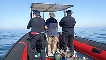
In South Africa, the standard dive boat is a large (6 to nearly 9 m) Rigid Inflatable Boat These are known as rubber ducks. Power is generally twin outboard motors, which may be two-stroke and smoky, but are increasingly often either four stroke, or the improved two-strokes which are cleaner and quieter.
These boats are generally powerful and fast, but speed is usually limited by sea state. They have a wet ride in a bumpy sea or if there is a crosswind. You travel in your dive suit, quite often with your hood on, and sometimes with your mask on to keep the spray out of your eyes. It has been known for the occasional diver to also use a snorkel to keep out heavy spray in rough conditions. If you wear a hat to protect your head from UV, make sure the hat is a tight fit, and preferably with a lanyard. The combination of cool sea air, wind, spray and high levels of UV can grill you in quite a short time, even in winter. Wear a good blockout or other method of keeping the sun from your skin. Unfortunately some blockouts wash off easily, and others sting your eyes if water gets into your mask and sloshes around a bit. A ski-mask is considered slightly eccentric, but it does the job.
Preparing for the dive.

If using all your own equipment, pack it as you find convenient, and check that everything is in good working order before leaving home. It will be wet on the way home, a waterproof bag or bin will keep the water off the upholstery. If using rental gear, get to the shop early to make sure it fits and works properly. If you are an unusual shape or size you may have difficulty finding a suit which fits well.At some places you will kit up at the side of the road or in a parking lot, and at others there will be changing rooms provided by the dive operator. If this is an issue, find out before the dive, You might want to take along a small mat or towel to stand on while putting on your suit, particularly if the ground is sandy or muddy.Some operators provide facilities at the dive shop for the customers to change into their dive suits and assemble equipment and load the boat before leaving for the launch site. In these cases the heavy equipment is usually loaded by staff, and the divers carry their light equipment to the boat. Where the boat collects divers from a jetty, the divers are expected to get their own kit to the boat. Actual loading will usually be done or supervised by the skipper.You will almost always be expected to wear your dive suit on the boat trip. There is no space to put it on during the ride, which may be wet.
What to take
- A small bag is useful to carry items like sunglasses, sunblock, hat, etc. Cell phones and car keys are usually kept in a waterproof bag or box by the skipper, and stored in the console. Large boxes for underwater cameras or video equipment should be negotiated before the dive, as there may or may not be space for them on board. In summer sunblock is advised for most skin types. UV factor is generally high and reflection from the water grills you from below. A peaked or brimmed hat may help if securely strapped on against the wind generated by boat speed.
- Kit bags for dive gear are not usually carried, but a medium sized soft bag to hold fins and mask, and other dive accessories like DSMB, reel, computer, dive light etc. is OK.
- On a long boat trip a small bottle of water or other suitable rehydration drink is nice to have, specially for after a deep or long dive. Similarly a small amount of high energy food may be welcome after a cold dive. In Cape Town, many dive boats supply a small chocolate bar or other sweet (candy) to each diver after the dive.
- A light waterproof windbreaker jacket is useful if the wind is strong, the weather or water is cold, or the trip is long. This can reduce wind-chill, particularly after the dive if you wear a wetsuit.
- A small emergency supplies (dive saver) kit of spare O-rings, fin strap, etc is acceptable.
What not to take
- Don’t take anything that you do not intend to use on the trip. (emergency equipment excepted).
- Don’t bring anything that must not get wet unless you have a watertight bag or box for it. A towel is usually a waste of time, as it will probably get wet. The same goes for dry clothing.
- Space is limited and must be shared by all. Do not annoy everyone by bringing a huge bin for your kit and fighting with the skipper at boarding time. No-one will have sympathy when you are evicted.
Loading kit and getting into the boat


The boat may loaded before launching, except where the water at the slipway is too shallow, when the boat is not taken out between dives, or when the slipway is not at the same place where the divers will be boarding.Loading of the boat is usually done by the skipper and divemaster. You are usually expected to transport your own equipment to the boat and hand it over to the person who will stow it for the trip. The standard arrangement is to stack scuba sets along a centreline rack, and tie them in place. You will usually sit at your scuba set, so if you want to do pre-dive buddy checks, ask for your gear and your buddy’s to be stowed together.Weight belts and pockets may be stacked on deck or in a box at the front or back of the rack. They are handed out when the boat gets to the site, so be sure you can identify your weights.
Fins and masks are usually stowed by the diver. There are often no special places reserved for this purpose, and fins are generally stowed either behind a handrope along the inner side of the pontoons, or between scuba sets along the rack. Be careful how you do this, as simply stacking them on top of the scuba sets can sometimes result in a fin or two being blown overboard by wind. This can ruin your dive, and is usually expensive. Masks are commonly stored in the foot pocket of a fin. The deck is not a good place for fragile items.Large cameras with strobe arms should be carried in the smallest plastic bin or crate that will hold them. There will often be several divers with camera boxes contending for the same limited storage space. Do not expect special treatment unless you have specifically organised it with the charterer.Some crews will carry your scuba set to the boat, but don’t count on it. If you need help, say so. If you are renting gear from the same organisation that runs the boat, they will usually load it for you. Make sure you can identify your rented gear and that it has all been loaded.
Slipway launches


Slipway launches are standard in the Western Cape
Where launching is from a slipway the procedure is fairly relaxed, and much depends on how far the slipway is from the parking area, and whether there is a convenient jetty.In some cases, usually at low tide, the water may be too shallow to launch the boat loaded with kit, but more often the boat is loaded with most of the dive gear, but not the divers, before launching. The boat is then launched with usually just the skipper on board, and the divers either get in from shallow water or from a jetty, as described above.Sometimes there may be commercial ski-boat fishermen launching at the same slipway. There are exceptions, but the lasting impression is of a mob of hooligans with no respect for anyone. They are generally a law unto themselves, and you will not gain brownie points by pointing out the error of their ways, and are likely to be given a brief introductory course in local invective at no charge.
Getting into the boat will depend on the launch site. In most cases the boat will be launched with only a skipper on board. Divers will board from the jetty or from the water.
Boarding from a jetty
Boarding from a jetty is usually easy, unless the step down to the boat is high. The crew will help where necessary and direct boarding. Follow their instructions. Do not leap down onto the deck, as it may not be designed to take this kind of shock load, and the sound of cracking glass fibre will not bring a smile to the skipper’s face. Also don’t leap down onto the pontoon, as this is likely to be followed by an inelegant face-plant onto the rack of scuba gear. The owners may be more concerned with damage to their equipment than your injuries.
The roll bar at the stern is a good place to hold if you can reach it. The radio antenna, plastic windscreen and engine control levers are not.Try to avoid getting parts of yourself between the boat and the jetty. The pontoons are fairly soft, but the jetty usually isn't, and may be decorated by barnacles and other abrasive material.
Boarding from shallow water
If boarding from standing in the water, try to get in where the water is not too deep, as most divers do not have the agility and upper body strength to boost themselves in without fins or a jump. Ask for help if you need it, but your fellow divers are more likely to be enthusiastic than skillful at pulling you in, Say goodbye to dignity, and hope for a reasonably comfortable landing.
The stern of the boat (blunt end) is usually lower and therefore easier to get into. This is often combined with it being in the shallowest water, so get in and out of the way of the people who have to hold the boat while the rest are getting in.
If you are a gymnast or acrobat you may safely ignore this advice.
Seating


Seating is almost exclusively on the pontoons, with your back to the water. This puts you in a position where losing your balance backwards will result in falling into the water, a manoeuvre most divers prefer to restrict to times when the boat is stationary at the dive site. To prevent unscheduled backward rolls, use the foot-straps and hand-ropes provided. As a general rule, sit opposite your scuba set, so you don’t have to move around when kitting up on site.
Occasionally there may be a seat across the stern in front of the motors. This will be the most comfortable place on the boat but may catch more spray in your face. The boat will bounce up and down as it hits waves. Bigger boats less so than small ones, and the part that bounces the least is the stern, so the most comfortable seating is as far back as you can get. This puts you close to the motors, and if they are two-stroke, closest to the exhaust smoke when the boat is not moving. You may not have much choice where you get to sit, but if you have a bad back or other disability which makes a rough ride a problem, mention this to your dive-master or the skipper as soon as possible. You will not be popular if the boat has to stop to re-arrange passengers. With practice it is possible to sit with one foot in a foot-strap (preferably the foot nearer the bow (pointy end)) and ride the bumps with very little effort. It is much like riding a horse, don’t fight the motion, absorb the bumps by relaxing a bit, and you will bounce less. A death-grip on the hand ropes will be exhausting if the ride is long.
Some boats have no footstraps. You will have to find something else to hold onto, or lean into the boat to keep more weight on your feet. Some divers may be seen comfortably sitting on the tubes, riding the waves with no obvious concern as the boat bounces along. They may not even need to hold on. They have done this before.
Moving around in the boat
If possible, don’t move around while the boat is moving, unless asked to trim the boat. You will be expected to sit where directed by the skipper, and unless there is a good reason not to, do as requested. Standing up when the boat is moving and there is nothing to hold onto can result in a fall and possible injury if the boat hits a wave or moves in an unexpected direction. If equipment comes loose under way, shout to the skipper, who will stop if it is safe, so that the equipment can be re-stowed.There may be cables and pipes in places on the deck. These are usually routed through areas where they are reasonably protected, but as a rule don’t stand on them or use them to hold on to. Batteries are often stored in plastic boxes near the transom, to keep the wires short. The lids are not usually load bearing structures, do not use them as steps.
Getting out of the boat

Getting into the water is usually done by a synchronised backward roll – falling into the water alongside your neighbour, neither on top nor underneath. Generally all the divers or a nominated group will roll off together, on a countdown from the skipper or divemaster. It is important to all roll together, as if you do not, the later divers may fall on top of the earlier ones, possibly casing injury or equipment damage. If you are not ready, or are not happy with this procedure, wait until the others are in and the boat is clear of them. The skipper will then let you roll in clear of the others, but you may have to fin a bit to get to them. This can be a problem if diving in a current. Some divers may not wish to backward roll with a large camera setup. Possono chiedere allo skipper di passare loro la telecamera quando sono in acqua. In questo caso dovrebbero stare vicino alla barca e preferibilmente tenerla fino a quando la loro macchina fotografica non viene passata.
La linea di tiro e la boa di segnalazione

La maggior parte delle immersioni a Cape Town avviene su una barriera corallina o su un relitto. È consuetudine segnare la posizione con una shotline prima dell'immersione in modo che i subacquei possano scendere nel posto giusto. Se c'è una leggera corrente in superficie, la linea di tiro andrà alla deriva sottovento per assorbire l'allentamento. In questo caso è consuetudine entrare in acqua poco a monte della boa, e iniziare la discesa non appena la lenza è visibile attraverso l'acqua, per ridurre al minimo il lavoro di nuoto controcorrente. Andare alla deriva fino alla boa significa che dovrai nuotare controcorrente. La shotline non è un'ancora. Se ti tiri giù dalla linea della boa, potrebbe trascinare il tiro e finirai sottocorrente del sito, così come tutti gli altri dietro di te. Se la linea di tiro è troppo corta, il tiro può essere sollevato dalla boa e deviare dal sito, quindi ha bisogno di un po' di gioco. La corrente potrebbe non scorrere direttamente sottovento. Anche quando si tratta di una corrente indotta dal vento, le forze di Coriolis la compenseranno in senso antiorario dalla direzione del vento nell'emisfero australe, in un effetto noto come trasporto di Ekman. L'effetto è di circa 45° in superficie, di più man mano che si va in profondità, ma con meno velocità.
Puoi scegliere di emergere sulla linea di tiro o lontano da essa. Se non conosci il sito potrebbe essere difficile ritrovare la strada. Questo di solito non è un problema e la maggior parte dei subacquei di Città del Capo salgono ovunque si trovino alla fine dell'immersione, ma in questo caso si consiglia vivamente di schierare un DSMB e risalire sulla propria boa o sulla boa del proprio amico. Il DSMB indicherà la presenza di un subacqueo in modo che le barche nell'area possano tenersi discoste e in modo che lo skipper dell'imbarcazione possa tenere traccia di dove è probabile che i suoi clienti emergano.

Se c'è una significativa possibilità di emergere lontano dalla linea di tiro in un'area con molto traffico di barche, i subacquei sono incoraggiati, o potrebbe essere richiesto, di portare un DSMB e di utilizzarlo prima di emergere. Altri siti in cui potrebbe essere richiesto ai subacquei di portare un DSMB sono quelli molto al largo, o in qualsiasi momento in cui lo skipper ritenga che possa essere difficile trovare un subacqueo a causa delle condizioni del mare. Per le immersioni ricreative, la scelta del colore e della dimensione per un DSMB personale spetta al subacqueo. Il giallo, l'arancione e il rosso sono i più comuni, ma occasionalmente si vede anche il rosa brillante e, a meno che non si comunichi esplicitamente allo skipper un significato speciale per un colore, si presume che non vi sia alcun significato speciale oltre a contrassegnare la propria posizione. A nessuno importerà quanto sia grande finché può essere visto da una distanza ragionevole. Strisce riflettenti, luci lampeggianti e il tuo nome sono anche opzionali.
Divemaster
Potrebbe essercene uno sulla barca, oppure no. Le barche che si rivolgono alla gente del posto hanno meno probabilità di fornire un divemaster rispetto alle barche collegate alle scuole o che generalmente si rivolgono al commercio di passaggio e ai visitatori. Se non sei sicuro di immergerti senza qualcuno che ti mostri in giro, menzionalo quando prenoti e chiedi informazioni sulle opzioni.
Immersioni con alghe
Nelle aree dove ci sono alghe pesanti, i subacquei generalmente non trainano le PMI durante l'immersione. Fortunatamente questi sono anche di solito luoghi dove non ci sono correnti significative, anche se il picco può essere forte. Molti dei siti costieri e costieri di Città del Capo hanno alghe pesanti, in particolare sulla costa atlantica. In queste aree i subacquei sono incoraggiati a portare i DSMB e ad usarli quando emergono lontano dalla linea di tiro, in modo che lo skipper possa tenere traccia di dove tutti stanno affiorando e in modo che le barche di passaggio possano avere la possibilità di evitare di investire se qualcuno sta disturbando per tenere d'occhio. I DSMB sono anche molto efficaci per segnalare alla barca quando sei in superficie, molto più di un braccio in una muta nera. Questo può essere particolarmente utile se il vento aumenta durante l'immersione e la superficie è increspata con acqua bianca.
Rientro in barca dopo un'immersione


Regola 1: Non togliere le pinne in acqua a meno che non ci sia una scala. Hai bisogno di loro per potenziarti. La maggior parte delle paperelle di gomma non fornisce una scala d'imbarco. Questo è ancora più importante se stai salendo sul lato di bolina della barca, poiché la barca andrà quasi sempre sottovento più velocemente di un subacqueo. Avvicinati alla barca e afferra la cima a mano esterna. Cerca di mantenere sempre la presa sulla barca e lascia andare solo per il tempo strettamente necessario per rimuovere il kit, poiché la barca potrebbe allontanarsi mentre non sei aggrappato.
Alcune barche possono fornire una breve cima con un anello in cui puoi far scivolare un braccio, ma per qualche ragione questo è estremamente raro. Ancora meno comune è una linea con una clip che puoi attaccare all'attrezzatura prima di toglierla. Presumibilmente non c'è richiesta da parte dei clienti per questi articoli... La tua attrezzatura verrà sollevata a bordo dall'equipaggio o da altri subacquei.
La procedura consigliata è quella di lasciar perdere qualsiasi macchina fotografica o altra attrezzatura allentata. Quindi togliere e consegnare i pesi. Questo ti assicura di galleggiare dopo aver rimosso il tuo jacket. Non mollare finché non sei sicuro che l'altra persona abbia una buona presa, le cinture dei pesi affondano molto velocemente. Rimuovi il set da sub e consegnalo all'equipaggio. Puoi aiutare spingendo verso l'alto sotto il set quando si solleva e controllando che DV e manometri non si agganciano alle corde manuali. Maschera e boccaglio possono essere consegnati in qualsiasi momento, se conveniente. Afferrare bene le maniglie fornite o una corda a mano il più in alto possibile lungo il lato dei pontoni. Immergiti il più possibile per ottenere un sollevamento galleggiante, quindi pinne con forza verso l'alto e usa le braccia per tirarti su il più in alto possibile, quindi spingi verso il basso la corda o le maniglie mentre fai rotolare la parte superiore del corpo sul pontone. Cambia la presa in una maniglia interna o in una lenza e fai oscillare una gamba nella barca. Potrebbe essere conveniente fermarsi qui mentre qualcuno ti rimuove le pinne, quindi sedersi e far oscillare l'altra gamba nella barca. Con buone pinne, buona tecnica e forza ragionevole è possibile salire a bordo in questo modo con comodità e dignità. Questo metodo è molto più difficile se sul lato sottovento con vento forte.

Se non hai la forza, la procedura è simile, ma con l'assistenza dell'equipaggio o dei subacquei già in barca, che ti trascineranno con la forza principale e qualunque cosa possano afferrare. Prima di accusare qualcuno di aggressione indecente, considera se ci fosse un luogo alternativo ragionevole per afferrare che avrebbe funzionato. L'eleganza è inversamente proporzionale alla tua taglia e alla tua massa. Se hai tasche sulle cosce davanti alla muta, non salire a bordo con attrezzature fragili o ingombranti nelle tasche. Le tasche laterali di solito non sono un problema.

C'è una nuova tendenza con alcune barche a fornire una scala per l'imbarco. Lo stile "albero di Natale" è relativamente popolare in quanto è facile arrampicarsi con le pinne ai piedi. Sulle paperelle di gomma è solitamente appeso alla murata, e sui catamarani a scafo rigido si preferisce lo specchio di poppa.
Scendere dalla barca dopo l'immersione

Uscire su un molo è di solito semplice, ma può essere complicato da un molo alto e dalla bassa marea. Se è un problema, l'equipaggio aiuterà e darà istruzioni. Se fai le tue cose, valgono gli stessi avvertimenti per entrare da un molo. In particolare sul non mettersi tra la barca e il molo.
Uscire su una spiaggia è insolito a Città del Capo, ma relativamente semplice. Di solito è più sicuro e conveniente scendere dal lato basso se la barca si inclina quando si risale la spiaggia. Se sei sul lato alto, aspetta finché non c'è spazio e spostati sul lato basso, o in alcuni casi il lato alto diventerà il lato basso mentre la barca si ribalta quando il carico viene rimosso. Non cercare di scaricare il kit dall'alto, nel caso ti trovi nel posto sbagliato e la barca ti rotoli addosso. Ciò è particolarmente probabile se la barca non è completamente libera dalle onde.
Vedere

Le acque della Penisola del Capo e di False Bay supportano una fiorente ecologia di organismi marini temperati freschi, molti dei quali endemici del Sud Africa, o anche di regioni più piccole, e sebbene i pesci non siano così spettacolarmente colorati come quelli visti nelle acque tropicali, molti sono abbastanza colorati per mimetizzarsi tra i vivacissimi invertebrati che ricoprono le scogliere.
animali marini
C'è una vasta gamma di animali marini che si possono vedere durante le immersioni in questa regione, e includono alcuni degli incontri più belli e spettacolari possibili per un subacqueo.
Balene e Delfini
False Bay è una destinazione nota per l'osservazione delle balene. Un gran numero di balene franche australi visita la baia ogni anno, ma è raro vederne una durante un'immersione. Altre specie di balene occasionalmente avvistate a False Bay sono le megattere, le balene di Bryde e l'orca, e queste sono ancora meno probabili durante le immersioni. Se hai la fortuna di incontrare una balena durante un'immersione, fai attenzione, poiché le loro enormi dimensioni rendono facile che un subacqueo si ferisca involontariamente.
I delfini si vedono anche a False Bay e sulla costa atlantica. I delfini comuni occasionalmente visitano banchi che si contano da centinaia a migliaia, ma non sono spesso visti dai subacquei. I delfini scuri tendono a viaggiare in gruppi più piccoli, ma hanno anche maggiori probabilità di indagare su un subacqueo alla sosta di sicurezza. Altre specie visitano occasionalmente, ma sono più note per incidenti di spiaggiamento che vengono viste sott'acqua dai subacquei.
squali

False Bay è uno dei posti più affidabili per vedere i grandi squali bianchi, anche se raramente come subacqueo, e spesso si vedono anche molte altre specie di squali. Il Sevengill o Cowshark può essere visto spesso in alcuni siti, mentre gli squali di burrone e i gattucci sono più diffusi. Ci sono quattro specie comuni di gattuccio a livello locale, dal colorato squalo timido puffa al molto più grande squalo pigiama. Altri squali pelagici di solito si vedono solo in immersioni in mare aperto "azzurre" al largo della penisola meridionale, e diverse grandi specie di pesci pelagici possono essere viste in viaggi simili.
pelagici

Occasionalmente si vedono grandi banchi di Yellowtail in alcuni siti di immersione e in occasioni imprevedibili i subacquei possono essere abbastanza fortunati da vedere pesci luna oceanici, balene franche australi, balene megattere, delfini comuni, tursiopi o scuri.
Lo Snoek comune, che è la pietra angolare di un'industria locale della pesca con lenza, è molto timido e quasi mai visto dai subacquei, nonostante la sua abitudine di brancolare in gran numero.
Pinguini e foche

Ci sono colonie di pinguini africani a False Bay, ma è estremamente raro vederli durante un'immersione. D'altra parte, le otarie del Capo sono sia curiose che non timorose dei subacquei e sono molto comuni, sia a False Bay che sulla costa atlantica. Ci sono molti posti dove possono essere quasi garantiti per essere visti.
Pesce di barriera

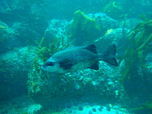


I pesci di barriera di questa regione sono più vari a False Bay e più comuni nelle zone ristrette delle Aree Marine Protette, dove sono protetti dalla legge da diversi decenni, anche se il bracconaggio si verifica ancora e l'applicazione è abbastanza inaffidabile. La maggior parte dei pesci di barriera sono mimetizzati in una certa misura. Molti sono grigio argenteo e contrastati, come l'onnipresente sarago degli ottentotti, l'argenteo Fransmadam e lo Steentjie. Altri hanno barre verticali o macchie scure che possono aiutare a spezzare il loro profilo nelle alghe, come il ceppo bianco, la zebra e lo steenbras bianco, mentre molte delle specie più piccole sono colorate in modo criptico e si fondono molto bene nel loro ambiente. Questi sono generalmente pesci che trascorrono la maggior parte del loro tempo su o molto vicino alla barriera corallina e la loro colorazione è solitamente un'indicazione dei colori tipici del loro habitat. Questi includono vari klipfish endemici, e alcuni bavose e ghiozzi, le pinne, il triplo pinna del Capo, lo scorfano pelle liscia, due specie di pesce cavallo, un pesce ago e il Rocksucker. Sono presenti anche alcuni pesci rossi, abbastanza visibili, come il comunissimo romano, e i meno comuni Red moncone e Red steenbras. La maggior parte dei pesci citati sono solitari o si trovano in piccoli banchi, ma ci sono anche Strepies e Maasbanker che tendono a insediarsi in numero abbastanza grande, e banchi di ottentotti moderatamente grandi si vedono abbastanza frequentemente. I Galjoen sono abbastanza rari e di solito si vedono in piccoli gruppi in cima alla barriera corallina dove c'è molto movimento delle onde, e il simile Cape Knifejaw preferisce reef più profondi e di alto profilo tra le rocce. I pesci gatto di mare sono timidi e tendono a trascorrere la giornata in fessure e buche.
Aree sabbiose

Le aree sabbiose hanno anche i loro pesci caratteristici, che comprendono alcune specie di razza, sogliole, gallinelle, un pesce palla e il pesce sabbia, raro e timido di giorno, ma può essere visto in gran numero di notte in alcuni siti, quando esce dalla sabbia in cui si nasconde e nuota liberamente. Anche alcune specie di klipfish vivono nella sabbia, con le varie specie che preferiscono diverse densità di sabbia, con quelle che preferiscono la sabbia fine con un corpo più simile a un serpente, mentre quelle in sabbia grossa sono più robuste. Anche il loro modello del corpo tende a corrispondere al tipo di sabbia.
Invertebrati di barriera
Gli invertebrati bentonici forniscono la maggior parte dei colori brillanti sulle barriere coralline di questa regione e la distribuzione delle specie è caratteristica delle diverse sottoregioni come la profondità e la temperatura dell'acqua. La diversità è grande e c'è una grande variazione nella copertura della barriera corallina predominante sia con la profondità che con la posizione geografica. La caratteristica vita della barriera corallina varia considerevolmente tra i lati est e ovest della penisola del Capo, e questo è riconosciuto come il confine tra il South Western Cape e le bioregioni costiere di Agulhas. La zonazione verticale è anche caratteristica delle diverse bioregioni, per cui possono esserci differenze molto evidenti in quanto si può osservare nei vari siti.
C'è una tendenza generale per una data area della barriera corallina ad essere dominata da una particolare specie di organismo, ad esempio, stelle piuma comuni, cetrioli di mare dal petto rosso, cetrioli di mare malva, esche rosse o ricci di mare, nella misura in cui un importante parte della superficie è coperta dall'organismo dominante. Ciò non significa che non ci sia varietà, in quanto vi è una vasta gamma di habitat sulla maggior parte delle scogliere a seconda dell'orientamento e della rugosità, e in larga misura gli organismi sessili vivono dove possono, e questo dipende in gran parte da dove le larve planctoniche trovare un punto d'appoggio.
a mezz'acqua
Gli invertebrati pelagici sono per la loro natura prevalentemente planctonica imprevedibile su quando e dove possono essere visti. Includono diverse specie di meduse, alcune specie di gelatina a pettine, alcuni sifonofori sporadici, salpe e pteropodi e molte cose troppo piccole per essere notate facilmente. Ci sono anche i calamari, ma sono molto timidi e si vedono raramente di giorno.
Le spugne, gli cnidari, le gelatine a pettine, i platelminti, i vermi segmentati, gli artropodi, i molluschi, i briozoi, gli echinodermi, le ascidie, i pesci, gli uccelli marini e i mammiferi marini registrati in questa regione sono elencati nel Wikipedia:Elenco degli animali marini della Penisola del Capo e False Bay. Molti di questi potrebbero essere visti da un subacqueo ricreativo.
alghe
Foreste di alghe
Le foreste di alghe sono le alghe più evidenti di Cape Town. Ci sono tre generi trovati localmente, a volte nelle immediate vicinanze. Il più evidente è il bambù marino, che raggiunge la superficie quando è completamente cresciuto, e ha un gambo spesso con una cavità piena di gas nella parte superiore e che mantiene la fronda vicino alla superficie per la massima esposizione alla luce. Questa alga è molto comune sulla costa atlantica e si trova anche su entrambi i lati di False Bay, ma più comunemente verso la parte meridionale della baia.
L'alga più piccola a ventaglio spaccato cresce su scogliere più profonde e non raggiunge la superficie. Gli stipiti sono più corti e non c'è cavità piena di gas, quindi le fronde rimangono immerse nelle acque più scure. Questo fuco si trova in acque più profonde rispetto al bambù marino, con una gamma geografica simile.
Il terzo è l'alga della vescica, che ha grappoli di lunghi gambi sottili, con lunghe fronde e un gran numero di piccole vesciche piene di gas che mantengono l'alga in posizione verticale e le fronde in superficie. Questa alga non si trova a False Bay e si vede principalmente vicino a Robben Island.
Tappeti erbosi algali e sottoboschi di foreste di alghe.
Al di sotto delle fronde di alghe, la barriera corallina nelle aree meno profonde dove c'è abbastanza luce, può essere coperta da un sottobosco di alghe assortite, e la specie particolare dipenderà da una varietà di fattori, tra cui la quantità di luce disponibile e la quantità di acqua movimento. Di norma, le alghe verdi e marroni si trovano in aree meno profonde e le alghe rosse saranno più profonde, poiché possono sopravvivere con meno luce. Le più profonde sono spesso le alghe coralline rosse, che possono formare un fitto tappeto erboso sulle superfici superiori delle rocce.
Coralline incrostanti.
Dove il surf è troppo potente o la luce è troppo debole per altre alghe, le alghe coralline incrostanti possono ancora trovare un punto d'appoggio e prosperare. Queste alghe rosse formano una crosta abbastanza dura e ben aderente sulla barriera corallina, e sono anche conosciute come "vernice rosa", che è una buona descrizione del loro aspetto - non assomigliano affatto alle alghe. La loro gamma è quasi ovunque nella regione dove penetra abbastanza luce e non ci sono già altri occupanti sulla barriera corallina.
Ci sono circa 57 alghe verdi, 49 alghe brune e 240 alghe rosse registrate da questa regione nel Wikipedia: Elenco delle alghe della Penisola del Capo e False Bay.
naufragi

Il Capo delle Tempeste e il Capo di buona speranza sono entrambe denominazioni tradizionali per questa regione, e per una buona ragione. Il tempo a volte può essere molto brutto, e la costa è molto esposta, con pochi porti riparati, ma è anche un importante punto di passaggio su una delle grandi rotte commerciali marittime del mondo. Di conseguenza, lungo la costa locale è stato registrato un numero spaventoso di naufragi.
Molti di questi relitti non sono mai stati trovati, e molti altri sono stati distrutti fino a renderli irriconoscibili, o ricoperti di sabbia, o nel caso di Table Bay, sono stati sepolti nell'ambito di progetti di bonifica, ma molti sono in luoghi subacquei e possono essere visitati subacquei se le condizioni sono adatte.
Le profondità dei relitti subacquei variano da 3 o 4 metri, a più di 65 metri, e la condizione varia da frammenti semisepolti di legno o acciaio, a navi che conservano la maggior parte della loro struttura e aspetto originali, e incombono dalle profondità come se navigando sul fondo sabbioso.
La maggior parte è fortemente incrostata di organismi di barriera, che vanno dalle alghe nelle acque poco profonde a una vasta gamma di invertebrati colorati nelle acque più profonde. Ospitano anche una varietà di pesci di barriera e possono essere visitati da pesci pelagici in occasioni imprevedibili. In effetti, servono come scogliere artificiali e, di conseguenza, sono generalmente di interesse anche per i subacquei che non sono particolarmente interessati a loro come manufatti.
Caratteristiche topografiche
Molti dei siti sono caratterizzati da interessanti elementi topografici, tra cui pinnacoli, calanchi, caverne, passaggi e strapiombi. Queste caratteristiche sono notevoli non solo per il loro contributo al paesaggio marino, ma forniscono anche importanti variazioni negli habitat disponibili nel sito, e il risultato è una forte correlazione tra elevata biodiversità e topografia interessante. Il carattere topografico generale di un sito dipende dalla geologia e i siti di granito sono immediatamente distinguibili dai siti di arenaria sedimentaria e scisto. Le rocce granitiche sono tipicamente arrotondate e accatastate come massi di corestone su affioramenti della stessa roccia, spesso con sabbia di quarzo bianco tra di loro, o come base gradualmente inclinata. Queste pile di rocce di varie dimensioni spesso formano pinnacoli e gole in direzioni abbastanza casuali, e gli strapiombi e i buchi tra di loro sono in alcuni casi abbastanza grandi da permettere ai subacquei di nuotare, fornendo una spettacolare struttura della barriera corallina.
Gli strati di arenaria tendono a produrre formazioni dominate dal tuffo e dall'urto locali, e questo è più prevedibile. Tuttavia, il dettaglio su scala più piccola tende a produrre più piccoli fori, fessure, sporgenze e creste rispetto alle aree granitiche, e queste sono generalmente meno spettacolari. Ci sono eccezioni, dove le scogliere di arenaria sono molto scoscese, di solito dove il tuffo è abbastanza ripido, ma non verticale, e la costa è piuttosto ripida, ma su un piano diverso dal tuffo.
Fortunatamente il vecchio detto "come sopra, così sotto" si applica abbastanza bene, e il carattere delle barriere coralline può essere previsto in modo abbastanza affidabile osservando il paesaggio del litorale adiacente. La principale eccezione a questa regola è a sud della baia di Smitswinkel, dove ci sono arenarie sopra l'acqua e granito sotto.
La struttura geologica e la storia di questa regione sono brevemente descritte in Wikipedia: Geologia marina della Penisola del Capo e False Bay
Leggere
Libri di riferimento sull'ecologia delle acque di Città del Capo:
A partire dal SURG, in particolare per i subacquei di questa regione: Disponibile da negozi di immersione selezionati e librerie a Città del Capo e direttamente da SURG.
- Jones, Giorgina. 2008. Una guida sul campo agli animali marini della penisola del Capo, SURG, Città del Capo. ISBN 9780620416399
- Zsilavecz, Guido. 2005. Pesci costieri della Penisola del Capo e False Bay, SURG, Città del Capo. ISBN 0620342307
- Zsilavecz, Guido. 2007. Nudibranchi della Penisola del Capo e False Bay, SURG, Città del Capo. ISBN 0620380543
Da altri editori, e di applicazione più generale:
- Branch, G. e Branch, M. 1981, Le rive vive dell'Africa meridionale, Struik, Città del Capo. ISBN 0869771159
- Filiale, G.M. Griffiths, C.L. Branch, M.L e Beckley, L.E. 2010, Two Oceans – Una guida alla vita marina dell'Africa meridionale, David Philip, Città del Capo. ISBN 9781770077720
- Gosliner, T. 1987. Nudibranchi dell'Arica meridionale, Sea Challengers & Jeff Hamann, Monterey. ISBN 0930118138
- Heemstra, P. e Heemstra E. 2004, Pesci costieri dell'Africa meridionale, NISC/SAIAB, Grahamstown.
- Ed. Smith, M.M. e Heemstra, P. 2003 I pesci di mare di Smith. Struik, Città del Capo
- Stegenga, H. Bolton, J.J. e Anderson, R.J. 1997, Alghe della costa occidentale sudafricana. Bolus Herbarium, Città del Capo. ISBN 079921793X (piuttosto tecnico)
Libri di riferimento sulla geologia della penisola del Capo:
- Compton, John S. 2004, Le rocce e le montagne di Cape Town. Doppio piano, Città del Capo. ISBN 1919930701

![]()