
Nel paesi nordici di Finlandia, Islanda, Norvegia e Svezia ci sono grandi aree scarsamente popolate adatte a zaino in spalla nella natura selvaggia e più giorni di escursioni da lodge a lodge e aree per escursioni di un giorno anche vicino alla maggior parte delle città e dei villaggi - in Norvegia, comprese le escursioni alle alte vette. C'è una ricca varietà di paesaggi nei paesi nordici, dall'Islanda vulcanica alle foreste orientali della Finlandia, dalle montagne alpine della Norvegia alle dolci pianure della Danimarca e della Svezia meridionale. Il libertà di vagare, chiamato anche diritto di accesso o, in svedese/norvegese allemansrätten/allemannsretten ("i diritti di ogni uomo"), dà accesso a chiunque alla maggior parte della natura.
In inverno, che può significare da gennaio a febbraio o da ottobre a maggio, a seconda della destinazione, sci di fondo è la strada da percorrere, almeno per le distanze più lunghe in molte aree: lo zaino in spalla nella natura selvaggia e lo sci di fondo sono più o meno considerate la stessa attività. Nelle destinazioni con sentieri escursionistici, in inverno ci sono spesso piste da sci.
Alcuni dei consigli seguenti sono rilevanti anche per altri modi di esplorare il paesaggio naturale.
Per Isole Fr Øer, Groenlandia e Svalbard, vedere i loro articoli principali.
Mentre le aree selvagge in Danimarca sono molto piccole rispetto ad altri paesi nordici, il paese ha ancora alcune opportunità per la vita all'aria aperta. Vedere Campeggio primitivo in Danimarca.
| COVID-19 informazione: Non è più consentito arrivare in una capanna selvaggia norvegese senza prenotazione. In Finlandia le strutture sono state chiuse nella primavera del 2020, ma sono state riaperte e ai visitatori viene semplicemente chiesto di evitare luoghi di sosta affollati e di seguire attentamente le raccomandazioni su igiene, distanze, ecc. Non vengono forniti sapone e disinfettanti, quindi dovrebbero essere trasportati da soli. | |
| (Informazioni aggiornate l'ultima volta il 02 feb 2021) |
Capire

| “ | Ha bisogno del fuoco, che ora è venuto, intorpidito dal freddo al ginocchio; cibo e vestiti che il viandante brama chi ha superato il limite è caduto. | ” |
—Hávamál | ||
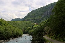
Norvegia, Svezia e Finlandia insieme coprono un'area di oltre un milione di chilometri quadrati, dieci volte più ampia dell'Austria e della Svizzera messe insieme. L'area escursionistica comprende gli umidi e miti fiordi atlantici e le coste della Norvegia, attraverso le alte vette alpine selvagge delle montagne scandinave, fino agli ampi altipiani e alle profonde foreste dell'interno.
Solo poche generazioni fa la maggior parte delle persone nei paesi nordici viveva in campagna. Con una popolazione sparsa e campi magri, la silvicoltura, la pesca e la raccolta delle bacche hanno dato a molti un importante reddito supplementare. Oggi, l'escursionismo, la pesca e la raccolta delle bacche sono parti essenziali delle vacanze per molte persone del posto, per lo più come passatempi al cottage estivo. Non tutti sono veri escursionisti in backcountry, ma ce ne sono parecchi.
Un aspetto della tradizione nordica all'aperto, la caccia, è strano per molti provenienti da paesi dove questa era una cosa riservata ai proprietari terrieri, la classe superiore. Nei paesi nordici i boschi sono sempre stati in gran parte di proprietà dei contadini e questi hanno avuto la caccia come a volte importante fonte di cibo complementare. In campagna è normale far parte del circolo di caccia locale. La parola finlandese per deserto, eramaa, significa anche caccia e pesca. Anticamente si faceva trekking proprio per procurarsi cibo e pellicce, e l'escursionismo contiene tracce di questa tradizione, almeno per alcuni escursionisti.
Anche le aree remote raramente sono veramente incontaminate. Nel nord la maggior parte delle aree sono utilizzate per l'allevamento delle renne. La maggior parte delle foreste non protette viene utilizzata per la silvicoltura. In pratica, la maggior parte delle persone lo noterà solo occasionalmente.
A causa della scarsa popolazione, soprattutto al nord, i sentieri saranno abbastanza tranquilli, oltre che vicino alle principali località turistiche. Fuori dai sentieri vedrai poche persone anche vicino alle città. Vicino alle strade principali potresti sentire il traffico, ma nelle zone più scarsamente popolate sentirai presto solo silenzio.
Clima e terreno

Il tipo di terreno e le condizioni meteorologiche variano enormemente, dalle ripide montagne della Norvegia alle pianure quasi pianeggianti dell'Ostrobotnia finlandese, dal clima temperato e piovoso della costa atlantica al clima quasi continentale dell'entroterra finlandese e dal clima temperato caldo del sud ai ghiacciai delle montagne e alla tundra nell'estremo nord.
Meno del 5% della superficie terrestre della Norvegia è sviluppata (terreni agricoli, strade, città) e la proporzione è simile negli altri paesi. In Norvegia, circa il 50 % dell'area è costituito da una sorta di spazio aperto senza foresta, compreso il terreno solido senza alberi e la nuda roccia, oltre il 30 % è costituito da foreste e circa il 5 % è costituito da zone umide e torbiere (in particolare nella Norvegia orientale, nel Trøndelag e nel Finnmark) , il 5% è acqua dolce (fiumi e laghi) e l'1% è ghiaccio permanente o neve. In Finlandia, il 70% è costituito da foreste, mentre lo spazio aperto è costituito principalmente da laghi e torbiere, nell'estremo nord anche vaste aree di brughiera. Anche in Svezia sono comuni le zone umide (circa il 20% della superficie). Circa il 63% dell'Islanda è un paesaggio arido, il 23% ha una vegetazione di qualche tipo, il 12% è coperto da ghiacciai e il 3% sono laghi.
I servizi di previsioni del tempo sono generalmente di buona qualità, ma potrebbe essere necessaria l'esperienza locale per interpretarli: le condizioni del vento variano a seconda della topologia locale e per la temperatura solo i massimi giornalieri medi sono riportati in molte previsioni, la variazione e le temperature notturne devono essere dedotte. Il vento è generalmente più forte nelle montagne alte e brulle e lungo la costa esterna. La differenza tra la temperatura massima e minima di un dato giorno è normalmente nell'intervallo 3-15°C (5-30°F), a meno che non ci siano cambiamenti climatici significativi. Un cielo sereno di solito significa una notte fredda. Le temperature medie massime diurne a luglio variano da circa 15°C (60°F) a circa 23°C (75°F) a seconda della posizione, a gennaio da circa lo zero a circa -10°C (15°F), alta montagna non conteggiato. Le temperature estreme possono variare da 35°C (95°F) in estate a -50°C (-55°F) nell'inverno dell'entroterra settentrionale.
Servizi di previsioni meteo e informazioni sul clima sono disponibili per la Finlandia dal istituto meteorologico (smartphone) o Foreca, per la Norvegia dal Ufficio meteorologico e notizie meteo e per l'Islanda da Ufficio meteorologico islandese.
L'area si trova nella zona di confine tra i Westerlies e il Subartico; il tempo può essere dominato da un determinato sistema meteorologico o potrebbe essere difficile prevedere un tempo alternato. Vicino alla costa atlantica (cioè in Islanda e dentro e vicino alla Norvegia) e ad alta quota sono comuni rapidi cambiamenti del tempo.

Alte montagne e ghiacciai sono difficili da visitare in alcuni periodi dell'anno. Quando giudichi l'altitudine, ricorda che la linea degli alberi può essere ben al di sotto dei 400 m nelle parti più settentrionali della Finlandia e della Norvegia. Nelle alte montagne della Norvegia e dell'Islanda la neve può rimanere dopo l'inverno fino a giugno, e grandi chiazze possono rimanere per tutta l'estate. A piedi, le alte montagne norvegesi possono essere visitate generalmente solo nella seconda metà dell'estate e all'inizio dell'autunno (in genere da luglio a settembre, i visitatori dovrebbero ottenere informazioni specifiche per ciascuna area).
La superficie in alta montagna è per lo più molto accidentata, spesso rocce sciolte, massi, neve e ghiacciai: l'escursionismo è solitamente faticoso e sono necessari buoni scarponi. Questa superficie aspra e arida appare in Norvegia a un'altitudine molto più bassa che nell'Europa continentale o nelle Montagne Rocciose degli Stati Uniti; anche a 1000-1500 metri sul livello del mare ci sono condizioni di alta montagna con quasi nessuna vegetazione e campi di neve che rimangono per tutta l'estate.

A quote più basse, ma al di sopra della linea degli alberi, c'è spesso una brughiera facile da percorrere. Questo è il terreno tipico delle "basse colline" (lågfjäll), come nell'estremo nord della Finlandia e tra le alte montagne e le foreste della Svezia. Il terreno umido vicino alla linea degli alberi è spesso fittamente ricoperto di salici (Salix) arbusti, abbastanza onerosi da attraversare. Le valli sono spesso boscose, principalmente con betulle, ma anche alcuni punti con pini e, un po' più in basso, foreste di pini e abeti rossi.
Le foreste di pini e abeti rossi sono la parte più occidentale della grande cintura della taiga dell'Eurasia settentrionale. La cintura della taiga copre la maggior parte della Finlandia e della Svezia e parti della Norvegia (in particolare la Norvegia orientale e alcune regioni di confine). Nelle pianure, specialmente in alcune parti della Finlandia e della Svezia, ci sono anche vaste paludi e paludi. L'era glaciale ha lasciato esker, che conferiscono al paesaggio un carattere peculiare in alcune regioni. Gran parte della Finlandia meridionale e della Svezia erano sotto il livello del mare quando il ghiaccio se ne andò, e il substrato roccioso è spesso visibile anche su basse colline, con alberi che crescono dove si è accumulato abbastanza terreno, creando una foresta sparsa sulle cime delle colline. Ad eccezione di alcune regioni, solo una piccola parte del territorio è coltivata. La foresta domina, anche se gran parte di essa è utilizzata per la silvicoltura, con molte radure. Qua e là si trovano vecchie foreste, salvate da terreni difficili, e aree più grandi abbastanza lontane da strade e fiumi.
Elevazioni e morfologie


Le quote più elevate si trovano nelle sezioni occidentali della penisola scandinava dall'estremo sud della Norvegia, attraverso la Norvegia centrale e le regioni di confine con la Svezia e fino Troms e Finnmark contee nell'estremo nord. Queste elevazioni sono spesso indicate come le montagne scandinave. Le vette più alte sono in Norvegia Jotunheimen, dove la vetta più alta è 2469 m. Circa 200 vette in Norvegia superano i 2000 m, principalmente nello Jotunheimen ma anche nel Rondane e Dovrefjell. Le vette più alte della Svezia sono in Lapponia vicino al confine con la Norvegia, con una manciata di vette sopra i 2000 m. Le vette più alte dell'Islanda sono in L'interno dell'Islanda e Islanda del sud, con una cima sopra i 2000m. Le pianure in Norvegia sono in gran parte limitate a valli e coste. In generale, le altitudini più elevate significano anche il terreno più selvaggio, in particolare lungo la costa atlantica norvegese con immensi fiordi (come Sognefjord) e picchi imponenti che si innalzano direttamente dall'oceano come in Lofoten. Ci sono tuttavia alcune altitudini elevate con morfologie più dolci (altipiani), come ad esempio Hardangervidda altopiano, Dovrefjell, lunghi tratti di altopiano tra le grandi valli della Norvegia orientale e Finnmarksvidda (interior Finnmark altopiano). A causa del clima più freddo nell'estremo nord, Finnmarksvidda e altre alture del Finnmark sono piuttosto aride anche a soli 300-500 metri sul livello del mare.
A differenza della sezione occidentale, Finlandia è caratterizzato più da morfologie dolci con foreste o catene aperte. Le quote più alte della Finlandia sono solo di circa 1300 m, e le montagne più alte di 1000 m sul livello del mare si trovano solo nel "braccio" della Finlandia nell'estremo nord-ovest. Salvo poche eccezioni a est, raramente incontrerai montagne più alte di 300 metri a sud di Lapponia. D'altra parte, gran parte della Finlandia è ricoperta da laghi e ruscelli.
Rispetto alla Finlandia, Svezia è più collinare e gran parte di ciò che si trova a nord della linea Stoccolma-Oslo è foresta selvaggia senza grandi città. Finalmente Scania, la parte più meridionale della Svezia, ricorda più la Danimarca, i Paesi Bassi o la Germania settentrionale: è fondamentalmente piatta come una frittella e gran parte di essa è terreno agricolo.
L'Islanda è allo stesso modo sterile della Norvegia. Le quote più alte dell'Islanda si trovano all'interno dell'Islanda e nella catena montuosa di Tröllaskagi nel nord dell'Islanda. Altrove in Islanda le altitudini sono inferiori a 600 metri.
Montagne

In norvegese, "montagna" ("fjell") si riferisce principalmente ad altezze che superano la linea degli alberi. Gli altopiani meno ripidi, relativamente pianeggianti e senza alberi senza picchi pronunciati sono spesso chiamati "vidde" (l'elenco che segue include in parte altipiani come ad esempio l'ampio Finnmarksvidda del nord).
Le montagne scandinave possono essere suddivise grossolanamente come sulla mappa.
- A & B: montagne artiche
- compreso Kebnekaise, Parco nazionale Sarekek, Lyngen Alpi, Lofoten, Ghiacciaio Svartisen, Narvik, Area selvaggia di Käsivarsi
- C: Altopiani del confine centrale (Norvegia e Svezia)
- D: Gamma dei fiordi
- compresi Sunnmøre e Romsdal Alpi, Jostedalsbreen ghiacciaio, la maggior parte Sognefjorden
- E: montagne centrali
- Compreso Rondane-Dovrefjell, Jotunheimen (più alto nel Nord Europa)
- F: altopiani meridionali
- Compreso Hardangervidda altopiano e Rogaland/Setesdal brughiera
Le stagioni
La stagione escursionistica estiva va generalmente da metà maggio a inizio settembre, tranne al nord e in alta montagna, dove inizia a giugno, in alcune zone anche a luglio. L'escursionismo è per lo più facile in questi tempi e c'è meno bisogno di preparativi, abilità e attrezzatura rispetto ad altre parti dell'anno, ma alcune destinazioni sono ancora impegnative. La maggior parte delle zanzare e dei moscerini estivi sono un fastidio in molte zone, soprattutto al di sotto del limite del bosco a nord da fine giugno ad agosto. Ad agosto le notti si fanno buie, i bambini tornano a scuola e alcune strutture turistiche chiudono per l'inverno.
L'inizio dell'autunno (soprattutto settembre) è il periodo di ruska, quando le foglie diventano rosse e gialle, uno spettacolo particolarmente bello in Lapponia e Finnmark (ma il periodo è spesso breve lì – l'inverno può arrivare presto). Molti locali escono per raccogliere funghi e mirtilli rossi. Questa è spesso una bella stagione escursionistica; le giornate sono generalmente miti, anche se di notte possono comparire gelate e le prime nevicate possono comparire verso la fine del mese. Gli insetti sono in gran parte spariti e l'aria è solitamente frizzante. Il tardo autunno (ottobre-novembre), d'altra parte, non è la stagione migliore per la maggior parte dei visitatori: è buio e umido, con qualche nevicata ma non un manto nevoso affidabile (le stazioni sciistiche sono aperte, ma spesso dipendono dall'innevamento artificiale) . A novembre la temperatura a volte scende a -15 ° C (5 ° F) o meno anche nel sud della Finlandia.
In pieno inverno non c'è affatto l'alba al nord e può esserci un freddo estremo. Le giornate sono brevi anche al sud. Potresti voler vivere la notte artica o il Natale nella patria di Babbo Natale (i finlandesi credono che viva in Lapponia e orde di britannici vengano a trovarlo). Altrimenti potresti preferire febbraio al sud o l'inizio della primavera al nord per le escursioni invernali. Se hai intenzione di utilizzare le strutture delle stazioni sciistiche, nota i picchi durante le vacanze invernali; potresti fare affari con un po' di tempo. Guarda anche Inverno nei paesi nordici.
La primavera è una stagione molto amata da molti locali. Le giornate sono leggere, il sole è forte e la natura si sta risvegliando. Le escursioni nella natura possono essere impegnative, con neve alta qui e terreno nudo là, e molta acqua, ma molte destinazioni non presentano problemi. Al nord e in alta montagna giugno è ancora un periodo di scioglimento delle nevi e l'acqua alta nei torrenti e in alta montagna la neve può persistere fino a luglio o più tardi. La neve marcia e l'acqua alta rendono difficili le escursioni nelle aree colpite in quello che è l'inizio dell'estate altrove. Successivamente la neve rimanente è spesso compatta, abbastanza dura da calpestare.
La primavera è particolarmente tardiva nelle alte montagne della Norvegia, anche a giugno alcune zone sono accessibili solo con gli sci. Questo è vero in montagne come il norvegese Jotunheimen e Hardangervidda, dove la neve può persistere fino a giugno e grandi chiazze di neve possono rimanere fino alla fine dell'estate. Anche in Finlandia c'è una gara di sci di mezza estate (at Kilpisjärvi). I norvegesi fanno escursioni a piedi portando gli sci nelle aree dove possono continuare con gli sci.
Libertà di vagare

I diritti fondamentali di tutti (diritto di accesso, libertà di movimento) sono il diritto di circolare liberamente a piedi, con gli sci o in barca, il diritto di pernottare in tenda e il diritto di raccogliere bacche e funghi commestibili. In quali aree non selvagge si applicano i diritti varia leggermente tra i paesi, ad es. in Islanda l'accesso a qualsiasi area chiusa fuori dalle strade richiede il permesso del proprietario terriero, così come alcuni dettagli. I diritti (più correttamente: mancanza del diritto del proprietario terriero di vietare) sono accompagnati dall'aspettativa di essere premurosi e non consentono di infrangere leggi specifiche, fare danni (come camminare nei campi con colture in crescita o lasciare rifiuti o cancelli aperti dietro) o disturbare i residenti o la fauna selvatica. Alcuni dettagli sono codificati in legge, ma molto dipende dall'interpretazione; i casi giudiziari sono rari.
Quando si visitano parchi nazionali e altre destinazioni "ufficiali", leggere le istruzioni per l'area specifica. Per lo più i servizi forniti (come falò e campeggi designati) compensano le restrizioni locali. Siete incoraggiati (a volte obbligati) a seguire i sentieri, se forniti.
Vedere Diritto di accesso per una discussione più approfondita e forse collegamenti a guide per i paesi specifici.
Fuoco
- Guarda anche: falò
Dovresti sempre stare attento quando accendi un fuoco: assicurati di sapere cosa significa. Dovrebbe essere sempre guardato e spento con cura. In particolare l'abete rosso, molto diffuso nei paesi nordici, crea molto materiale infiammabile. Usa i siti designati per i falò quando possibile. Non accendere fuochi su roccia (che si crepa) o torba (che è difficile da spegnere in modo affidabile). In Svezia non è necessario alcun permesso, purché si stia attenti. In Islanda il fuoco è consentito al di fuori delle aree protette dove non c'è rischio di incendi o altri danni (ma la legna da ardere è scarsa). In Norvegia, è generalmente vietato accendere un fuoco dal 15 aprile al 15 settembre, tranne che a generosa distanza di sicurezza da foreste, edifici e altro materiale infiammabile o in siti ufficialmente designati. In Finlandia il fuoco aperto richiede sempre il permesso del proprietario terriero, ma nel nord c'è un permesso generale per gran parte dei terreni di proprietà statale (controlla le aree coperte e le condizioni). Essere autorizzati ad accendere un fuoco non implica necessariamente il diritto di prendere legna da ardere; non danneggiare alberi o tronchi di valore estetico o ecologico. In Islanda il legno è una risorsa particolarmente scarsa e ciò che passerebbe per formalmente non consentito ma non arrecante (e quindi accettato) negli altri paesi potrebbe essere definitivamente dannoso lì. Nelle emergenze usi il tuo giudizio.
In circostanze particolarmente secche, potrebbe esserci un divieto totale di qualsiasi fuoco aperto all'aperto (comprese le griglie usa e getta e simili). In Finlandia tali divieti sono comuni in estate, pubblicizzati per regione (in Lapponia: per comune) nella maggior parte delle previsioni del tempo come "allerta per incendi boschivi" (metsäpalovaroitus/varning per skogsbrand). In primavera potrebbe esserci un avvertimento per il fuoco d'erba, che non è così grave, ma vale comunque la pena notare. I fornelli da campeggio non sono considerati fuoco aperto, ma spesso sono abbastanza in grado di innescare un incendio, quindi fai attenzione con loro (e con i tuoi fiammiferi usati). In Svezia i divieti non sono pubblicizzati a livello centrale; i divieti sono decisi dai servizi di emergenza, solitamente a livello regionale o comunale.
Nei parchi nazionali e simili ci sono piazzole per falò con legna da ardere fornita gratuitamente. In alcuni grandi parchi nazionali e aree selvagge può essere consentito accendere il fuoco dove non ci sono siti per falò nelle vicinanze (controllare le regole dell'area). Non accendere fuochi eccessivamente grandi, ma usare la legna con parsimonia. Se parte della legna da ardere è già pronta e parte no, o parte è all'aperto, la nuova legna da ardere dovrebbe essere prodotta e portata all'interno invece di quella usata. Di solito non dovresti rifornirti dalla natura. C'è spesso un'ascia e forse una sega per lo scopo, specialmente in luoghi più remoti, ma potresti voler portare la tua. Un buon coltello è l'attrezzatura di sopravvivenza di base e dovrebbe essere portato in qualsiasi escursione più lunga, come dovrebbero essere i fiammiferi, con ricambi imballati in modo impermeabile.

Per accendere un fuoco in condizioni difficili, nella foresta di solito sono disponibili alcuni dei tre tipi di esca: ramoscelli secchi morti in basso sugli abeti (prendere solo quelli facili da spezzare - l'abete si infetta facilmente), corteccia di betulla (non simile alla corteccia quella di altri alberi) o di pino resinoso. I tre richiedono tecniche diverse, quindi allenati da qualche parte dove prendere il materiale non nuoce, prima di doverli usare. Usando i rametti di abete ne hai bisogno a sufficienza, con materiale abbastanza fine, e il giusto compromesso tra abbastanza aria e abbastanza calore (potresti aver bisogno di usare le mani, dovresti rispettare il fuoco ma non aver paura). Usare la corteccia di betulla è facile, ma controlla come si comporta. Un coltello è utile per staccarlo dal legno in pezzi più grandi. Per il pino la chiave è avere fette abbastanza fini. Il pino utilizzabile come esca è riconosciuto dal profumo di un taglio fresco e dal fatto che è morto da tempo ma non marcio, spesso come parti dure di un ceppo coperto di muschio altrimenti disintegrato (allena il tuo occhio!). Nei boschi di betulla abbattuti, dove non c'è legna secca, il legno di betulla va tagliato in pezzi abbastanza sottili, e reso estremamente sottile per accendere il fuoco (la legna più spessa può essere usata per tenere a bada le zanzare, e dopo che si è asciugata abbastanza). Sopra la linea degli alberi puoi usare ramoscelli secchi, ma ottenere abbastanza legna da ardere secca può essere difficile.
Leggero
A causa della latitudine settentrionale, il sole vaga abbastanza vicino all'orizzonte sia di giorno che di notte per gran parte dell'anno. Il crepuscolo dura molto più a lungo che vicino all'equatore, per più di mezz'ora a sud e forse per diverse ore nella notte artica (senza luce del giorno).
La luce del giorno è limitata nel tardo autunno e all'inizio dell'inverno, e le ore disponibili per le escursioni sono molto limitate, almeno nella fitta foresta, nei terreni accidentati e dove l'orienteering è difficile, soprattutto perché il cielo è spesso nuvoloso nel tardo autunno. In inverno la neve aiuterà anche le stelle a dare un po' di luce nella notte, che può essere sufficiente in terreni aperti e facili una volta che ci si abitua - la luce della luna può sembrare abbondante.
Da maggio a luglio le notti sono abbastanza chiare in tutta la regione. C'è Sole di mezzanotte da un mese e mezzo all'estremo nord e solo poche ore di (relativo) buio anche al sud intorno al solstizio d'estate. Ad agosto le notti si fanno scure e nel tardo autunno, prima che arrivi la neve, ci sono serate molto lunghe e buie.
Tieni presente che i raggi del sole possono essere estremamente forti in estate ad alta quota a causa dell'aria pulita, dei riflessi dei laghi e dei campi di neve e della poca vegetazione.
Persone
.jpg/220px-Amanda_Delara_(29519019388).jpg)
Il personale di qualsiasi centro informazioni, hotel eccetera di solito parla fluentemente inglese e le informazioni rivolte ai turisti sono per lo più disponibili anche in inglese. Nelle grandi attrazioni turistiche, alberghi e simili di solito c'è personale che parla diverse lingue, ma nelle imprese familiari gli anziani non parlano necessariamente fluentemente se non nella loro lingua madre. Tuttavia, per lo più sarai in grado di sopravvivere con l'inglese e potresti incontrare un Sami nato in un goahti ma che parla fluentemente diverse lingue straniere.
Il nord dei paesi scandinavi è la patria del popolo Sami; sono la maggioranza in alcuni comuni e grandi minoranze in altri. A causa della politica linguistica mezzo secolo fa, molti Sami non parlano Sami, ma molti lo fanno, specialmente nella Lapponia finlandese e svedese più settentrionale e nella maggior parte del norvegese Finnmark. Parlano anche la lingua maggioritaria del paese e dei confini, forse la lingua del paese vicino (anche svedese e norvegese sono reciprocamente comprensibili). Ci sono grandi gruppi che parlano dialetti finlandesi (Meänkieli, Kven; oltre alla lingua maggioritaria) nello svedese Tornedalen e in alcune parti del Finnmark.
Nell'arcipelago di Uusimaa, il sud Mare Arcipelago, Una terra e la costa di Ostrobotnia Lo svedese è la lingua tradizionale. Sopravviverai con il finlandese o l'inglese, ma le persone di lingua svedese potrebbero non essere molto impressionate dal tuo tentativo di salutarli in finlandese.
In alcune delle aree scarsamente popolate, come la Lapponia e l'arcipelago finlandese, il turismo rappresenta per molti un importante reddito supplementare. Le piccole imprese familiari non fanno pubblicità necessariamente su Internet o nelle brochure turistiche. Devi tenere gli occhi aperti e chiedere a livello locale.
Destinazioni

- Il fuoco è necessario al nuovo arrivato
- le cui ginocchia sono congelate e insensibili;
- Carne e biancheria pulita di cui un uomo ha bisogno
- Chi ha attraversato le colline... – L'Hávámal
La libertà di vagare ti permette di andare più o meno ovunque. Ci sono foreste o altri tipi di natura aperti al pubblico in tutte le parti dei paesi. Coloro che amano lo zaino in spalla nella natura selvaggia o vogliono essere fuori strada per diversi giorni potrebbero cercare le aree meno popolate, come nell'entroterra settentrionale della Finlandia, Norvegia e Svezia, o appena ad est delle montagne della Norvegia centrale (Jotunheimen, Hardangervidda, Dovre ), nella Finlandia orientale e nell'entroterra islandese. In alcuni punti si possono percorrere un centinaio di chilometri più o meno in una direzione senza vedere una strada.
In Norvegia, ci sono sentieri per escursioni giornaliere o trekking più lunghi in tutto il paese. Anche negli altri paesi ci sono ovunque aree non sviluppate, adatte per una passeggiata nel bosco o per la raccolta dei frutti di bosco, ma per sentieri o altri percorsi adatti a un trekking più lungo di solito bisogna studiare un po' di più la cartina, o percorrere una certa distanza per un sentiero adatto.
Nota che lo zaino in spalla nei paesi nordici può significare fare escursioni senza alcuna infrastruttura, forse non incontrare nessuno per giorni ed essere da solo anche quando qualcosa va storto. Questo è qualcosa per cui molte persone vengono, ma se dubiti delle tue capacità, scegli percorsi appropriati. Ci sono tutti i livelli di compromessi disponibili.
Le migliori escursioni o paesaggi non sono necessariamente nei parchi nazionali o nelle riserve naturali. Può, tuttavia, valere la pena considerare prima le destinazioni "ufficiali" o comunque ben note, che coprono alcune delle natura più preziose e alcuni dei paesaggi più belli. È anche più facile trovare informazioni e servizi per questi.
Aree protette di diverso tipo sono talvolta mescolate tra loro. Ci possono essere, ad esempio, aree con restrizioni severe all'interno di un parco nazionale o una zona di confine meno ristretta al di fuori del parco. Ci sono anche aree protette che hanno poca influenza sull'escursionista, limitando principalmente le azioni del proprietario terriero e delle autorità di pianificazione.
In Finlandia, i parchi nazionali, le aree naturali e alcune delle altre destinazioni sono gestite da Metsähallitus, l'amministrazione forestale finlandese, che dispone di informazioni sulle destinazioni e sulle escursioni in generale su parchi nazionali.fi. Le informazioni vengono fornite anche presso i punti di assistenza clienti e i centri visitatori del parco nazionale, dove potresti essere in grado di prenotare un letto in una capanna o acquistare permessi di pesca (o persino di caccia). Anche Parchi nazionali finlandesi ha informazioni sulla maggior parte delle destinazioni "ufficiali".
In Norvegia, il Associazione Trekking mantiene sentieri tra le sue numerose baite (rifugi di montagna) in tutte le parti del paese.
parchi nazionali

In Norvegia, "parco nazionale" denota principalmente lo stato protetto per l'area non sviluppata. L'escursionismo e il paesaggio sono spesso ugualmente belli fuori dai parchi. I parchi nazionali sono spesso circondati da una zona di "paesaggio protetto", che dal punto di vista dell'escursionista è spesso la natura selvaggia più interessante e solitamente più accessibile.
Altrimenti i parchi nazionali sono le destinazioni più ovvie. Coprono la natura particolarmente degna di essere vista, i servizi sono in genere facilmente disponibili e la maggior parte sono raggiungibili senza troppe storie. Di solito ci sono sentieri più brevi vicino ai centri visitatori, adatti per vedere rapidamente un po' della natura tipica, per gite di un giorno e per escursionisti meno esperti. In quelle più grandi ci sono anche zone remote per chi vuole percorrere i propri sentieri. Contrariamente alla pratica in altri paesi, i parchi nazionali non hanno strade, recinzioni o guardie – in Norvegia solo sentieri e rifugi.
Ci sono parchi nazionali in tutti i paesi, che coprono la maggior parte dei tipi di paesaggi selvaggi (e alcuni coltivati): Parchi nazionali finlandesi, Parchi nazionali svedesi, Parchi Nazionali Norvegesi, Parchi nazionali islandesi.
I centri visita ("naturum", "nasjonalparksentre"), a volte abbastanza distanti dal parco stesso, offrono spesso un'utile introduzione alla natura e alla cultura della zona. Potrebbero esserci film, visite guidate o simili, che vale la pena controllare in anticipo. Alcuni dei centri sono chiusi fuori stagione o non presidiati affatto.
Aree ricreative
Le aree ricreative sono spesso più facilmente raggiungibili rispetto ai parchi nazionali e possono avere meno restrizioni. Molti di loro sono adatti per l'escursionismo, anche se sono più piccoli della maggior parte dei parchi nazionali e raramente offrono lo scenario più maestoso.
In Finlandia Aree escursionistiche nazionali sono mantenuti da Metsähallitus.
La maggior parte delle città ha almeno alcune aree ricreative, solitamente raggiungibili con l'autobus locale o con una passeggiata dal centro della città. Ci sono ampie possibilità di escursioni fuori da alcune città. Per esempio in giro Oslo ci sono vaste foreste con sentieri o percorsi ben tenuti (alcuni con luci) a portata di metropolitana e autobus urbani, e all'interno di Bergen ci sono diverse montagne vicino al centro della città.
Ci sono percorsi escursionistici e sciistici intorno alla maggior parte delle stazioni sciistiche e simili. A volte si collegano alle reti di sentieri del parco nazionale.
Riserve naturali

Le riserve naturali hanno generalmente la forma di protezione più rigorosa e le regole per la riserva specifica dovrebbero essere verificate in anticipo. Sono creati per proteggere la natura, per se stessa e per la ricerca. Di solito ci sono sentieri escursionistici attraverso quelli più grandi e potrebbero esserci alcune strutture di alloggio o campeggio al di fuori dell'area protetta. Possono comprendere una natura molto speciale o ben conservata. Sono per lo più più piccoli dei parchi nazionali e (quelli con sentieri) di solito adatti per una gita di un giorno o un'escursione di un giorno. È spesso consentito deviare dai sentieri in inverno o al di fuori della stagione della nidificazione.
Aree selvagge
Aree selvagge in Finlandia sono aree remote definite dalla legge, con severe restrizioni alla costruzione di infrastrutture o qualsiasi sfruttamento diverso dai mestieri tradizionali (come l'allevamento di renne, la caccia o il prelievo di legna per le necessità domestiche). Lo stato ha poco impatto diretto su un escursionista, ma sono destinazioni interessanti per coloro che non vogliono sentieri già pronti. Le aree sono importanti per l'allevamento delle renne, potrebbero esserci pescatori, ma per lo più sarai solo, forse per giorni. Ci sono alcuni sentieri e rifugi nelle aree selvagge e di solito ci sono alcuni servizi turistici nelle vicinanze. Le licenze per la caccia alla piccola selvaggina (in stagione) sono generalmente disponibili. Per esempi, vedere Käsivarsi, Pöyrisjärvi e Muotkatunturit.
Destinazioni non ufficiali
Puoi fare escursioni più o meno ovunque tu voglia. La solita ragione per non usare una destinazione "ufficiale" è che vuoi fare un'escursione o vagare vicino al luogo in cui alloggerai o ti capita di passare. Anche vicino alle città più grandi di solito c'è molta natura incontaminata. La gente del posto spesso non fa distinzione tra destinazioni "ufficiali" come i parchi nazionali e altre aree escursionistiche. La libertà di movimento ti permette di goderne fintanto che ti allontani da cortili, terreni coltivati e simili. Sii premuroso ed educato quando incontri persone e cerca di non disturbare gli altri.
Most of the countries (about 95% of Norway) is some kind of wilderness where the public is allowed to hike. Even in such wilderness there may be occasional roads reserved for logging, hydro power construction or power line maintenance. In Finland such roads are common in unprotected areas and provide easy access for berry pickers and hikers alike, while ruining the feel of wild nature – choose routes where the forestry roads (and clearings) are not too common. In Norway there are in addition many roads to summer farms (seter) in the forests or mountains or to abandoned farms. Such roads may not be open to public traffic and are usually dead-end roads with minimal traffic. Seters are usually hubs for hiking trails in the area.
Sentieri

Trails are often meant for use either in summer or in winter. When using them outside the intended season it is important to check the viability of the route. Winter routes are usually meant for cross-country skiing and may utilise the frozen lakes, rivers and bogs, while summer routes may have all too steep sections, go through areas dangerous in wintertime or simply be difficult to follow when marks are covered with snow. When evaluating the route, make sure you understand whether any descriptions are valid for the present conditions. Local advice is valuable.
Usually deviating from trails is allowed, except in nature reserves and restricted parts of national parks, although not encouraged in sensitive areas or areas with many visitors. Many experienced hikers prefer terrain without trails, at least for some hikes.
In addition to hiking trails at separate destinations there are some long distance hiking trails and hiking trail networks connecting nearby protected areas and recreational areas. They usually follow minor roads some or most of the distance, going through interesting natural surroundings wherever possible and sometimes passing by villages and tourist attractions, where you might be able to replenish. Lengths vary from suitable for a one day hike to the extreme European long distance paths. The longest routes are usually created by combining trails of different trail networks, which increases the risk of some parts not being well signed or maintained. There may even be parts missing. As hiking on other persons' land is perfectly allowed, you can make your own adjustments to the routes, but this may sometimes mean walking by a road or through unnecessarily difficult terrain.
On combined trails or trails that pass borders (between countries, municipalities or areas with different protection status), it is quite common that the markings or the maintenance standard change. Check that the same agent is responsible for the trail all the way or be prepared for it to change character. This is no problem if you have the equipment and skill to continue regardless, but can be problematic if you made your decision based on what the first part looked like. The character of the trail can change also for other reasons, such as leaving for the backwoods, reaching higher mountains or crossing mires.

In contrast to many trails in continental Europe, the hiking trails seldom go from village to village, but tend to mostly keep to non-inhabited areas. There is usually no transport (for instance for luggage) available. Where the trails follow traditional routes (from the time before the cars), they usually do so in the wilderness, where few villages are to be found. Newer trails have usually been made for exploring the natural landscape, not to connect settlements. Many trails lead from permanent settlements to shielings (summer farms, seter in Norwegian, fäbod in Swedish, karjamaja in Finnish) in the forest or in the high valleys, then onwards to pastures further into the uplands, high plateaus or high valleys. In Norway, such shielings are often starting points for hiking trails at higher altitudes, DNT lodges are often found at old shielings.
There are trails usable with wheelchair or prams, but this is not typical. Many trails follow quite narrow and rough paths. Even trails that start wide and smooth may have sections that are muddy (possibly with duckboards) or narrow, steep and rocky. This is true also for some very popular trails, such as the one to Trolltunga. Check, if this is important for you.
DNT maintains some 20,000 kilometres of summer trails in Norway. In the fells these are usually marked with cairns, some of which are marked with a red "T". In woods, markings are often red or blue stripes painted on trees. Winter routes and routes where the cairns would be destroyed in winter often have poles instead, also these usually with a red mark. Note that new or little used trails may be less worn than other paths leading astray. Winter routes are often marked with twigs instead of permanent marking, before the main season in spring. Markings in Finland and Sweden follow somewhat different standards.
The DNT trails are also classified: green trails do not require special skills and are often short (those suitable with wheelchair or pram are specially marked as such), blue trails require some fitness and basic skills, red trails require experience, fitness, good footwear and adequate equipment, while black trails can also be hard to navigate. Metsähallitus in Finland has some years ago started with a similar classification (with red and black combined and less emphasis on fitness, as the terrain is less demanding there).
In addition to the classification, DNT gives height profile and estimated time for the trails. The times are calculated for a fit and experienced hiker, excluding breaks – add considerable time to get a realistic estimate of total time needed.
There are three hiking routes in the Nordic countries that belong to the European long distance paths network (long sections are missing or unmarked at least in the Finnish parts):
- E1 hiking trail runs from Italy through Denmark and southern and middle Sweden to Nordkapp in Norway
- E6 hiking trail runs from Turkey through Denmark, southern Sweden and Finland to Kilpisjärvi (the north-west tip of Finland by the Swedish and Norwegian border). You can continue by the Nordkalottleden.
- E10 hiking trail runs from Spain through Germany and Finland to Nuorgam (the northern tip of Finland, by the Norwegian border). A partire dal Koli National Park per Urho Kekkonen National Park in Finland the route is known as the UKK route.
Il Nordkalottleden/Nordkalottruta trail (800 km) goes through Sweden, Norway and Finland offering versatile northern fell landscape, with easy to travel fell highlands, lush birch forests, glaciers and steep-sided gorges.
Il Padjelantaleden trail (140 km) and Kungsleden trail (440 km) meander through the national parks of Swedish Lappland, one of Europe's largest remaining wilderness areas.
Some Finnish trails are described by Metsähallitus. For trails at specific destinations, see that destination. There are also trail networks maintained or marketed by municipalities and other entities, such as the Walks in North Karelia Rete.
Gear

For a basic idea about what to pack, have a look at packing for a week of hiking, zaino in spalla nella natura selvaggia e tempo freddo.
Good quality hiking equipment is available in many specialist shops, the largest probably being Partiovaruste / Scandinavian Outdoor Store, owned by a non-profit Finnish Girl and Boy Scout foundation. Such specialist shops should also be able to give good advice. Some equipment is available for rent at some destinations, especially if you are using a guide.
Every hiker must be familiar with the proper equipment for various seasons and areas as well as their style of hiking. In the Nordic area, choosing the right equipment may be particularly challenging outside the warmest summer and for the higher mountains.
Pack so that your spare clothes and outs won't get wet in rain and moist. Most backpacks are water repellent, but few if any are water resistant. Many have an integrated "raincoat", for others one is available as an add-on. Using plastic bags or similar inside the backpack is wise.
Tutto l'anno
- Map – 1:50,000 standard topographical maps with trekking info are generally recommended; 1:25,000 are available for some areas and give greater detail, necessary for hikes in forests, where sight is limited; 1:75,000 and 1:100,000 are usable for good trails but may not give enough details in rough or steep terrain
- Compass – you want robust, low-tech navigation
- First aid kit
- Bottle(s) for water – e.g. used mineral water bottles
- Sunglasses – in summer, on snow and at high altitude
- Sunscreen – particularly at high altitude and where there is sun and snow
- Sleeping bag, hiking mattress and tent – on overnight hikes, unless you know you will get by without
- Food, snacks
- Camping stove – on any longer hike
- Cutlery etc.
- partite
- Coltello – carrying a knife in a public place is illegal, unless you have a good reason, carrying it together with camping equipment is acceptable.
- Repair kit covering any essential gear (by your definition of essential on the hike in question – knife, rope and tape will get you a long way)
- Fabric in bright colour, such as a reflexive vest, to aid finding you if need be. Can be your tent, backpack or similar.
- Opzionale
- satellite navigator (GPS) – not a substitute for map & compass
- Mobile phone (pack watertight and keep off most of the time)
- Binoculars
- Torch, candles: seldom needed in the white nights, but at least in autumn and winter a light source may be needed in the night; many wilderness huts lack electricity
- Towel (light)
- Nordic walking poles, walking staff or similar, to aid in keeping the balance in rough terrain and while fording
Estate

On short hikes or in easy terrain you may get by without some of these. The right foot wear is the most important for a successful hike.
- Foot wear:
- Jogging shoes are acceptable on tractor roads and other smooth trails in the lowland
- Rubber boots are good in wet terrain, unless the terrain is too rough for them
- Hiking boots with ankle support and a sturdy sole on rougher trails and in some terrain off trails; some people prefer lighter footwear also on rough ground, do as you wish if you are sure-footed and have strong ankles
- Gaiters or tall (military style) boots useful in muddy areas, after snow fall or in areas with dense low bushes
- For steep hills, on very rocky surface, with crampons or heavy backpacks, stiff, durable mountain boots often needed
- Trousers:
- Flexible, light hiking/sport trousers in synthetic material is useful for most conditions, preferably water repellent, if you have two pairs one pair should probably be suitable for hot weather
- Shirt on body:
- Cotton or synthetic on warm days
- Wool or similar on cool days/high altitudes
- Walking staff can be useful in rough terrain and for fording, Nordic walking sticks also serve some of these needs
- In the backpack
- Mosquito repellent (for the warm season, particularly in the interior), in some areas a mosquito hat is very much recommended
- Wool underwear
- Shirt/jumper (wool or microfleece)
- Wind proof, water repellent jacket
- Raingear (on short hikes the jacket may be enough, on some hikes the raingear should be heavy duty)
- Head cover (for rain, warmth, sun and mosquitoes)
- Neck cover (in high altitude for all but the shortest hikes, otherwise probably not necessary)
- Light gloves/mittens (high altitude, also otherwise if weather can become cold)
- Light footwear for the camp (to let the foots rest and the heavy duty boots dry), possibly also for fording
Inverno


Already 15 cm (half a foot) of snow makes walking arduous, and much more is common also in the south, in some areas more than two metres (6 feet) is possible. Walking is thus a serious option only around your base or camp, at much used trails (do not spoil skiing tracks!) or if you know there will be little snow. In addition, in early Winter (November-December) there is little or no daylight. On Norway's Atlantic side heavy snowfalls are common, particularly a bit inland and uphill. Several metres of snow has been recorded along the Bergen railway (near Hardangervidda). In the city of Tromsø the record is more than two meters, in the month of April, more than a metre heavy snow is common. The deep snow typical in Western Norway and Troms county is often heavy and sticky, making hiking really difficult.
Snowshoes probably work as well here as in Canada, and there are snowshoe trails at some destinations, but they are much slower than skis in most Nordic conditions.
This means sci di fondo are necessary for most Nordic winter hiking. Depending on conditions you may get away with skis meant for track skiing, but if you are going to ski off tracks, "real" cross-country skis are much better. There are many options though, mostly depending on whether you are going to mountainous terrain and whether deep loose snow is to be expected. Also check what possibly breaking parts there are, and whether the skiing boots are suitable for all conditions (warm enough etc.).
For clothing, advice for tempo freddo applicare. You should have light enough clothing not to get too sweaty going uphill (especially important when it is cold, as you will not get dry easily), but also warm enough when having sought shelter for a snow storm.
Alcuni portable stoves fare badly in really cold conditions. Check that for yours.
Some mobile phones fare worse in cold weather than others. Having the phone off in a sealed bag close to your body protects it and its battery, but it might still not work when needed.
When the sun comes out in earnest, i.e. after midwinter, be careful about snow blindness and sunburn. Mountain goggles are good also in some windy conditions (the snow carried by strong wind sometimes feels like needles).
Most people hiking in winter in the north or in the mountains stay overnight indoors, at wilderness huts. In severe weather it may however be hard to get to the hut, and in some areas there simply are no huts where you would need them. If you might have to sleep outdoors, make sure your equipment is good enough. Some tools for digging snow can come handy. In the south, where temperatures are comparably manageable, even quite cheap winter sleeping bags are enough, at least in mild weather or when sleeping by a fire at a shelter.
Remember that the unmanned huts are usually heated by wood, and it may be as cold indoors as outside (even colder, if temperatures have risen) when you arrive. It will take some time and labour before it gets warm – and if your matches got wet you won't be able to light the fire (unless you find some hidden away in the hut). A good knife, matches, torch and candles are important equipment.
For areas where avalanches are possible, and on glaciers, special equipment is needed.
Entra

From most towns there is some hiking terrain in reach by local bus and by foot. Here is some advice for more remote destinations, such as most national parks.
In autobus
There are usually coach connections with stops near your destination. Watch out for express coaches that may not stop at your stop. Connections that start as express may stop at all stops in the far north.
Some destinations do not have direct coach connections. There might be a school bus, a regular taxi connection or other special arrangements to use for the last ten or twenty kilometres.
In macchina
- Guarda anche: Guidare in Svezia, Guidare in Norvegia, Guidare in Islanda

There are usually parking areas near the starting points of hiking routes in national parks and at similar destinations. You might, however, want to consider leaving your car farther away and use local transports, to be freer to choose the endpoint of your hike. On the other hand you can drive your car on minor roads without coach connections and stop at your whim – and for planned hikes you often can have a local business drive your car to a suitable location near the endpoint.
You are allowed to drive on some private roads, but not all. In Finland and Sweden roads that get public funding are open for all to use. Generally, unless there is a sign or barrier you are OK (watch out for temporarily opened barriers, which may be locked when you return). Parking may be disallowed in Norway except in designated places, in any case you should take care not to block the road or any exits. Some private roads are built for use with tractors, all-terrain vehicles or similar (or maintained only before expected use) and may be in terrible condition. In Iceland also many public roads (with numbers prefixed with "F") require four wheel drive cars and many mountain roads are closed in winter and spring.
Guida invernale requires skills and experience, and should be avoided unless you are sure you can handle it. Nordic roads are regularly covered in ice, slush or hard snow during winter. Not all minor roads are ploughed in winter. In Norway even some regional roads are always closed in winter and there is a telephone service (ph 175 in Norway) to ask about temporarily closed roads and road conditions.
In barca
Some destinations are best reached by boat. There may be a regular service, a taxi boat service or the possibility to charter a boat (crewed or uncrewed).
By taxi
Taxi rides are expensive, but they may prove worthwhile to avoid hiring a car or bringing your own, and to allow you to choose starting and ending points of the hike more freely.
Sometimes there are special arrangements that can be used, such as a reduced rate or shared regular taxi service, or a possibility to use a taxi transporting children to or from school (minivan taxis are common for these services).
Although taxis in the towns are usually ordered via a calling centre, in the countryside you might want to call the taxi directly. Numbers may be available from the yellow pages of the phone catalogue, from tourist information centres, visitor centres or tourist businesses.
Con il treno

In Norway and Sweden there are train connections to some hiking destinations. Also in Finland train can be a good option for part of the voyage. Iceland has no railways. Long-distance trains often run durante la notte. There may be combined tickets, where you get a reduction on ferries or coaches by booking the voyage in a special way.
In Finland trains are especially useful for getting from the south (Helsinki, Turku, Tampere) to Lapland (Rovaniemi, Kemijärvi, Kolari). The overnight trains on this route also take cars (loaded quite some time before departure, and not to all stations, check details). Nearly all trains take bikes. There is usually a smooth transfer to coaches or minibuses to get farther.
In Svezia Abisko sul Luleå–Narvik ferrovia (Malmbanan, "Iron Ore Railway") and Porjus on Inlandsbanan provide railway access into the Laponia national park complex or nearby destinations, such as Abisko National Park, Kebnekaise e il Kungsleden e Nordkalottleden sentieri. Bikes are not allowed on mainline SJ trains, except foldable ones.
In Norway Hardangervidda can be reached directly from the spectacular Bergensbanen railway between Oslo e Bergen, and some stations are available by train only. The Nordlandsbanen (Trondheim–Bodø) railway runs across the Saltfjellet plateau, while the Dovrebanen (Lillehammer–Trondheim) runs across the Dovrefjell plateau. The Malmbanan runs through the Narvik mountains and passes the wild areas at the border between Norway and Sweden.
In aereo

Some destinations are remote. There may be an airport near enough to be worth considering. The airport probably has good connections to the area.
If you want to spend money you might be able to charter a seaplane or helicopter to get to the middle of the wilderness – but part of the joy is coming there after a tough hike and few areas are remote enough to warrant such a short-cut other than in special circumstances. There are flights for tourists to some destinations especially in Sweden, where also heliskiing is practised near some resorts, while such flights are available but scarce in Finland, and air transport into the wilderness generally is not permitted in Norway.
By bike
Most destinations are reachable by bike. If the destination is remote you might want to take the bike on a coach or train or rent a bike nearby. In Sweden only some trains take bikes. Foldable bikes can be taken also on the others.
By snowmobile
There are networks of snowmobile routes in parts of the countries, e.g. covering all of northern Finland. Rules for driving differ between the countries. Driving around by snowmobile is forbidden at many destinations, but routes by or through the areas are quite common. Ask about allowed routes and local regulations (and how they are interpreted) when you rent a snowmobile. Nota avalanche e sicurezza sul ghiaccio implications and do not disturb wildlife. Maximum speed is about 60 km/h on land, with trailer with people 40 km/h, but lower speed is often necessary.
Nel Finland driving snowmobile (moottorikelkka, snöskoter) on land requires landowner's permission. Driving on lakes or rivers is free, unless there are local restrictions. There are designated snowmobile routes and tracks especially in the north, leading by national parks and wilderness areas. The snowmobile routes maintained by Metsähallitus ("moottorikelkkareitti", "snöskoterled") are regarded roads and thus cost nothing to use, while snowmobile tracks ("moottorikelkkaura", "snöskoterspår") require buying a permit, giving "landowner permission". Beside Metsähallitus, also e.g. some local tourist businesses make snowmobile tracks. Snowmobile "safaris" (i.e. tours) are arranged by many tourist businesses. Minimum age for the driver is 15 years and a driving licence is required (one for cars or motorcycles will do). Helmets and headlights must be used. Check what tracks you are allowed to use; driving on roads is not permitted, except shorter stretches where necessary, as in crossing the road or using a bridge. Vedere Finnish Lapland#By snowmobile for some more discussion on snowmobiles in Finland.
Snowmobiles are extensively used by the local population in the north, especially by reindeer herders (permits are not needed for using snowmobiles in reindeer husbandry or commercial fishing).
Nel Svezia snowmobiles may in theory be driven without permission, where driving does not cause harm (there has e.g. to be enough snow), but local regulations to the contrary are common, especially in the north. In the fell area driving is generally restricted to designated routes. Minimum age is 16. A driving licence is needed, a separate snowmobile licence unless the licence is from before 2000 (foreigners might be treated differently, ask). Headlights must be used.
Nel Norvegia all use of motor vehicles in the wilderness is generally forbidden unless specific permission is obtained. A driver's licence covering snowmobile (snøskuter) is needed. Helmets and headlights must be used.
Nel Islanda driving a registered and insured snowmobile is allowed when the ground is frozen enough and there is enough snow not to cause harm. Driving in national parks and cultivated lands however is forbidden. A driving licence for cars is needed.
Tasse e permessi
- Guarda anche: Right to access in the Nordic countries
There are no entrance fees to national parks, wilderness areas or other hiking destinations, and entry is usually allowed from anywhere. There may however be service available for a fee, such as lodging in cabins (which is highly recommended at some destinations) – and of course fees for transportation, fishing permits and the like. Many services of visitor centres are free.
In most nature reserves only marked trails may be used; entry is entirely forbidden for the public to a few nature reserves and to a few restricted areas of national parks. The rules often vary by season: more severe restrictions when birds and mammals have offspring, often April–July, or when there is no snow cover. Otherwise you are mostly allowed to find your own paths.
Picking commestibile berries and mushrooms is allowed even in most nature reserves, with limitations in non-protected areas varying by country. Non-edible species are usually protected in nature reserves. Collecting anything else, including invertebrates, stones or soil is usually forbidden in the reserves, often also in national parks.
Camping in nature reserves is usually forbidden, but there may be a suitable site (with toilet etc.) by the trail just outside the reserve.
Pesca

There are several systems for fishing permits. Normally you pay for a permit for fishing in general and separately to the owners of the waters or an agency representing them. Some fishing is free. Salmon waters (many inland waters in the north) are often not covered by the ordinary fees, but use day cards instead. Make sure you know the rules for the area you will be fishing in; there are minimum and maximum sizes for some species, some are protected, and there may be detailed local regulations. Note that there are parasites and diseases that must not be brought to "clean" salmon or crayfish waters by using equipment used in other areas without proper treatment (be careful also with carried water, entrails, which can be carried by birds etc.). Tourist businesses and park visitor centres should be happy to help you get the permits and tell about needed treatments.
In Finland, fishing with a rod and a line (with no reel nor artificial lure other than a jig) is free in most waters. For other fishing, people aged 18–64 are required to pay a national fishing management fee (2016: €39 for a year, €12 for a week, €5 for a day). This is enough for lure fishing with reel in most waters, but streams with salmon and related species, as well as some specially regulated waters (not uncommon at the "official" hiking destinations), are exempted. For these you need a local permit. Fishing with other tools (nets, traps etc.) or with several rods always requires permission from the owner of the waters, in practice often a local friend, who has a share. There are minimum sizes for some species, possibly also maximum sizes and protection times. The restrictions are published online at kalastusrajoitus.fi (national restrictions by species and local exceptions by water area), but in practice you probably have to check from a visitor centre, suitable business, local fisherman or the like.
In Norway fishing with a rod and a line is free in salt water (living bait and fish as bait are prohibited). Norway's rivers and lakes are generally private and landowner permission is required. In water with salmon and related species a state fishing licence is also needed.
In Sweden fishing from the shore with hand-held tools (rod-and-line, lure and similar fishing) is generally permitted in the biggest lakes (Vänern, Vättern, Mälaren and Hjälmaren in southern Sweden, Storsjön in Jämtland) and in the sea. For fishing with nets etc. or from a boat, check the regulations. Other waters are mostly private property and a permit is required. The permits can often be bought from e.g. a local petrol station or fishing shop, for some waters also on Internet or by SMS.
In Iceland fishing does require buying an permit from the land owner. This also applies to fishing within national parks.
A caccia
The additional meat got by hunting has always been welcome in the countryside, and hunting has remained a common pastime. Especially the hunt on elk get societies together, as the hunt is usually by driving. Among city dwellers hunting can be much more controversial.
For hunting yourself, you need general hunting and arms licences, and a permit for the specific area, time and intended game. Check the regulations well in advance. Some tourist businesses arrange hunting trips. If you are going to use such a service, they can probably help also with preparation and may enable hunting without licences, under their supervision.
The licences are usually easily obtained if you have such in your home country, but regulations are strict and some bureaucracy needed. You should of course acquaint yourself with local arms and hunting law, the game you are going to hunt and any similar protected species.
The permit is usually got either as a guest of a hunting club (which has obtained rights to hunting grounds), through a governmental agency (for state owned land; Finland: Metsähallitus, mostly for the wilderness areas) or through an association administering renting of private land (common in Norway).
Big game hunting in Norway (moose and red deer) is generally reserved for landowners and most forests are private. Reindeer hunting is possible in some areas of Southern Norway, largely on government land in the barren mountains. In Finland big game (including also wolves and bears in small numbers) requires special permits, usually acquired by the hunting club in an area. You may get a chance to join, but probably not to hunt independently.
Andare in giro

Freedom to roam is mostly about getting around by foot or ski, but you may also want to use other equipment. There are often trails but seldom roads inside the protected areas.
You are allowed to use nearly any road, also private ones, unless you use a motorized vehicle. With a motorized vehicle you may drive on most private roads, but not on all (see In macchina above), and use of motorized vehicles off road is restricted: usually you at least need landowner's permission. In Norway and Iceland there are also restrictions on the use of bicycles outside trails or tractor roads.
As all Nordic countries are members of the Schengen Agreement (and have far-reaching cooperation), border controls are minimal. Unless you have something to declare at customs, you can pass the border wherever – and if you have, visiting any customs office before you go on your hike may be enough. This is especially nice on the border between Sweden and Norway, on Nordkalottleden near Kilpisjärvi, where Norway, Sweden and Finland have common land borders, in Pasvik–Inari Trilateral Park vicino Kirkenes and (for the hardcore backcountry hiker) if combining visits to Lemmenjoki National Park e Øvre Anárjohka National Park. The border to Russia is quite another matter, paperwork is needed to visit that border area.
Se hai un cane, be sure to check the procedures: there are some animal diseases that need documented checking or treatment before passing the border.
Dogs should be on leash at all times, except where you know you are allowed to let them free. They can easily wreck havoc among nesting birds and among reindeer. They are disallowed altogether in some areas. In any case you must be capable of calling your dog back if it e.g. finds a wild animal, livestock or another dog.
Orienteering
.jpg/220px-In_the_forest_(Tromsø,_Norway).jpg)
At least on longer hikes you will need a compass, a suitable map and the skill to use them. Official trails are usually quite easy to follow, but there might be signs missing, confusing crossings and special circumstances (for instance fog, snow, emergencies) where you can get lost or must deviate from the route. Finding your way is your own responsibility. UN GPS navigation tool is useful, but insufficient and prone to failure.
Magnetic declination is roughly in the range −15° (western Iceland) to 15° (eastern Finnmark), usually – but not always – negligible on land and in the inner archipelago. Finnish compasses often use the 60 hectomil for a circle scale; declination may be given as mils ("piiru"), i.e. 6/100 of degrees. One mil means about one metre sideways per kilometre forward, 10° about 175m/km.
As anywhere, compasses are affected by magnetic fields, and magnets have become common in clothing and gear, e.g. in cases for mobile phones. A strong magnet, or carrying the compass close to a weaker one, can even cause the compass to reverse polarity permanently, so that it points to the south instead of to the north. Check your gear.
Per Finland, Maanmittaushallitus makes topographic maps suitable for finding your way, in the scale 1:50,000 (Finnish: maastokartta, svedese: terrängkarta) for all the country, recommended in the north, and 1:25,000, earlier 1:20,000 (peruskartta, grundkarta) for the south. You can see the map sheet division and codes at Kansalaisen karttapaikka by choosing "order" and following directions. The former map sheets cost €15, the latter €12. For national parks and similar destinations there are also outdoor maps based on these, with huts and other service clearly marked and some information on the area (€15–20). Some of these maps are printed on a water resistant fabric instead of paper. For some areas there are detailed big scale orienteering maps, available at least from local orienteering clubs. Road maps are usually quite worthless for hikers once near one's destination.
Newer maps use coordinates that closely match WGS84 (EUREF-FIN, based on ETRS89), older ones (data from before 2005) a national coordinate system (KKJ/KKS/ISNET93; difference to WGS84 some hundred metres). In addition to coordinates in degrees and minutes (blue), metric coordinates are given in kilometres according to some of the old KKJ/YKJ grid, the local ETRS-TM grid and the national ETRS-TM35FIN grid. Old maps primarily show the metric (KKJ/YKJ) coordinates.
The data is free (since spring 2012) and available in digital form, packaged commercially and by hobbyists (but maps included in or sold for navigators are sometimes of lesser quality). The data is used by OSM and thus by OSM based apps. The map sheets are also available for download gratuito as png files (registration mandatory) at the National Land Survey; topographic raster maps 1:50,000 are about 10 MB for 50×25 km.
Online maps for all the country with Metsähallitus trails and services marked (most municipal and private ones missing) are available for general use e dispositivi mobili.
Explanatory texts are usually in Finnish, Swedish and English. Maps can be ordered e.g. a partire dal Karttakeskus.
Per Islanda ci sono sérkort in 1:100,000 scale with walking path information. Online map from the national land survey.
Per Norvegia ci sono Turkart (including trail and hut information etcetera; 1:25,000, 1:50,000 and 1:100,000) and general topographic maps by Kartverket (1:50,000, 1:100,000 and 1:250,000). Maps at 1:50,000 give enough detail for navigation in difficult Norwegian terrain (standard maps in Norway), maps 1:100,000 tend to be too course for hiking. Maps at 1:250,000 can be used for general planning, but not for navigation in the wilderness. Maps can be ordered e.g. a partire dal Kartbutikken o Statens Kartverk[collegamento morto]. Electronic maps are available from Norgesglasset. Online map for general planning is provided by the Trekking Association (DNT). The DNT maps also have information on huts and routes. Although the info is in Norwegian, it is in a standard format, quite easy to grasp. Note that walking times are given as hours of steady walk, you have to add time for breaks, and you might not be able to keep the nominal speed.
Lantmäteriet, the Swedish mapping, cadastral and land registration authority, used to publish printed maps of Sweden. Since 1 July 2018 they only publish maps on their website, where it is possible to download maps in the scales of 1:10 000 and 1:50 000.
For fell areas in Svezia there were two map series by Lantmäteriet, Fjällkartan 1:100 000 covering all the fell area, and Fjällkartan 1:50 000 covering the southern fells. The maps included information on trails, huts, weather etcetera, were adapted to the trails and overlapped as needed. They were renewed every three to five years.
For most of the country there is Terrängkartan (1:50 000, 75 cm x 80 cm). The road map, Vägkartan (1:100 000), covers the area not covered by Fjällkartan and includes topographic information. It may be an acceptable choice for some areas.
Lantmäteriet has an online map.
Maps are often for sale in well equipped book stores, outdoor equipment shops and park visitor centres. Maps for popular destinations may be available in all the country and even abroad, maps for less visited areas only in some shops. Ordering from the above mentioned web shops is possibly restricted to domestic addresses.
Note that maps, especially when based on older data, can have coordinate systems other than WGS84.
Nel border areas you often need separate maps for the countries. Some electronic maps handle the situation badly (the device showing blank areas of one map instead of information of the other map).
Polaris (North Star) is high in the sky, often seen also in sparse forest, but low enough that the direction is easily seen. Altro natural orienteering aids include ant nests (built to get as much warmth from the sun as possible, thus pointing to the south), moss preferring the shadow and the boundary between grey and red of pine tree trunks, being lower on one side.
Fording

On marked routes there are usually bridges or other arrangements at any river, but at least in the backcountry in the north, in the mountains and in Iceland there are often minor (or "minor") streams too wide to jump over. In times of high water fording may be difficult or even impossible. Asking about the conditions beforehand, being prepared and – if need be – using some time to search for the best place to ford is worthwhile. Asking people one meets about river crossings ahead is quite common.
In Norway and Sweden it is common to have "summer bridges", which are removed when huts close in autumn. Off season you have to ford or take another route unless there is strong enough ice or snow cover. It is not always obvious from the maps what bridges are permanent (and permanent bridges can be damaged by spring floods). Not all bridges are marked at all on the maps, so you can have nice surprises also.
At some crossings there may be special arrangements, such as safety ropes. At lakes or gentle rivers there may be rowing boats, make sure you leave one at the shore from where you came.
Often the streams are shallow enough that you can get to the other side by stepping from stone to stone without getting wet (at some: if you have rubber boots or similar). The stones may be slippery or may wiggle; do not take chances.
In a little deeper water you will have to take off boots and trousers. Easy drying light footwear, or at least socks, are recommended to protect your feet against potential sharp edges. If you have wading trousers, like some fishermen, you can use those to avoid getting wet. A substitute can be improvised from raingear trousers by tying the legs tightly to watertight boots (e.g. with duct tape). Usually you get by very well without – avoiding drenching boots and raingear would your construction fail.
When your knees get wet the current is usually strong enough that additional support, such as a walking staff or rope, is needed. Keep the staff upstream so that the current forces it towards the riverbed, make sure you have good balance and move only one foot or the staff at a time, before again securing your position. Do not hurry, even if the water is cold. Usually you should ford one at a time: you avoid waiting in cold water or making mistakes not to have the others wait. People on the shore may also be in a better position to help than persons in the line behind.
Unless the ford is easy, the most experienced one in the company should first go without backpack to find a good route. If you have a long enough rope he or she can then fasten it on the other side. A backpack helps you float should you loose your balance, but it floating on top of you, keeping you under water, is not what you want. Open its belt and make sure you can get rid of it if needed.
The established place to cross a river is often obvious. Sometimes an established ford is marked on the map (Finnish: kahlaamo, Swedish, Norwegian: vad, vadested), sometimes it can be deduced (path going down to the river on both sides), sometimes you have to make your own decisions. Always make a judgement call: also established fords can be dangerous in adverse conditions, especially when you lack experience. Non fare mai affidamento sulla capacità di guadare un fiume che può essere pericoloso, ma riserva abbastanza tempo per evitare la necessità se il guado sembra troppo difficile.
Quando cerchi dove attraversare il fiume, non cercare il punto più stretto: è lì che la corrente è più forte. Meglio una sezione più ampia con corrente moderata e profondità moderata. La sabbia dura sul letto del fiume è buona, anche se non troppo comune. A volte puoi saltare sul fiume in una gola o sui sassi in una rapida, ma non scommettere con la tua vita (la mente si muove o le rocce scivolose, i muschi sciolti ecc.).
Il tempismo può essere fondamentale in alcuni guadi. Con forti piogge dovresti probabilmente guadare il prima possibile o arrenderti. I fiumi con neve o ghiacciai a monte saranno più facili la mattina dopo una notte fredda.
Per alcuni fiumi basta risalire la corrente finché non sono abbastanza piccoli. Questo accade quando manca un ponte o si cammina in un momento di acqua alta. Se il fiume proviene da un lago con più affluenti, trovare un percorso sopra il lago è spesso una soluzione. Si potrebbe anche seguire un percorso sui crinali invece che nelle valli fluviali, per evitare di salire e scendere ai singoli torrenti.
In rare occasioni il modo migliore per attraversare un fiume può essere quello di utilizzare una zattera improvvisata, che può essere costruita ad es. dai tuoi zaini, un telo, una corda e un paio di giovani alberi. Assicurati che la tua attrezzatura sia ben imballata in sacchetti di plastica e che non ci sia corrente che ti metta in pericolo.
In inverno si possono spesso attraversare fiumi sulla neve e sul ghiaccio, ma questa è un'arma a doppio taglio: lo spessore del ghiaccio nei fiumi a flusso veloce varia drasticamente e ci possono essere acque libere, o acque coperte solo da un ponte di neve, anche in inverni estremi. I ponti di neve attraversati da un'azienda precedente potrebbero crollare per te. Non fare troppo affidamento sul tuo giudizio se ti manca l'esperienza.
A piedi

Per brevi escursioni potrebbe non essere necessaria alcuna attrezzatura speciale.
Nella maggior parte delle aree è prevedibile terreno umido. I sentieri escursionistici mantenuti hanno passerelle nei posti peggiori, ma non sempre sono sufficienti.
In alcune zone montuose il terreno è roccioso e sono necessarie calzature robuste.
Nelle aree remote ci sono pochi ponti e i ponti segnati sulla mappa potrebbero mancare (distrutti da fiumi in piena o rimossi per l'inverno). Preparati a usare guadi e forse zattere improvvisate. Il livello dell'acqua può essere molto elevato in primavera (a valle dei ghiacciai: l'estate) o dopo piogge abbondanti e prolungate, rendendo pericoloso il guado anche in torrenti altrimenti minori. Di solito è possibile ottenere informazioni almeno sui sentieri segnalati e sulla situazione generale della zona dai centri visitatori del parco e dalle attività turistiche che si rivolgono agli escursionisti. Sui percorsi segnalati gli attraversamenti del fiume non dovrebbero essere pericolosi o richiedere abilità speciali in condizioni normali, ma usa sempre il tuo giudizio.
Ci sono vaste paludi in alcune aree. Prima di uscire su uno, assicurati di poterlo scendere. Il problema principale è perdere la strada in modo tale che quando ti arrendi e torni indietro, trovi punti troppo difficili anche lì. Evitandoli otterrai sempre di più dal tuo percorso originale. Ricordare con sufficiente precisione il percorso utilizzato è sorprendentemente difficile.
Con gli sci

Le escursioni invernali di solito sono fatte da sci di fondo. Gli escursionisti più esperti dispongono di sci destinati all'uso anche fuori pista, il che consente escursioni nella natura selvaggia, in paesaggi che sembrano incontaminati dall'uomo. Anche con i normali sci da fondo si possono vivere panorami sorprendenti, lungo piste preparate o vicino alla propria base, in alcune condizioni anche su tour più lunghi senza piste.
Dove ci sono sentieri escursionistici, ci sono spesso percorsi segnalati per lo sci di fondo in inverno, con piste da sci mantenute. Il percorso spesso differisce dai percorsi estivi, ad es. per evitare tratti troppo ripidi o sfruttare laghi e torbiere ghiacciate. Gli standard differiscono. In prossimità di città e stazioni sciistiche i percorsi possono avere doppi binari, corsia freestyle e semafori, mentre alcune "piste da sci" in backcountry vengono mantenute solo percorrendole di tanto in tanto con una motoslitta. Alcuni percorsi sciistici sono persino non mantenuti, il che significa che devi creare le tue tracce anche quando le segui, a meno che qualcuno non l'abbia già fatto. Per lo più le piste vengono preparate regolarmente, ma non necessariamente subito dopo la nevicata. Durante i tour organizzati da aziende turistiche, a volte potresti avere delle tracce create appositamente per te.
Quando ci sono tracce di motoslitta può essere più facile seguirle che sciare sulla neve a debole coesione. Attenzione però, poiché le motoslitte seguono i loro percorsi a velocità piuttosto elevata e le tracce realizzate da autisti indipendenti possono portarti fuori strada.
Nelle zone interne settentrionali le temperature possono essere basse per gran parte dell'inverno, il che significa che la neve è asciutta e sciolta (tranne nelle piste battute e dove indurita dal vento). Alcuni giorni (e notti) possono essere incredibilmente freddi. Questo è il prezzo per sciare nella notte artica.
La migliore stagione sciistica al nord è quando le temperature diurne salgono sopra lo zero, dando una buona superficie dura al mattino, dopo la notte gelida. Attenti a cecità da neve e scottature. Alzarsi presto: la forte luce del sole e le giornate spesso calde ammorbidiscono la neve e nel pomeriggio sciare su piste battute può diventare faticoso.
Pur godendo del bel tempo al nord o in montagna, non dimenticare che il tempo può cambiare rapidamente. Essere sorpresi da una tempesta di neve in aree prive di alberi è pericoloso, soprattutto se non sei allenato e preparato. Inoltre, se arrivi in ritardo e devi passare (parte della) notte all'aperto, farà molto più freddo che di giorno.
In tarda primavera al nord, quando le notti non sono più abbastanza fredde, la neve è soffice anche al mattino – se nevica non è detto che sia facile sciare. Allo stesso tempo, la neve che si scioglie inonda ogni piccolo ruscello. Pianificando un viaggio sull'ultima neve, dovresti assicurarti di capire le condizioni.
Con i pattini

Spesso le condizioni del ghiaccio su laghi, fiumi e mare consentono il pattinaggio su ghiaccio e le escursioni a lunga distanza dai pattini. Andare da soli è una cattiva idea, poiché le condizioni del ghiaccio possono essere difficili da prevedere, ma i club e alcune attività turistiche organizzano tour. Poiché i laghi poco profondi si congelano prima, l'arcipelago interno un po' e il mare molto più tardi (con molte variazioni a seconda dei venti, delle correnti, delle nevicate locali, ecc.) di solito ci sono alcuni luoghi in cui non c'è stata alcuna nevicata o solo una leggera nevicata da quando il ghiaccio si è depositato . Gli appassionati locali sanno dove tentare la fortuna oa chi chiedere. Assicurati di portare l'attrezzatura di sicurezza specifica per questo tipo di pattinaggio (a meno che la tua guida non lo fornisca).
In bici

La bicicletta è generalmente inclusa nella libertà di vagare in Finlandia, Svezia e sulle montagne norvegesi, ma le biciclette lasciano tracce e possono causare erosione - e non ti è permesso causare danni. Potresti voler evitare la natura sensibile o incontaminata. Nelle pianure norvegesi, cioè al di sotto del limite del bosco, la bicicletta è consentita solo su sentieri e strade. La bicicletta è vietata anche su percorsi selezionati in pianura. In Islanda è consentito andare in bicicletta solo su sentieri, strade e sentieri.
In alcuni parchi nazionali e aree selvagge la bicicletta lungo alcuni dei sentieri è consentita e incoraggiata, mentre la bicicletta nelle aree protette potrebbe essere altrimenti implicitamente o esplicitamente vietata.
Potreste anche voler pedalare nella normale campagna, percorrendo strade secondarie che attraversano i paesi e trascorrendo le vostre notti in tenda, usufruendo del diritto di accesso. Qualche ricerca per trovare B&B:s e simili possono rivelarsi utili, ad es. per prendere tè e panini in un ambiente piacevole e chiacchierare con la gente del posto. I B&B vendono spesso alcuni prodotti propri, come l'artigianato o il formaggio di capra. Potrebbe essere necessaria una chiamata in anticipo.
Il Rallarvegen (Navvy road) è una popolare pista ciclabile, originariamente una strada in costruzione lungo la ferrovia Oslo-Bergen.
A cavallo
L'equitazione è generalmente inclusa nella libertà di vagare, almeno in Finlandia e Svezia, ma dove l'equitazione è più che casuale, ha un impatto sulle strade secondarie e sul terreno. Se noleggi cavalli, la scuderia probabilmente ha accordi con i proprietari terrieri locali e i manutentori delle strade. Chiedi quali percorsi dovresti usare.
In barca

Ci sono molte destinazioni che possono essere vissute al meglio in barca o dove una canoa offre un'esperienza diversa e utile. In alcuni, puoi avere un trasporto aziendale locale che parte della distanza con un battello fluviale e proseguire a piedi.
In Norvegia il trasporto a motore è vietato in tutte le acque interne, negli altri paesi in alcune acque specifiche. I moli privati non possono essere utilizzati senza autorizzazione. Altrimenti ci sono raramente restrizioni sugli spostamenti in barca, a patto che tu sia premuroso.
Spesso è possibile noleggiare canoe e piccole imbarcazioni nei pressi della destinazione. Gli yacht possono spesso essere noleggiati nelle città più grandi. Se vuoi usare qualcosa di grande o veloce dovresti conoscere i regolamenti ordinari. Guarda anche In barca sul Mar Baltico.
Se stai andando giù rapide dovresti avere abbastanza esperienza per sapere cosa chiedere o assicurarti che la tua guida sappia che sei un principiante. Ci sono molte aziende turistiche che sono felici di aiutare. Ci sono anche molte opzioni per saperne di più canoa tranquilla, soprattutto in Finlandia.
Canoe, kayak e altre barche non devono essere spostate tra i sistemi idrici senza un'adeguata disinfezione per evitare contaminazioni (come parassiti del salmone e peste di gamberi; potrebbe essere sufficiente che la barca si asciughi completamente), o controllare che non sia necessario nel caso specifico.
Sulle coste, nei grandi laghi e negli arcipelaghi ci sono buone opportunità per kayak di mare. Le destinazioni includono il Mare Arcipelago, sistemi lacustri del Regione dei laghi finlandese e l'arcipelago di Mälaren in Svealand.
Vedere

Sfogliare le descrizioni dei parchi nazionali può darti un'idea delle cose che vuoi vedere.
Nelle notti invernali dell'estremo nord, occasionalmente al sud, potresti vedere il Aurora boreale (Aurora boreale). Nella maggior parte dell'Islanda, a Troms, Finnmark, Norrland settentrionale e nella Lapponia finlandese settentrionale si verificano il 50-75% delle notti con cieli sereni, e nella natura selvaggia non c'è inquinamento luminoso, a parte la torcia: evita di rovinare la tua visione notturna . La probabilità è più alta dalla tarda sera, quando normalmente la tua giornata è finita (se il cielo è sereno potresti voler uscire per un po' la sera), ma con poche ore diurne e un po' di fortuna, potresti farti illuminare la strada , il che rende la magia ancora più forte.
Altri fenomeni che potresti vedere sono i fenomeni dell'alone, come i cani solari e le colonne luminose, che emergono quando la luce del sole o della luna viene riflessa attraverso i cristalli di ghiaccio nell'atmosfera.
C'è anche il Sole di mezzanotte a nord del Circolo Polare Artico, quando il sole non tramonta affatto, per diverse settimane nella Lapponia settentrionale e nel Finnmark. Anche dove il sole tramonta ufficialmente, non diventa affatto buio, tranne che nel sud della Svezia. D'altra parte, in pieno inverno sarà buio per gran parte della giornata (di nuovo, al di sopra del circolo polare artico, c'è notte polare fino a diverse settimane intorno a Natale). Questo rappresenta una buona opportunità per vedere l'Aurora a meno che non sia nuvoloso. Ci sarà ancora una sorta di "alba" per qualche ora in pieno giorno e la neve amplificherà la poca luce che c'è. Le notti senza luna particolarmente limpide nelle aree prive di alberi innevate offrono una sensazione magica, dove la poca luce fornita dalle stelle (e potenziali aurore boreali) infatti può essere sufficiente per orientarsi. Evita di usare le torce (torce elettriche), poiché ci vuole circa un'ora perché gli occhi si adattino completamente all'oscurità.
Neve si verifica regolarmente per un paio di mesi in inverno - ancora una volta, questa stagione inizia prima e finisce più tardi man mano che si va a nord. I laghi e in una certa misura il mare (la maggior parte della Baia di Botnia e il Golfo di Finlandia, a volte quasi tutto il Baltico) si congelano ed è possibile sciare, pattinare, pescare nel ghiaccio o persino guidare sul ghiaccio in inverno (ma solo se il ghiaccio è abbastanza spesso, chiedi e guarda la gente del posto!). Lo sci di fondo può essere il modo migliore per spostarsi. Il inverno nei paesi nordici può essere un'esperienza completamente nuova per i visitatori provenienti dai paesi più caldi. Sulla costa atlantica e nel terzo meridionale il clima è più caldo e potrebbe non esserci molta neve, ma molta pioggia nella prima.
I paesaggi invernali differiscono molto a seconda delle condizioni meteorologiche. In alcune condizioni il gelo ricopre la vegetazione con strutture delicate, in altre abbondanti nevicate ricoprono gli alberi, in alcune gli alberi sono spogli a causa del vento o del disgelo. Soprattutto nell'estremo nord i carichi di neve sulla corona sono creati dall'umidità che forma un bordo duro sopra la neve. Gli abeti rossi del nord crescono in modo diverso da quelli più a sud per far fronte ai carichi.

Ci sono molti foresta in questa regione, tranne che in Islanda, sulle montagne più alte dove non cresce praticamente nulla, negli altopiani del nord e sulla tundra. La taiga - con principalmente pini e abeti rossi, alcune betulle e chiazze minori ad es. pioppo tremulo, ontano e sorbo – domina gran parte della regione. Nel sud ci sono anche ad es. boschi di faggi e querce, mentre all'estremo nord e vicino al limite del bosco domina la betulla.
In autunno le foglie diventano gialle, arancioni e rosse prima di cadere. Poiché la lunghezza del giorno e le temperature scendono più rapidamente nella parte più settentrionale della regione, i colori sono più intensi. In Finlandia alcune persone si recano addirittura in Lapponia per vedere i colori dell'autunno noto come ruska (una bella stagione escursionistica anche se i tempi si sbagliano).

Alcuni dei più grandi arcipelaghi in Europa si trova in Scandinavia. Se tu viaggiare in barca da Stoccolma a Turku o Helsinki, vedrai diverse isole per la maggior parte del tempo. Il Mare Arcipelago fuori Turku ne ha circa 40.000 (se si contano anche gli isolotti). Un arcipelago molto lungo e più montuoso si estende lungo la costa norvegese: per vivere appieno questo arcipelago, fai una crociera sul Hurtigruten. Ci sono ovviamente anche traghetti più piccoli che ti portano da un'isola all'altra. Lungo la costa norvegese ci sono circa 300.000 isole, più che in qualsiasi altro paese d'Europa. Arcipelaghi più piccoli si trovano su entrambi i lati di Kvarken – il Costa Alta vicino Umeå e l'arcipelago di Kvarken vicino a Vaasa, che insieme formano an Sito Patrimonio dell'Umanità dell'UNESCO. Ancora un altro arcipelago si trova in Bohuslän appena a nord di Göteborg. Se vuoi vedere arcipelaghi lacustri, il Regione dei laghi finlandese, particolarmente Saimaa, è sicuramente il posto dove andare.
Ci sono tracce dell'era glaciale; tutta la regione era ricoperta da più di un chilometro di ghiaccio nell'ultima era glaciale, fino a circa 10.000 anni fa. Gli esker si sono formati dove la materia è stata spinta via dal ghiacciaio in crescita e dove l'acqua dello scioglimento dei ghiacciai ha portato sabbia, ghiaia e pietra. Le rocce giganti sono state trasportate dal ghiaccio e lasciate lontane dalla loro origine (spesso attribuite ad atti di giganti nel folklore locale). Pietre sciolte in ruscelli turbolenti scolpiti bollitori giganti. Pietre e ghiaia spinte dai ghiacciai hanno curato il substrato roccioso, come si vede dal substrato roccioso liscio su molte sponde. Gli stessi fenomeni su scala minore sono in corso nei ghiacciai esistenti. Nella riserva naturale di Kolvananuuro in Kontiolahti ci sono tracce di un'era glaciale 2500 milioni di anni (sic!) fa; il substrato roccioso finlandese è tra i più antichi del mondo (motivo per cui mancano le montagne: sono state consumate, le montagne scandinave sono molto più giovani).

Sul lato culturale, nella parte più settentrionale della Finlandia, Norvegia e Svezia puoi sperimentare Cultura Sami. Ci sono anche pietre e incisioni interessanti da vedere qua e là: petroglifi, pietre runiche, segnalibro di confine e memoriali. Negli aridi altipiani si possono vedere antiche fosse di trappolaggio, usate per cacciare la grossa selvaggina (renne e alci), tieni presente che gli antichi manufatti sono per impostazione predefinita protetti dalla legge. Gli altopiani e le valli montuose norvegesi sono ancora utilizzati per pascolare gli animali domestici e gli escursionisti dovrebbero essere preparati a incontrare mucche, capre e pecore, e in alcuni luoghi anche cavalli. C'erano migliaia di "fattorie estive" ("seter", shielings) dove le mungitrici producevano formaggio e burro da capre e mucche durante l'estate. In alcune zone tali protezioni facevano parte di uno stile di vita semi-nomade in cui l'intera famiglia si trasferiva durante l'estate. Questi shieling esistono come rovine o sono mantenuti come capanne per le vacanze, alcuni sono ancora gestiti come caseifici.
fauna selvatica
- Guarda anche: fauna eurasiatica
Nella regione collinare e nel nord ci sono molte specie artiche. Nella taiga, specialmente nell'est e nel nord, ci sono molte specie orientali che non si trovano nell'Europa occidentale o centrale. Poiché rimangono grandi boschi e aree altrimenti non sviluppate, si trovano molte specie rare o estinte nelle parti più densamente popolate d'Europa, anche comuni.
Per la maggior parte dei mammiferi, devi avere un po' di fortuna per individuarli, anche quelli più comuni. Non fare troppo rumore al tuo campo e camminare tranquillamente, magari controvento, ti aiuterà ad aumentare le tue possibilità - così come il rischio che ti avvicini troppo prima di accorgertene, tieni a mente i consigli su animali pericolosi. Molti animali sono attivi al tramonto e all'alba, quindi tieni gli occhi aperti in quei momenti. Hai anche maggiori possibilità di trovare feci e impronte di zampe - specialmente nella neve fresca adatta - e altre tracce, rispetto a vedere gli animali veri e propri.
Se sei seriamente intenzionato a vedere la fauna selvatica specifica, vale la pena assumere una guida. Sanno dove e quando le possibilità sono migliori, possono mostrare le loro tracce e probabilmente anche individuarle prima di te. Ci sono scorciatoie, come passare la notte in un nascondiglio con l'esca. Verifica che la guida sia sulla stessa lunghezza d'onda e conosca i tuoi desideri.
Grandi carnivori

I quattro grossi (orso, lupo, ghiottone e lince) sono timidi e si vedono raramente anche se gli escursionisti possono imbattersi in tracce. Norvegia, Svezia e Finlandia sono gli unici paesi in Europa (tranne la Russia) con ghiottone. Il ghiottone e la lince vagano per vaste aree in pochi giorni. Nessuno dei grandi carnivori è una minaccia per l'uomo, tranne le madri di orso che proteggeranno i suoi cuccioli.
C'è orso (orso bruno eurasiatico, Ursus arctos arctos) nella Svezia settentrionale, in tutta la Finlandia e in parte della Norvegia. Vive principalmente nelle foreste di conifere, le maggiori concentrazioni sono in Carelia settentrionale. D'inverno dorme. Gli escrementi sono spesso facili da identificare, nella stagione dominata dal mirtillo. A differenza degli orsi nordamericani, non hanno imparato a seguire il cibo degli escursionisti.
Il lupo era estinto in Scandinavia, ma i lupi immigrati dalla Finlandia e dalla Russia hanno ora stabilito una popolazione più o meno sostenibile al confine tra Norvegia orientale e la Svezia centrale intorno Värmland. Ci sono lupi in tutta la Finlandia a sud dell'area di allevamento delle renne, piuttosto scarsamente. È molto più probabile che tu senta i lupi, o veda le loro tracce nella neve, piuttosto che vedere i lupi stessi. Le impronte assomigliano a quelle di un grosso cane e sono per lo più identificate studiando il comportamento: i lupi si muovono spesso su lunghe distanze con poche deviazioni, e cambiano regolarmente il piede anteriore da sinistra a destra e indietro a quelle lunghe distanze. In un branco, i lupi usano spesso una scia comune, simile a quella di un solo lupo.
Maggior parte ghiottoni si trovano nella regione montuosa scandinava e nella regione dello spartiacque di Suomenselkä tra il lago-Finlandia e la Finlandia settentrionale. Ci sono popolazioni sparse anche nella Lapponia settentrionale e orientale e singoli ghiottoni sono stati avvistati anche sulla costa meridionale. Hanno beneficiato molto del ritorno del lupo. Il lince vaga per gran parte della penisola scandinava e della Finlandia, ma come il ghiottone in numero modesto, è timido e si vede raramente. La lince è grande circa il doppio della lince rossa nordamericana.
Volpe rossa è comune in numero relativamente elevato in tutta l'area. Il Volpe artica è gravemente in pericolo, ma gli sforzi norvegesi hanno avuto buoni risultati e può essere trovato in diverse aree delle alte montagne scandinave e molto raramente nell'estremo nord della Finlandia.
ungulati
mezzo selvaggio renna è una vista comune nell'area di allevamento delle renne, cioè le parti settentrionali della Finlandia, della Norvegia e della Svezia. Ci sono popolazioni di renne selvatiche sopra la linea della foresta nel sud della Norvegia in aree come such Hardangervidda, Reinheimen, Setesdal-Ryfylke e Dovrefjell-Rondane. Ci sono selvaggi renna della foresta nel Kainuu ea Suomenselkä (ora diffusa anche al di fuori di quella regione). Le renne erano un tempo un gioco molto importante e le fosse preistoriche per la cattura sono ancora una vista abbastanza comune nel nord. La parola finlandese per renne della foresta (perura) fa parte di molti toponimi, mostrandone il significato. Gli escursionisti non dovrebbero disturbare le renne.

Alci (americano: alce; norvegese: elg, finlandese: hirvi), "re della foresta", sono presenti in tutte le aree boschive, più facilmente visibili nei campi e nelle radure. L'alce è una selvaggina grossa più comunemente avvistata dagli escursionisti in quanto meno timida del cervo nobile. cervo rosso vivono in gran numero nella Norvegia occidentale e nella Svezia meridionale, capriolo in habitat idonei in tutta la regione ad eccezione del nord. Il cervo vive principalmente nei boschi, ed è comune in estate e in autunno anche intorno al limite del bosco. I caprioli sono spesso visti nelle fattorie e negli insediamenti nelle pianure. americano Cervo dalla coda bianca sono comuni in Finlandia (introdotti negli anni '30). Con un po' di fortuna vedrai alcuni di questi, almeno vedrai le feci.
Mysk buoi sono stati reintrodotti a Dovrefjell negli anni '40, essendo stati assenti dall'Europa per 9000 anni, e ora ci sono branchi anche in poche altre aree.
cinghiali (Svedese: vildsvin) sono abbastanza comuni in Götaland e Svealand in Svezia e nel sud della Finlandia. I cinghiali che immigrano da lì possono essere visti occasionalmente in altre regioni (come lungo le aree di confine della Norvegia a Østfold e Hedmark), ma hanno problemi a sopravvivere ai rigidi inverni più a nord.
Altri mammiferi terrestri

tassi europei sono abbastanza comuni, ma notturni. Nelle zone fredde dormono tutto l'inverno. Sono assenti nelle zone più settentrionali.
Il lontra sta di nuovo diventando abbastanza comune in Finlandia, mentre probabilmente è ancora raro in Norvegia e Svezia. Il castoro era estinto in Finlandia e Svezia, ma reintrodotto, in Finlandia utilizzando anche castori americani (allora ritenuti la stessa specie).

lemmings si verificano in gran numero all'interno e vicino alle aree collinari alcuni anni, mentre raramente si vedono diversamente. I picchi della popolazione dei lemming sono noti come "anno dei lemming" (lemenår) e può occasionalmente portare ad affollamento in montagne e altopiani. Questa fluttuazione ha un forte impatto anche su gufi e uccelli rapaci, alcuni migrano o non nidificano quando i roditori sono radi. Il lemming ha le dimensioni di un piccolo criceto ed è famoso per l'atteggiamento aggressivo se minacciato.
Il scoiattolo è comune nella taiga e nel sud, più raramente nelle foreste di betulle. Scoiattolo volante siberiano vive principalmente nella vecchia foresta mista, che è un biotopo minacciato, ed è raramente visto perché è notturno, ma può essere comunque abbastanza comune in Finlandia (si trovano cercando escrementi negli habitat giusti).
Ci sono due specie di lepre: la lepre bianca è comune nella maggior parte dell'area, mentre la lepre europea è comune nella Finlandia meridionale e ha una popolazione introdotta più piccola in Svezia. Il primo è più piccolo (ma le zampe sono grandi, un adattamento alla neve profonda), bianco in inverno tranne le parti superiori delle orecchie, e un maestro nel creare percorsi confusi (correndo avanti e indietro, saltando di lato ecc.).
Altri carnivori includono il cane procione (in Finlandia, a sud del circolo polare artico), la martora, il visone (originariamente fuggito dagli allevamenti di animali da pelliccia, ora comune), la puzzola europea (in Finlandia eccetto Lapponia, nel sud della Svezia e nel sud-est della Norvegia), ermellino e almeno donnola. Il visone europeo, poco imparentato con quello americano, è qui classificato come estinto, in parte superato da quest'ultimo.
Uccelli

Incontrerai anche molti diversi uccelli, e in primavera e all'inizio dell'estate sentirai spesso il cuculo. Spesso è necessario un buon binocolo per osservare gli uccelli.
L'Islanda e la Norvegia hanno ripide scogliere lungo la costa, dove nidificano migliaia di uccelli acquatici. La costa norvegese ha il maggior numero di uccelli, mentre gli altopiani interni hanno un numero minore di uccelli - uccelli spesso rari come il gufo delle nevi o la poiana dalle zampe ruvide (quest'ultima onnipresente nelle aree collinari del nord).
La costa della Norvegia ha il maggior numero di grandi aquile di mare europee (conosciute anche come aquila dalla coda bianca). Il grande uccello è protetto dalla legge e può essere osservato solo da lontano. Il gran numero di aquile, in particolare intorno a Bodø, significa che sono frequenti. L'aquila è diventata comune anche sulle coste finlandesi, grazie a massicci programmi di conservazione dopo che soprattutto sostanze chimiche come il DDT e il mercurio l'hanno resa quasi estinta negli anni '70. Presso i fiordi, nelle montagne scandinave e nell'entroterra finlandese settentrionale (principalmente da Suomenselkä verso nord), si trova anche l'aquila reale (chiamata "re aquila" in finlandese e svedese).
La poiana dalle zampe ruvide è onnipresente nelle zone collinari. Il gufo delle nevi nidifica scarsamente sulla brughiera. Qui si possono vedere anche falchi come il girfalco, il falco pellegrino (entrambi in via di estinzione nei paesi nordici) e lo smeriglio. Il grande gufo grigio nidifica nelle foreste settentrionali, il gufo-falco settentrionale nei boschi di betulle o in altre rade foreste settentrionali, il gufo degli Urali nella taiga, mentre il gufo reale nidifica in habitat adatti alla natura selvaggia nella maggior parte delle aree tranne l'estremo nord . Allocco è comune nelle foreste meridionali. L'astore e lo sparviero europeo sono comuni nelle foreste della maggior parte della regione. La poiana comune è comune nelle aree agricole.
Molti uccelli nidificano o si nutrono nelle zone umide. Molti santuari per uccelli hanno passerelle e torri di osservazione che offrono una buona visuale, mentre le zone umide nell'entroterra richiedono spesso un po' di dedizione, poiché sono più o meno per definizione difficili da attraversare e ospitano milioni di zanzare (e dovresti stare attento a come tanto da disturbare gli uccelli nidificanti). È possibile ottenere una vista decente di alcune zone umide da una riva o comunque al di fuori della zona umida stessa.
Il cigno reale è comune nel sud. Il cigno selvatico è l'uccello nazionale della Finlandia, l'uccello del Norrland, un simbolo della cooperazione nordica e un simbolo di prodotti rispettosi dell'ambiente. Nidifica principalmente in piccoli laghi nel deserto settentrionale, anche se si sta diffondendo nella Finlandia centrale e nella Scandinavia meridionale. Un libro di Yrjö Kokko sulla sua scomparsa è stato un'importante scoperta negli anni '50, contribuendo alla conservazione della natura.
Altri uccelli selvatici che nidificano all'interno o in prossimità di laghi selvagge includono svassi dalla gola rossa e nera, phalarope dal collo rosso, codone settentrionale, alzavola eurasiatica e oche dalla fronte bianca.
acqua
I corpi idrici hanno anche animali da individuare, in particolare l'Oceano Atlantico dove è possibile vedere balene, foche, pesci e una serie di creature più piccole che vivono nel mare. Puoi anche vedere uccelli marini, che vanno dai gabbiani alle aquile dalla coda bianca. Un raro incontro è la foca dagli anelli Saimaa in pericolo di estinzione (saimaannorppa), una foca che vive solo nel lago Saimaa.
Fare

Nuoto è consentito e possibile quasi ovunque nelle centinaia di migliaia di laghi della regione, o nel mare e nei fiumi. Dovresti mantenere una distanza ragionevole da case, cottage e coetanei privati (in Norvegia almeno 50 metri dagli edifici residenziali). In molte zone le spiagge sabbiose sono rare, ma le scogliere lisce lungo la costa sono comuni sulle coste della Finlandia e della Svezia (rundhäll) e in alcune parti della Norvegia (svaberg), e talvolta preferito dalla gente del posto. Fai attenzione alle correnti, ai tronchi semisommersi e alle rocce scivolose. Verso la seconda metà dell'estate, i laghi e il mare (in particolare il Mar Baltico) possono essere infestati da cianobatteri ("fioritura algale"), che producono neurotossine. In tal caso non dovresti nuotare lì. Altrimenti l'acqua è solitamente pulita (un colore brunastro è comune in molte zone e non c'è nulla di cui preoccuparsi).
Più ti allontani a nord, più fredda diventerà l'acqua e nuotare nel Mar Artico o in un lago o in un ruscello nell'estremo nord sarà probabilmente un'esperienza un po' fredda anche in estate. Tuttavia, alcuni locali amano nuotare nell'acqua fredda, anche in inverno dove è ghiacciata. Viene praticato un buco nel ghiaccio (svedese: vak, finlandese avanti) dopodiché è possibile fare il bagno nell'acqua quasi gelida. Ci sono molti eventi in inverno a tema in giro nuoto invernale.
In Finlandia, questo è spesso accompagnato da a sauna bagno per riscaldarsi prima e dopo, anche se andare in sauna è comune tutto l'anno. Ci sono saune nella maggior parte degli hotel e cottage finlandesi e in alcune capanne (anche in Svezia), a pagamento o gratuitamente. Nelle strutture più primitive, dovresti spesso riscaldare la sauna da solo, portare l'acqua e fare legna da ardere.
È possibile raccogli il tuo cibo nel deserto. Da mezza estate all'autunno si possono raccogliere frutti di bosco e funghi (vedi Mangiare sezione). Nota che i funghi possono effettivamente essere la cosa più pericolosa che vedrai nelle foreste; assicurati di conoscere il fungo che stai raccogliendo e i possibili sosia locali. caccia e pesca sono attività piuttosto popolari in campagna, ma fatta eccezione per la pesca in determinate circostanze, di solito è necessario il permesso del proprietario terriero, delle autorità o di entrambi (vedi il commissioni sezione). In inverno la pesca sul ghiaccio è comune.
Mentre l'escursionismo è qualcosa che si fa a piedi, ci sono anche altri modi per spostarsi, alcuni dei quali sono esperienze in sé. Se vuoi girare nei boschi (o altrove) quando c'è la neve, sci di fondo può essere una buona alternativa. Fiumi, laghi e mare sono luoghi per canoa, kayak e yachting (vedi il Andare in giro sezione). Se ti piace alpinismo, le tue migliori opportunità sono in Norvegia o vicino al confine norvegese in Svezia. Per questa attività hai bisogno di più attrezzatura rispetto alle normali escursioni e, in alcuni casi, ad es. per ghiacciaio tour – anche una guida. Altrove le montagne sono generalmente più basse e non così ripide, quindi è possibile raggiungere le vette semplicemente camminando. Arrampicata è possibile qua e là nella maggior parte della zona.
Ci sono anche altre attività specifiche per la destinazione come la ricerca dell'oro a Lemmenjoki e Tankavaara nella Lapponia finlandese.
Mangiare

Sei autorizzato a raccogliere bacche e funghi (tranne in alcune riserve naturali) e si possono acquistare permessi per la pesca (alcune attività di pesca sono gratuite, ma variano in base alla regione) e talvolta anche per la caccia (assicurarsi di compilare preventivamente le pratiche burocratiche necessarie). Quello che ottieni può essere utilizzato per rendere i tuoi pasti più vari e a volte può permetterti un giorno in più, ma non contarci. Raccogliere bacche o funghi vicino ad altri, o alle loro case e cottage, può essere considerato maleducato.
Come ovunque, il cibo per pochi giorni può essere trasportato abbastanza facilmente, ma per i viaggi più lunghi è necessario pianificare con attenzione. Anche quando la maggior parte del viaggio è attraverso la natura selvaggia, potresti passare in luoghi dove puoi rifocillarti. Il cibo è venduto in molti rifugi: selvbetjent hytte (con cibo secco e in scatola) e betjent hytte in Norvegia e molti fjällstuga in Svezia. In Finland, Iceland and northernmost Norway such "huts" are rare, you will have better luck trying to pass by a camping ground with a well equipped kiosk or a village with a shop, the smallest ones sometimes serving you on request outside normal hours as well, some even delivering purchases to or nearby the trail on agreement.
You can also get meals at some destinations: food is served in the fjällstation in the Swedish fells and betjent hytte in the Norwegian outdoors. In Finland some tourist businesses serve meals also in the wilderness on request (if not too far from usable roads or off-road routes; you could ask them to bring replenishment as well), otherwise you could at least have a good meal before or after your hike – or have a guide catering for the meals. The normal way is to cook one's own food, though, at least most of the time.
You should keep your food (and edible waste) away from rodents, especially at wilderness huts, campfire sites and similar, where they might get accustomed to finding food of hikers, and when staying a longer time at some location.
cucinando food over an open fire is nice and you may have plenty of opportunities, but open fires are not allowed when there is a risk of forest fire, and not everywhere. Wilderness huts have stoves, where you can cook your meals, but you are advised to also carry your own camping stove. Check in advance that fuel is available for your stove, in the right package if you use gas; locals typically use denatured alcohol (Sweden: "T-sprit", Finland: "marinoli" or "sinoli", note that also other products sold under the last name) or propane (or propane/butane/whatever), in Iceland mainly the latter [check!].


If you plan picking mushrooms, do make sure you pick only edible ones and treat them correctly, and if you have any doubt in your ability to avoid eating poisonous mushrooms, don't pick any. Beware that some deadly mushrooms may resemble edible ones growing where you come from. Be especially cautious about anything that can be mixed with Amanita species such as Death cap and European destroying angel or with Deadly webcap. The false morel Gyromitra esculenta is regarded a delicacy, but is potentially deadly unless carefully prepared the right way. "Safe" mushrooms that are often picked include chanterelles (Cantharellus cibarius) and many species of ceps (porcini), e.g. porcini (Boletus edulis). Most mushrooms are extremely perishable, so handle them with care. Mushroom picking trips with an expert guide are arranged at many locations, or you might have a knowledgeable friend who could give you advice.
Commonly picked berries include bilberry (Vaccinium myrtillus), bog bilberry (V. uliginosum), strawberry, raspberry, lingonberry (cowberry), cranberry, cloudberry and crowberry. There are also poisonous berries, but they should be easy to distinguish from these. The berries can be eaten untreated, although some of them are at their best as juice or jam. Picking cloudberry may be restricted in northern Norway and northern Finland, so check before picking large quantities (eating as much as you want on the spot is always allowed). In Iceland berries may be picked only for immediate consumption.
Choice of food varies very much depending on the length of the journey and possibilities of replenishment – and personal preferences. Also, the season affects choices: in cool weather you might not need a fridge, but many fruits and vegetables dislike freezing temperatures (heard at a winter camp: "may I have a slice of milk, please").
In Finland, a common choice for hiking breakfasts is oat porridge with soup made from berry powder (kissel, fruit soup; Finnish: kiisseli, svedese: kräm). Lunch should be easy to prepare, an extreme variety being to heat water at breakfast and put soup powder in it at lunch. Sandwiches are common on shorter hikes. If weather and terrain permits, a somewhat more time-consuming lunch can be made. The heaviest meal is usually eaten in the evening (contrary to local practice at home) — often freeze-dried stews or meals with dehydrated mashed potato or pasta combined with e.g. suitable tins. On longer hikes crispbread (näkkileipä/knäckebröd) is often used as snack and accompaniment. Fresh fish made by open fire is a luxury, as is self-made bread or wild herbs as complement. Some prefer to avoid the industrialised food altogether, using home-dried ingredients.
Wash up dishes some distance from the water source and pour used water on land, not in the stream (there is no bear problem here). Washing-up liquids are often unnecessary if you can use hot water. Have somewhere to put used tins and other packages.
Bere
.jpg/220px-Øye_waterfall_(cropped).jpg)

In the wilderness you can usually drink good-looking acqua from springs and streams without treatment, and most hikers do. In the Norwegian mountains above the forest line one can often see where water is coming from which makes it easy to assess quality. There is no guarantee, however. A dead elk or reindeer upstream can make you severely ill with no warnings. In general, streams from high ground have the best water, particularly from areas too high for animals to graze. In the high mountains, free-flowing streams offer superb water quality, and lakes in the high mountains also have good water. However, water directly from glaciers including glacial melt water rivers has lots of particles and should be avoided. In periods of warm weather, water in minor slow-running streams can easily become unhealthy. Heavy rains, although they increase the flow, also increase the amounts of unhealthy elements from the ground. Massive reindeer movements, such as at the round-ups in June, can make water in the affected area unhealthy for a few weeks – check your map and take your water upstream.
You might be advised to boil your water for a few minutes unless tested (and it is wise to do so if you have any doubts about the quality; boiling seems to be more effective than filtering) – but drinking the water fresh from a stream is one of the pleasures. Water with visible amounts of cyanobacteria is unusable also as boiled, but you would probably not drink that anyway.
Where natural water (or snow) can be used, you do not want to carry excess water. Half a litre to one litre per person is usually enough for breaks between water sources. On the Norwegian mountains there is generally plenty water throughout summer, except on ridges and high plateaus. In wintertime you might prefer a thermos bottle.
When planning where to eat or stay overnight, remember that the smaller streams running off fells without glaciers may be dry in hot summers. Have a backup plan with more reliable sources if in doubt.
In populated areas the water is more likely to be unhealthy, e.g. because of roads, settlements or grazing cattle upstream. Also in some boggy areas, and in certain types of terrain in Iceland, good water is hard to find. Tap water is nearly always potable (except in trains, boats and similar); you can expect there to be a warning if it is not.
At lodgings and cooking sites there are usually wells, unless a nearby stream can be used. The water may or may not be usable untreated. If the water is supposed to be good, there should be official test results confirming the quality. The snow is usually clean if it looks so, and can be melted on the stove (if there is both a gas stove and a wood heated one, the wood stove should mostly be used for this, to save gas).
Private wells may not be used without permission, but if you are polite, people at any house will probably be happy to give you water.
Dormire

You are probably going to carry a tent, at least as a safeguard. Using it is free in the wilderness, but when camping at a site with facilities, you may have to pay for the service.
There are also lodging facilities of varying standards, especially at "official" destinations and maintained trails. In northern Finland there are open wilderness huts (in the south lean-to shelters are more common), where small parties can stay overnight for free. In Sweden and Norway you usually have to pay for the lodging, but the huts have a more hostel like standard, sometimes B&B or hotel like. The "huts" are usually cottages, but some resemble the traditional goahti (kota, kammi, gamme, kåta). Some facilities are meant only for those moving by foot or ski (check separately, if you e.g. are using a snowmobile).
In many wilderness huts there is a wood fired stove for heat and a gas stove for cooking. Do not use gas for warming or for melting snow for water. It takes some time to get the cabin warm in the cold season, but you have warm clothes, don't you.
If you have a dog, check where it is allowed. Usually it is allowed in Finnish wilderness huts if the other users agree, but not in the reservation huts. In Norway there usually is a separate apartment for those with dogs, or a special place for the dogs.
In Finland most wilderness huts are maintained by Metsähallitus, the governmental forestry administration. Many huts in Norway are maintained by "dugnad" (common work) by local clubs of the non profit DNT, Den Norske Turistforening, or administered by DNT. Within the Norwegian DNT-system there are more than 500 lodges available. Svenska Turistföreningen (STF) administers many of the huts in Sweden. There are often discounts for members of the tourist associations involved, and possibly of their sister organisations in other countries. You will also need the key of DNT to access its unmanned huts (deposit of 100 kr for members of DNT, STF, Suomen Latu e Ferðafélag Íslands).
Nowadays most Metsähallitus wilderness huts have a page at the nationalparks.fi site, most huts in or near Norway have one at the DNT site ut.no (in Norwegian, but the summary information is in a consistent format), often with links to the official page if any, and many huts in Sweden have a page at the operators site, sometimes also elsewhere. These pages provide basic information, but are sometimes generic. "Overnatting: lite egnet" ("hardly suited for overnight stay") on ut.no may just mean that the hut is not up to DNT standards – the reason may e.g. be lack of mattresses and blankets as in the Finnish open huts. A somewhat more comprehensive description is provided (e.g. "... med sovepose ... er det greitt å overnatte": with sleeping bag ... fine), but may require proper knowledge of Norwegian. STF appends a general description of their huts, which may or may not apply.
In Iceland wilderness huts are maintained by Icelandic travel clubs, with most of them being maintained by The Icelandic touring association e il icelandic travel club útivist.
You might want to stay at a hotel or some other non-wilderness facility before or after your hike. There is also the possibility to rent a cottage as a base for your hikes, either by the roads, with service in reach, or in the backwoods.
Sleeping bags
There are accommodations with sheets and pillows in some areas, but unless you know you are going to get to use such service every night, you will need to have sleeping bags and hiking mattresses. Mostly the "three season" version, with "comfort" temperature around freezing and "extreme" temperature about -15°C to -25°C ( 5 to -15°F), is the right choice. Freezing night temperatures are possible all the year in the north and in the mountains, most of the year elsewhere, although also night temperatures of 10–15°C (50–60°F) are possible. Sleeping bags for "summer" use are adequate in summer with some luck (sometimes even slumber party bags suffice), but use your judgement before trusting one for a certain hike. A sheet and the right pyjamas will go a long way in making a borderline sleeping bag warmer. In cold weather it is common to use also a cap and possibly other additional garment, but try to reserve dry clothes for that. The clothes used in the day are usually damp, and will give you a colder night than necessary (but it is a judgement call, sometimes you want to dry them in the bag). And note the difference between a borderline sleeping bag and one totally inadequate: your ability to withstand cold is seriously diminished while laying down; a cold winter's night is really incredibly cold. You do not want night temperatures anywhere near the "extreme" figures of the sleeping bag (where most fit men survive a short night, not necessarily unharmed).
If hiking in cold weather, the hiking mattress is not just a luxury, but as essential as the rest of the gear. It need not be expensive, but should be good enough. Double cheap ones are often as good as one expensive, if you sleep between others (the expensive ones are usually wider and less slippery). Air-filled hiking mattresses are not warmer or more comfortable than the ordinary ones, they just save a little space and weight, at the cost of being less reliable.
Unless having some experience or going for extreme adventures, you probably do not intend to sleep outdoors in winter. A good sleeping bag allows sleeping in a tent (sometimes even without) also in cold winter nights, but not in all conditions without quite some skill; fire can make the night warmer, but building and maintaining it is not necessarily easy. For mountain hikes and for winter hikes in the north, unless you have an experienced guide in the company (friend or professional), you should make sure you have some understanding of the worst case scenarios and appropriate survival techniques.
Sleeping bags for the winter are unnecessarily warm indoors. A version with double bags (use only one when in a hut) is probably a good choice. Some use a pair of sleeping bags the other way round: two lighter sleeping bags can be used as one for the winter, given the outer one is big enough. The latter solution allows saving money, at the cost of more weight.
tende

Even when you plan to use huts, a tent may be a necessary safeguard. Local hikers mostly use tents with waterproof roof and bottom and a mosquito proof but breathing inner layer. The typical size is "2–3 persons". Larger tents are often clumsy and heavy. Good ventilation is key to avoid excessive moisture, but you also want to keep the wind and snow out. In winter moisture is hard to avoid, and often the tent should be dried in a cottage after use. In the fells the tent should be usable also in hard winds (learn how to cope). In warm weather, the sun shining at the tent from three o'clock in the morning can turn it into a sauna. Choose a place with shade in the morning if you want to avoid that.
There are tents warmed by fire, either with a stove (typically the same types as the military uses) or constructed for an open fire (the Sámi lávvu, the Finnish laavu or loue or similar). They are quite commonly used, but weight or need of firewood make them impractical on many wilderness hikes. In some of these, three season sleeping bags are adequate also in cold winter nights.
In spring and autumn, when the nights are not too cold and the mosquitoes are absent, a laavu, loue or tarp tent can be a real alternative also where you cannot keep an overnight fire: lighter than tents, giving shelter in the evening and getting you closer to the nightly nature. With some tents it is possible to use just the inner layer (for mosquitoes) or the outer layer (for wind and moisture), to likewise get closer to the environment.
You might get away without a tent in areas where extreme conditions are unlikely. In Norway, where light packings are the norm, bivvy bags or similar are commonly carried instead, but you should know how to survive in any foreseeable conditions with the equipment you choose.
There are no fees for using the tent in national parks and similar in Finland. There may be a fee in Norway and Sweden, if you want to use facilities of non-free huts (toilets etcetera – which you are supposed to intend to use if you camp nearby).
You are often allowed to camp freely in the backcountry. In minor protected areas, where there is no true backcountry, camping is often restricted to designated campsites, possibly outside the area proper. Camping by infrastructure such as campfire sites and lean-to and cooking shelters is usually allowed (put the tent up at a small distance, so that also others can use the facilities).
Outside protected areas the diritto di accesso allows camping, as long as you keep the distance to people and do not disturb. If you are staying in the same place for more than one night (or a few, if far enough from people), you should make sure the landowner does not mind. Probably you should ask for permission and give something to show appreciation.
Camping sites do have fees. If you are planning to stay near a camping site you should probably use it and pay the fee – but you are free to find a suitable place for your tent somewhere farther from people, if you prefer.
Lean-to shelters

Lean-to shelters (Finnish: laavu, kiintolaavu; Norvegese: gapahuk; Svedese: vindskydd, skärmskydd) are structures with a leaning roof and three walls, often of timber, with a campfire place near the missing front wall. They are common in Finnish national parks and usually primarily intended for breaks, but can be used for spending the evening or even the night. There is often a pit toilet, a woodshed and some water source nearby.
Although the lean-to shelters are constructed also for overnight stay, you might sleep more comfortably in your tent nearby. The shelters are usually designed so that the fire will be of little use to persons sleeping, to avoid massive consumption of firewood. In Sweden some, but not all, shelters are meant for overnight stays.
There are similar shelters made from tent fabric (Finnish: laavu), which can be carried instead of a tent. Where keeping a big enough fire through the night is possible, they offer a lighter and warmer solution than normal tents – but the firewood is hardly available in non-emergencies unless you know the landowner. Traditionally these, or similar shelters made from spruce branches, were used with a log fire, which would burn steadily through the night (rakovalkea, nying; the dimensions of the logs: an inch an hour, the length of an axe handle per person). Lone Finnish wanderers would use an even lighter loue o erätoveri (a kind of tarp tent) in the same fashion.
Day huts

Day huts (in Sweden: rastskydd, in Finland päivätupa, raststuga) are wilderness huts not meant for staying overnight. They can be nice locations for a lunch break and similar and in emergencies they may be used also for overnight stay.
In many Finnish national parks there are so called "Lap pole tents", primarily used as day huts, but at least some suitable also for overnight stay. They are much more primitive than the normal wilderness huts, their construction inspired by the Sámi timber or peat goahtis.
The Norwegian emergency huts (nødbue) are also commonly used as day huts.
The Icelandic day huts are generally emergency huts (neyðarskýli), run by the local search and rescue teams. Road signs with an red house and a blue border will lead you to the emergency huts.
Open wilderness huts

Open wilderness huts are unmanned and unlocked cottages open for use without any fee. They are typical for the Finnish national parks and wilderness areas, but open wilderness huts exist also in other countries.
Most wilderness huts in Finlandia sono mantenuti da Metsähallitus. Wilderness huts maintained by others (typically by reindeer herders, fishers, hunters or the border guard) work much in the same way, but are usually not marked as such on official maps. Nowadays many of these other huts are locked, especially at popular destinations.
The wilderness huts may be very primitive, but typically provide at least beds (without mattresses or blankets; traditionally one wide bunk bed for all to share), a table and benches, a stove for heat and cooking (often separate, the latter with gas), firewood, a well or other water source and a guest book. There may be a folder with instructions. There should be a pit toilet nearby (use your own toilet paper). You usually get light by your own candles and torch (flashlight). As heating is by the wood fired stove, it will take some time to get the hut warm in the winter. The capacity varies, with beds for six to twelve persons being typical; sleeping on the floor is not unusual.
Wilderness huts may not be used for commercial overnight stays, but may otherwise be used for one or two nights by anybody moving by foot. In some huts you are explicitly allowed to stay somewhat longer. The ones arriving last have an absolute right to the facilities: if there is no room left, earlier guest have to leave, be it in the middle of the night (such latecomers are probably in dire need of the shelter). Usually there is room for everybody, with proper consideration, but larger parties coming early should go to sleep in their tents instead (or use a reservation hut), to avoid hassle.
If you stay for more than one night, you should put up your tent and keep the hut tidy, so that you easily can leave it for another party turning up (still having some equipment drying and making food indoors is usually no problem). Otherwise the newcomers will probably themselves put their tent up. If the area is busy, you should leave the hut after one night, unless there are special reasons for you to stay (drenched equipment, snowstorm, what have you).
Much of the responsibility for maintaining wilderness huts is by their guests (regular maintenance being done only biennially at many remote huts). Check the stove before using it and report any faults that you cannot repair yourself. Make sure there is dry firewood ready for use (the next party may arrive late, wet and cold).
Nel Svezia similar wilderness huts can have a fee, paid after the visit by giro forms available at the hut. Unlocked compartments of manned huts (or a small unlocked hut nearby), available for emergencies when the hut is closed outside season, work in a similar way.
Nel Islanda too you are supposed to pay for using unlocked wilderness huts. Some of the huts are intended for use in summer only and may lack a stove. There are also emergency huts (usually painted red or orange), where you are not supposed to stay in normal circumstances. If you do use the hut, sign the guest book and tell if you used any of the supplies.
Anche in Norvegia there are open huts for overnight stay in emergencies (nødbue), often used as day huts otherwise. The standard resembles that of Finnish open wilderness huts. In some areas of Norway (particularly those not covered by the trekking association) there are also very basic huts maintained by regional mountain councils.
Locked wilderness huts

Some wilderness huts are locked, with the key available from a park visitor centre or similar location. In Norway the key of DNT is used for most of these, but not all. A few of the Norwegian huts are closed in midwinter, in the hunt season in autumn or in the reindeer calving season in May–June. In Finland booking is compulsory, in Norway typically not possible.
Ubetjent hytte in Norway resembles the open wilderness huts in Finland, but has mattresses, blankets and pillows (use your own sheet bag/sheets). Extra mattresses are available, so that everybody gets a place to sleep even when the hut is crowded. The price is typically 300–500 kr per person for a night, less if you have bought a membership in DNT. Nowadays many of the huts have solar panels for light (the 12V symbol on ut.no pages usually signifies this, not that phones can be charged).
Selvbetjent hytte is also unmanned (except possibly in season), but with possibilities to buy food, which is paid together with the accommodation. The food item selection is intended to be sufficient (but no perishables).
Reservation huts in Finland are often available at popular destinations, meant for larger or commercial parties and those wanting a guaranteed bed. They are often located by an open wilderness hut (and may consist of a separate locked department of this). They are like the open wilderness huts, but often have mattresses, blankets, pillows and cooking utensils. The fee is about €10 per person for a night.
Wilderness huts in Iceland have sleeping bag accommodations (use your own sleeping bags), a WC and either a kitchen or a stove. The huts are open during the summer, closed during the winter. To ensure a place in the hut you should reserve in advance. The price is typically 4500–7000 ISK for a night. Some of the wilderness huts are manned during the summer.
Manned wilderness cottages

In Sweden and Norway it is common to have bigger staffed wilderness cottages in popular areas. You may or may not be able to reserve a bed beforehand and there may be service available, such as food to buy or meals served. The standard is sometimes like that of a hostel or even a hotel.
Fjällstuga in Sweden are often located by trails at 10–20 km distances, equipped with mattresses, blankets, pillows and kitchen utensils. There may be a sauna and a kiosk for buying food (quite limited assortment). The guests are supposed to fetch water, make firewood, clean up etcetera themselves. Booking beds may or may not be possible. Larger parties or persons with dogs should announce their arrival beforehand. Prices vary, typically 150–400 SEK/night/person.
If the cottage is closed outside seasons, there may be an unlocked room available for emergencies (see open wilderness huts above).
The Swedish fjällstation are larger establishments, with both hostel and hotel like lodging, restaurant, self-service kitchen, sauna and other facilities. In season booking beds is recommended. Outside season the fjällstation may be closed, with an unlocked space available for emergencies (see open wilderness huts).
Covid-19 information: Advance reservation is mandatory at staffed Norwegian wilderness huts. For information about how to make a reservation, refer to the hut's page on ut.no.
Betjent hytte in Norway often offer electricity (by the grid or a local source), dinner and breakfast, bedrooms for a few persons each and dormitories, showers and drying rooms. Their web pages usually show weather forecasts for the area. The price for room and meals might be around 800 - 1000 NOK/night/person for members (dormitory prices are often in the range of unmanned huts, i.e. 200–300 NOK).
Off season they may function as unmanned self-service (selvbetjent) or serviceless (obetjent) hytte. Some close entirely.
Rental huts and cottages
If you want a base for exploration of an area you might want to rent a hut or cottage. Some may be available for a single night also. The cottages may be maintained by governmental agencies, tourist businesses, associations or private people. The standards and prices vary wildly.
Statskog in Norway has some 80 cottages for rent across the country for NOK400 per night.
Many former border guard huts, little used open wilderness huts and similar in Finland have been transformed to rental huts. These are usually maintained by Metsähallitus.
Motorhomes, caravans
It is not legal to park a motor-home on most parking places. Usually it is legal to spend the night on a rest area along the roads, but especially in southern Sweden, there have been thefts there. It is recommended to stay at camping sites if having a motorhome. In Finland, using rest areas for caravans is possible at least while visiting some wilderness areas.
Alberghi
Hotels and other high standard accommodation is used by many hikers before or after a long journey, to get a good rest and as a way to become ready for the civilisation (or for the hike). There are often hotels and other high level accommodation available near "official" hiking destinations. Often most guests are staying at the hotel, enjoying just local facilities, possibly making day trips or the odd overnight trip.
Acquistare

You might want to buy an all-round hiking and handicraft knife, either a Finnish "puukko" or a Sami "leuku" or "niibi", and a Sami wooden cup "guksi" (Finnish: kuksa, svedese: kåsa). Quality varies from cheap import to masterpieces by local craftsmen – and the price accordingly.
The literature for sale at park visitor centres may be interesting – and a postcard is never wrong. There are some souvenirs to buy, but you probably want to look in real shops also.
Some shops in the country side have an impressing collection of things, worth investigating if something breaks or you lack something essential. They may also be willing to order things for you. Buying food here instead of in supermarkets will help these shops survive, but hiker's specialities, such as freeze-dried foods, may not be available. Opening hours are often short (but sometimes very flexible) and some shops are closed off-season.
You might want to check beforehand where to get products of local artists, craftsmen and craftswomen. Tourist shops may have quite a limited assortment of the real thing, with lots of (possibly imported) kitsch instead.
Rimanga sicuro

As the Norwegian mountains have been "discovered" by the world, even people without mountaineering experience have come to think "I have to go there". Countless rescue operations frustrate local authorities and volunteer rescue services, and fatal accidents have not been avoided. The other Nordic countries have similar risks, although the numbers of careless adventurers are smaller.
Nordic hikers usually grow into the hiking tradition from childhood, and often have a great deal of experience and understanding of the dangers before going on their own. When you know what you are doing, most risks can be avoided or given due attention without even thinking twice about it. This is not necessarily the case for tourists. Do heed warnings even when not emphasized, and make sure you are up to your planned adventure.
If you are at all unsure about your skills and fitness or the difficulties on the intended route, talk with somebody who can make an assessment. There are many easy routes, but some routes are easy only for those with enough experience, and that may not always be apparent from the descriptions.
- You are on your own.
- Check the route on a good map and evaluate it. Do not expect stairs, rails or foolproof markings – or any guarantee about the weather. If you head for wilderness views, expect to have to handle the wilderness, whatever that means, sometimes even on busy trails.
- Be aware that in general there are no guards on duty and mostly no fences. Also warning signs are used sparingly in the Nordic countries – do not expect any in the wilderness. People are supposed to have enough experience and to use their own judgement; if something looks dangerous, it probably is. The rare cases of warnings are really serious.
- You do not have immediate help available on your hike, you have to be able to help yourself for quite a while. While cell (mobile) phones add to safety, hikers can not rely on them; in some areas there is no phone coverage in the lowlands and valleys. The obvious minimal precaution is to never go alone and never without experienced enough company.
- Somebody knowing your plans and calling for help if you do not return on time is a good life insurance (if you are delayed, do tell the person or, if that fails, the emergency service).
- Stay warm and dry
- The main hazard in the Nordic countries is tempo freddo, which can turn minor mishaps into emergencies. Hypothermia can happen even in summer at above freezing temperature. Water and wind increases cooling tenfold and can turn an easy hike into an unpleasant and even dangerous situation. At high altitudes (such as in Jotunheimen) strong wind and snowfall can occur even if there is nice weather in the valleys beneath. Bring basic winter clothing (beanie, gloves, scarf, warm jumper, wind proof jacket) even in summer for higher altitudes and longer hikes.
- Frostbite is a risk at temperatures considerably below freezing, particularly when wind adds to the cooling effect. Frostbite occurs first or primarily in extremities (fingers, toes) and exposed areas of the face. Hypothermia and frostbite are related because hypothermia causes the body to withdraw heat and blood from the limbs to protect the body core. Alcohol, smoking, medical conditions, fatigue and insufficient food and water increase the risk.
- When crossing rivers or lakes in the winter, mind sicurezza sul ghiaccio.
- Wind warnings are given for quite moderate winds – for a reason. In open terrain in the mountains hard winds will make everything more difficult. In the lowland already gale force winds can take down trees and branches.
- Nel mountainous areas there are all the usual risks, including fog, high waters, avalanches (lavin(e)/snøras/snöskred/lumivyöry), and snowstorms even in the summer at sufficient altitudes. Heed the advice and you will be reasonably safe. Guarda anche Snow safety e Alpinismo. Avalanche warnings are given for the slopes of ski resorts and for the general mountain areas. Check them and make sure you understand the implications, especially if you are going off season or off marked trails.
- Know where you are
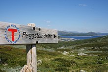 Signs are helpful and convenient, but no substitute for a map and compass. Raggsteindalen in Buskerud.
- It is easy to get lost at ridiculously short distances in unfamiliar terrain. Take a careful look even if you are going only for a minute. Dense forest, fog and open plateaus with no clear landmarks are the most difficult.
- Always take a map and compass with you when leaving the immediate vicinity of your camp (electronics is no substitute, only a supplement – instead of checking battery status you should create a good mental map). Learn to use a compass for navigation and learn to match your map with the terrain.
- If you do get lost, admit it and stop immediately. A few minutes of good rest is surprisingly effective at making you think clearly again. Lines in the terrain can be used to find way back, for instance rivers (rivers can lead you to settlements or to lakes and other points that can be identified on the map), power lines and slopes. But beware of slopes making you change direction and leading you only to a local depression, rivers leading you to hard-to-walk wet terrain, etc. Check the map for what lines are usable.
- Bugs e animali
- Mosquitoes and black flies are a nuisance in June and July, especially in Lapland and Finnmark. They do not carry diseases, but repellents, long sleeves, long pants and perhaps a mosquito hat in the worst areas are recommended. Avoid keeping doors and windows open in the evening.
- zecche can carry Lyme disease and TBE in some areas (especially south Norway to south-west Finland). The risk is small for a casual visitor, but you may want to take precautions.
- There are big predators like bears, wolves, lynxes and wolverines in the Nordic countries, but they are generally no threat to people, as they will flee in most circumstances once they smell or hear humans. Back out if you encounter bear cubs, as their mother will protect them. Also musk oxen, elks and boars can be dangerous if you go too close.
- If you are hiking in the hunting season (the autumn), in areas where hunting is allowed, you should wear some orange or red clothing. Ask for local advice about whether any areas should be avoided. Hunting season varies by species. Moose hunting is common in the forest areas of Sweden, Finland, East Norway and Trøndelag. Red deer hunting is common in West Norway. Reindeer hunting occurs mostly in the barren mountains.
- Be careful in sun
- Clear Nordic air, high altitude and snow patches can multiply the effect of the sun, which hardly sets during the Nordic summer. Snow blindness is a serious risk, so bring UV-resistant sunglasses, and preferably mountain goggles. Bring sun cream or sun block (sun protection factor). Light can be strong in the highlands even if the sun is not visible.
- Glaciers
 Do not go on your own. Jostedalsbreen glacier.
- Glaciers are one of the most dangerous places for visitors to the Norwegian outdoors. Never underestimate the power of the glacier. Observe warning signs. Never approach the front of the glacier. A glacier is not a stable piece of ice, it is constantly moving and huge chunks regularly fall off. Snowbridges can obscure crevasses.
- The sun's rays get reflected from the white snow, so it necessary to use sunscreen and sunglasses to protect your skin and eyes. Bring warm clothes for tours on the glacier.
- Fare non enter a glacier without proper equipment and a skilled local guide.


Rules of mountain conduct
Norway's trekking association has compiled a set of rules or guidelines for sensible hiking, "fjellvettreglene":
- Don't go for a long hike without training.
- Tell where you are going.
- Respect weather and forecast
- Be prepared for storm and cold weather even on shorter hikes. Bring a rucksack with the kind of gear needed.
- Listen to experienced hikers.
- Dont hike alone.
- Use map and compass
- Turn back in time, it is nothing to be ashamed of.
- Don't waste your energy. Dig into snow if necessary.
Volcanic eruption

Out of the Nordic countries, Iceland is the only one with active volcanoes.
As a precautionary mesure carry a cell phone and a battery powered radio, and heed to warnings from the Icelandic civil protection about hazardous areas. Listen to either the radio station Rás 1 or Bylgjan. Rás 1 is on the LW frequencies 189 kHz and 207 kHz. For the FM frequencies see the frequency map of Ras e frequencies of Bylgjan. Pay attention to any SMS messages you get, as the Icelandic civil protection does send out SMS messages in Icelandic and English to phones in hazardous areas.
Should an eruption occur the ash can spread throughout the whole country depending on the wind direction. Eruptions increase the chance of lightnings and a glacial eruption will generate n flood in rivers with sources at the melting glacier.
Regardless of where you are in the country during an eruption, consider the wind direction and consider whether the wind can spread the ash to you. As an alternative you can use the mobile website of the Icelandic met office. If so, walk high up in the landscape to avoid poisonous gases, cover your nostrils and mouth with a cloth. Should the ash get thick or if you have an asthma, go into the next day or wilderness hut, close windows on the side that the wind blows at, close the chimney and stay there until the wind direction changes.
Should you be in close proximity of an eruption walk opposite to the wind direction to get out of the area. If you have concerns that you cannot abandon a hazardous area in time, do not hesitate to call the emergency number 112.
Rispetto

Many people you meet on remote trails are there to be with nature only. They might not be interested in socializing and will probably frown upon noisy behaviour. It is common, though, to stop and exchange a few words, e.g. about the terrain ahead, and at least some kind of greeting is usually expected when you meet people on (or off) the trail. Some might of course be interested in where you come from. People are often less reserved with strangers when they are in the wilderness.
Smoking is disliked by many and can be a serious hazard. In hot and dry periods a cigarette butt can cause a forest fire (even if "extinguished"), so just like with other litter, avoid leaving them in nature. Smoking indoors is mostly prohibited. Where locals smoke you might follow their example, but otherwise try to be a good example yourself.
Even if there is right of access, wilderness is often privately owned. In Norway only barren high mountains are public (government) property. Trails and bridges are usually maintained by volunteers (the trekking association for instance) or by landowners for the visitors' benefit. Tieni presente che sei un ospite su un terreno privato di qualcuno. Possono esserci animali al pascolo e selvaggina grossa che non devono essere disturbati. Non lasciare rifiuti. È sempre più popolare tra i visitatori costruire ometti di pietra nella natura selvaggia, lungo le spiagge rocciose e sui passi di montagna. Gli ometti di pietra sono usati per segnare i sentieri e possono infatti essere fuorvianti per gli escursionisti. I visitatori che costruiscono ometti spesso raccolgono pietre da recinzioni in pietra, alcune delle quali sono in realtà patrimonio culturale o in uso. È illegale alterare la natura in questo modo, anche solo con un semplice macigno.
Analoghe considerazioni valgono per il suolo pubblico. La maggior parte della Lapponia è di proprietà del governo perché i Sámi non hanno avuto la stessa nozione di proprietà. Gli abitanti dipendono dal deserto come se possedessero la terra. E dove le strutture sono mantenute dal denaro dei contribuenti, sono il risultato di una volontà comune, che dovrebbe essere tenuta con non meno considerazione delle donazioni private.
Nomi di luogo e parole utili
Poiché i nomi sulle mappe e sui segni di solito indicano la topografia, può essere utile comprendere alcune parole del paesaggio. Se hai la possibilità di studiare in anticipo mappe di grandi dimensioni, potresti voler controllare il significato dei prefissi e suffissi più frequenti, ma alcuni sono elencati qui. Spesso dicono cose non ovvie dalla mappa sulla caratteristica del terreno o danno suggerimenti sulla storia dell'area.
Nella zona di Sami i toponimi sono generalmente di origine Sami, anche quando ciò non è evidente. Per esempio. Lemmenjoki è originariamente "fiume caldo" (da Sami: leammi; finlandese: lämmin), non "fiume d'amore" (finlandese: lempi, lemmen). Le caratteristiche del terreno dell'area sono spesso chiamate con la parola Sami (ad esempio "jåkk", johka, invece delle parole svedesi per flussi).
Le lingue coinvolte usano nomi composti. I nomi sono in genere creati da parole composte, dove l'ultima parte indica quale caratteristica del paesaggio è. Per esempio Jostedalsbreen è un nome creato da Jostedal (Valle Joste) e bre (ghiacciaio), in altre parole, il ghiacciaio di Jostedal. Spesso le parole sono al plurale e/o genitivo, il che modifica leggermente le parole, in finlandese e in Sámi non sempre troppo leggermente.
Inoltre, in norvegese e svedese, l'articolo determinativo ("il") appare come suffisso, integrato nella parola, so breen si intende il ghiacciaio.
Ci sono un paio di diverse lingue Sámi e la loro ortografia è stata standardizzata solo pochi decenni fa, il che significa che ci sono differenze di ortografia anche indipendentemente da quale delle lingue è coinvolta.
Le lettere svedesi ä e ö sono scritte æ e ö in islandese, æ e ø in norvegese; å è scritto o in finlandese e nella maggior parte delle lingue Sami. La ä svedese è spesso pronunciata vicino alla e, e in molti di questi casi è scritta e in norvegese. Riconoscere queste e altre differenze più o meno sistematiche nell'ortografia o nella pronuncia aiuta a capire una parola che conosci da un'altra delle lingue, come joki/jåkk/jåkkå/johka nelle aree Sámi (finlandese, svedese e Sámi).
svedese e norvegese and

- kart/karta
- carta geografica
- fjell, fjäll
- montagna, vetta, picco (si riferisce al paesaggio che si estende al di sopra della linea degli alberi, può riferirsi a una vetta specifica o alle montagne in generale)
- video
- alto altopiano aperto (sopra la linea degli alberi)
- innsjø, vann, vatn, sjö
- lago, stagno
- tjern, tjärn
- stagno, laghetto, tarn
- skog
- foresta, bosco
- myr, kärr
- fango, palude
.jpg/220px-Besseggen_Hike,_Norway_(14673663307).jpg)
- ur, taluskon
- ghiaione, depositi di talus
- bre/glaciär, forma, skavl
- ghiacciaio, cumulo di neve
- dal
- valle
- juv, kløft/klyfta, ravin
- gola, burrone, canyon
- elv, bekk/älv, å, indietro
- fiume, ruscello, torrente
- bro/bru, sommarbro, helårsbru
- ponte, ponte ritirato in inverno, ponte tutto l'anno
- vad
- guado
- stuga/stue, hytte
- capanna, capanna
- förfallen
- decaduto
- snaufjell/kalfjäll
- montagne aride
- tregrense/trädgränsen
- linea degli alberi
- skyddsområde
- area protetta
- sti/stig
- sentiero, sentiero
- ruskmärkning
- segni sotto forma di rami nella neve
- øy/ö, holme, skär
- isola, isolotto
- foss/fors, vattenfall
- cascata, rapide
islandese

- kort
- carta geografica
- caduto, fjall
- montagna
- heiði
- alto altopiano aperto
- vatn, tjörn
- lago, stagno
- mýri
- fango, palude
- fjörður
- fiordo, baia
- jökull
- ghiacciaio
- dalur
- valle
- gjá, gljúfur
- gola, burrone, canyon
- un
- fiume
- foss
- cascata
- eyja, sker
- isola, isolotto
Finlandese e Sami
- kartta
- carta geografica
- vuori, tunturi/tuodtar, vaara / várri (várre, várrie, vaerie, vare)
- montagna; vuori è la parola generale in finlandese, tunturi e vaara non si estendono rispettivamente oltre la linea degli alberi - ma várri in Sámi è la parola generale per collina o montagna (spesso su grandi ripidi), spesso "tradotto" come vaara; tunturi/duottarmailbmi viene utilizzato anche su tutta la regione al di sopra della linea degli alberi
- kaisa/gaissa; kero/tseärru; oaivi; kielas/gielas, kaita/skäidi; rova/roavvi
- montagne di forme diverse: alta vetta innevata; montagna a forma di mucchio sopra la linea degli alberi; montagna rotonda sopra la linea degli alberi ("testa"); cresta; collina sassosa con rada foresta
- čohkka (tjåhkkå, tjåhkka, tjahkke, tjåkkå)
- vetta, vetta
- mäki, kallio, harju/puoldsa
- collina, (collina di) roccia solida, esker
- skäidi, selkä/cielgi
- cresta, zona spartiacque (selkä anche distesa di mare o grande lago)/cresta con betulla, da una montagna
- pahta/pahte
- pendio alto e ripido
- järvi/jávri (jávrre, avrre, havrre, jávrrie, jaevrie, jävri, jäu'rr, jauri, jaure, jaur)
- lago, stagno
- vesi
- acqua, che spesso significa "lago" nei nomi
- lähde, kaltio/galdu
- primavera
- lampada
- stagno, laghetto, tarn
- lahti/luokta (luoktta, loekte)
- baia
- niemi/njárga (njárgga, njarka)
- mantello

- suo, rahka, räme, aapa/aaphe, jänkä/jeäggi, vuoma/vuobme
- fango, palude; suo è il vocabolo generico, gli altri tipi diversi; vuoma/vuobmi anche valle
- palsa
- cumulo di brina (nel fango o nella palude)
- jäätikkö
- ghiacciaio, cumulo di neve
- laakso
- valle
- rotko, kuru/autsi, ävdzi, gorsa
- gola, burrone, canyon
- joki/johka (jåhkå, juhka, johke, jåkkå, jåkk), eno/eädnu, puro, oja/ája,
- fiume, ruscello, torrente; joki/johka è la parola generale, eno è piuttosto grande, puro è piccolo, oja tiny
- kahlaamo
- guado
- metsa; kuusikko, männikkö, koivikko ecc.
- foresta, boschi; questi ultimi boschi di diverse specie arboree (kuusi=abete rosso, mänty=pino, koivu=betulla)
- raja
- confine, limite
- puuraja
- linea degli alberi
- rajavyöhyke
- zona di confine
- kuusimetsän raja
- (nord) limite per le foreste di abete rosso ("kuusi")usi
- polku, reitti
- sentiero, sentiero
- mökki, pirtti, tupa; kammi/gamme
- capanna, capanna; capanna di erba
- siida
- Villaggio o comunità Sami

- seita/sieidi
- spirito, oggetto sacro
- saari, luoto
- isola, isolotto
- koski, niva, kurkkio, kortsi/gorzze
- rapide, queste ultime ripide e sassose
- suvanto, savu
- acqua ferma (sotto una rapida)
- köngäs
- ripide rapide, piccola cascata
- (vesi)putous
- cascata
- latu (pl. ladut)/láhtu
- pista da sci
Collegare

Posta ordinaria
Ci possono essere cassette postali e francobolli disponibili presso negozi e attività turistiche. Invece di poste restante potresti voler usare un adatto c/o indirizzo. Chiedi informazioni sulle pratiche locali.
telefoni
Generalmente c'è una buona copertura di telefonia mobile nei paesi nordici, ma non necessariamente dove ne hai bisogno. Alcuni rifugi hanno telefoni per le chiamate di emergenza (non più in Finlandia; in Svezia sono comuni e dovrebbero essere usati anche per segnalare il ritardo e per avere consigli se necessario, non solo in caso di emergenza).
In terreni montuosi spesso non c'è segnale nelle valli. Nelle aree remote potrebbe non esserci segnale tranne che sulle cime ripide. Potresti voler testare importanti servizi Internet con una connessione a bassa velocità (anche 9600 bit/s) in anticipo. Ci sono servizi meteo SMS. Il 3G era disponibile solo vicino a grandi città e importanti località turistiche e lungo alcune strade principali, ma ora è disponibile in Finlandia anche in gran parte della natura selvaggia.
La copertura varia da un fornitore all'altro. Se hai più di un telefono (scheda SIM) in azienda, potresti voler avere provider diversi. Nota che il miglior segnale potrebbe provenire da un paese vicino e quindi potresti dover pagare per le chiamate internazionali anche con una scheda SIM nazionale, se lasci che il telefono scelga il provider.
Laddove il segnale è scarso, non provare a fare chiamate, ma usa gli SMS: i messaggi necessitano di segnale solo per alcuni secondi, e saranno così sia più affidabili che consumano meno energia.
Tieni il telefono asciutto. Ricorda che le batterie vengono utilizzate molto più velocemente dove c'è un segnale scadente. Tieni il telefono spento per la maggior parte del tempo. L'elettricità di solito non è disponibile nell'entroterra, non necessariamente nemmeno nei cottage e nelle case.
Chiamate di emergenza
Il numero di emergenza 112 funziona in tutti i paesi nordici. Potrebbero esserci numeri speciali per alcune emergenze, ma ☏112 può gestirli tutti. Le chiamate al 112 sono gratuite e funzionano senza alcun riguardo per i blocchi con la maggior parte dei telefoni. Basta digitare il numero o utilizzare un pulsante di emergenza (su alcuni smartphone). In effetti, in alcuni casi potresti voler rimuovere la scheda SIM per assicurarti che il telefono utilizzi la migliore connessione disponibile. Purtroppo, il 112 svedese mette in attesa le chiamate senza SIM finché non si preme "5". In Finlandia tali chiamate verranno messe in attesa per circa mezzo minuto prima di ricevere risposta.
Per telefoni satellitari il numero del servizio di emergenza è ☏ 46 63-107-112 (Svezia), 358 9 2355-0545 (Finlandia), 354 809-0112 (Assegno islandese!). I satelliti Inmarsat-14 sono solo circa 15 gradi sopra l'orizzonte meridionale e quindi facilmente bloccati da terreni più alti o altri ostacoli. Iridium non ha questo problema.
Non esitate a informare il servizio di emergenza di eventuali problemi che potrebbero portare a un'emergenza. Assicurati di chiamarli anche per dire loro che sei al sicuro, e allo stesso modo quando sei in ritardo e qualcuno potrebbe chiamare per iniziare un'operazione di salvataggio. Le spese sono facilmente numeri a cinque cifre – in Euro all'ora (normalmente pagate dai soldi dei contribuenti, ma non si vuole abusare del sistema).
La posizione potrebbe essere meglio indicata come coordinate ETRS89/WGS84 (controlla in anticipo se è quello che viene utilizzato sulla tua mappa). È inoltre possibile utilizzare la direzione e la distanza da una posizione nota o da qualsiasi sistema di coordinate sulla mappa. Dire anche alcuni nomi vicino alla posizione, per evitare errori. Si noti che sui compassi vengono utilizzati sia i sistemi 360° che diversi mil (60, 63 o 64 hektomil per un cerchio) e che alcuni nomi, come Ailigas ("santa caduta"), sono ambigue. In Finlandia il servizio di emergenza può chiedere il comune e l'indirizzo (servono aree enormi), ma saranno ragionevoli quando dirai loro che non lo sai.
Navigatori satellitari (GPS ecc.; spesso incluso negli smartphone, a volte nelle fotocamere) consumano molta energia, quindi è meglio tenerli spenti la maggior parte del tempo, ma spesso possono fornire coordinate precise in caso di emergenza. Ci vuole un po' di tempo per trovare i satelliti e fino a quel momento potrebbero dare coordinate sbagliate. Verifica di aver compreso le loro impostazioni e il loro comportamento.
Far fronte
Rifiuto
Ci sono spesso cestini dei rifiuti nelle capanne, nei rifugi e nei falò. Soprattutto dove non c'è strada dovresti evitare di usarli e fare i bagagli. Svuotare i cestini dei rifiuti nell'entroterra significa traffico inutile e costoso. Gli avanzi di cibo e simili non devono essere messi in un cestino dei rifiuti a meno che tu non sappia che verrà svuotato presto. Piccole quantità di rifiuti organici, come avanzi di cibo, possono essere collocate nei servizi igienici a fossa (e nei servizi igienici di compostaggio più avanzati). Ci sono composter separati in alcune località. Nei punti di riciclaggio carta, metallo e vetro possono essere trattati separatamente. Se necessario, anche i rifiuti organici fuori pista possono essere interrati, ma soprattutto nella torba e al di sopra del limite del bosco, la decomposizione può richiedere molti anni. La carta pura può essere bruciata nei fuochi da campo e nelle stufe, ma la carta rivestita di metallo o plastica dovrebbe essere imballata. Non lasciare che altri rifiuti brucino.
Servizi igienici
Lungo i sentieri ci sono servizi igienici nelle capanne e spesso nei rifugi e nei falò, di solito sufficientemente per le tue esigenze più grandi se usi quei servizi. Di solito sono gabinetti a secco: una latrina con un buco nella panca e un secchio con torba, segatura o simili con cui coprire le feci. Potrebbe essere necessario utilizzare la propria carta igienica. Lavarsi le mani di solito è un tuo problema (non farlo a monte da dove le persone prendono l'acqua potabile, né vicino al secchio dell'acqua potabile). Fuori pista e tra baite, consigli di Campeggio senza lasciare traccia può essere seguito.
Lavaggio
Ci sono molti ruscelli e laghi, o in riva al mare, nella maggior parte dei paesi, quindi trovare acqua per lavarsi è raramente un problema, ma soprattutto al nord e ad eccezione di luglio-agosto è per lo più abbastanza fresco. Adottati semplicemente o usa le saune. Per lavarsi le mani è possibile riscaldare piccole quantità d'acqua sul fornello, ma spesso è sufficiente l'acqua fredda. In molti luoghi dovresti evitare di sporcare o di sapone nel lago o nel fiume, facendo la maggior parte del lavaggio a terra. L'acqua del mare non è troppo salata nel Baltico e raramente nei fiordi.
Le docce non sono generalmente disponibili nelle capanne selvagge, ma possono essere disponibili in alcune capanne e nei veri campeggi se le incontri. Usa invece le saune, che si trovano in molte capanne e capanne. Per il sauna procedura, vedi quell'articolo (quando non sei in Finlandia, controlla se il comportamento previsto è diverso), ma il lavaggio corretto di solito consiste nel mescolare acqua calda e fredda in una bacinella e usarla. Mescolare un nuovo set o due per il risciacquo.